Bois de Paiolïve
Paiolïve Woods
Useful Information
| Location: |
D252 between D901 and 07460 Berrias-et-Casteljau.
West of Vallon-Pont-d'Arc, between Les Vans and Chandolas, Chassezac valley. (44.396035, 4.171835) |
| Open: |
no restrictions. [2023] |
| Fee: |
free. [2023] |
| Classification: |
 Sentier Karstique Sentier Karstique
 Karst
Limestone Pavements Karst
Limestone Pavements
|
| Light: | bring torch. |
| Dimension: | Ar=16 km². |
| Guided tours: |
self guided. Saint Eugène Hermitage (N°17A): L=4.5 km, D=2 h. La Corniche (N°17B): L=4 km D=2 h. Circuit de la Vierge (N°18): L=1.8 km, D=1 h. |
| Photography: | allowed |
| Accessibility: | no |
| Bibliography: |
Jules de Malbos (1851): Sites pittoresques de l'Ardèche, le Bois de Païolive, in Journal des villes et des campagnes, Paris, Pillet Ainé, 30 juin 1851.  online
Emmanuel Lierdeman, Yannick Giloux, Gérard Ducerf, François Aubry, Fabienne Alvarez (2001): Bois de Païolive et Basse Vallée du Chassezac, Document D’Objectifs Du Site FR 820 1656 2001-2007, Syndicat Intercommunal pour le Développement Économique et Touristique du Pays des Vans (SIDET).
pdf
|
| Address: | Association Païolive, Maison des associations, 07120 Grospierres, Tel: +33-475-39-96-79, Tel: +33-676-22-23-19. |
| As far as we know this information was accurate when it was published (see years in brackets), but may have changed since then. Please check rates and details directly with the companies in question if you need more recent info. |
|
History
| 1851 | first described by the French botanist, geologist, prehistorian, poet and politician Jules de Malbos. |
| 11-OCT-1934 | declared a Natural Monument. |
| 2004 | inscribed as Natura 2000 site FR8201656. |
| 2011 | Natura 2000 site extended. |
Description
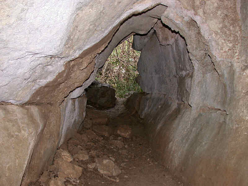
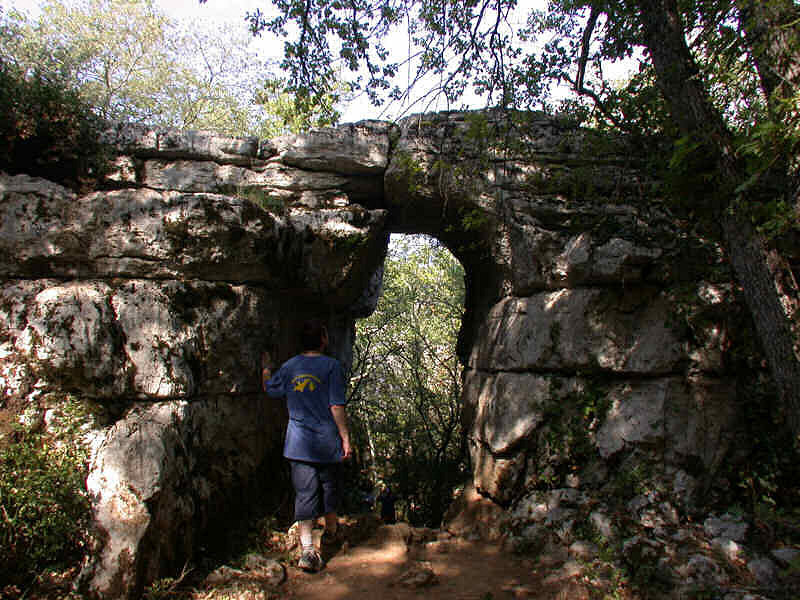

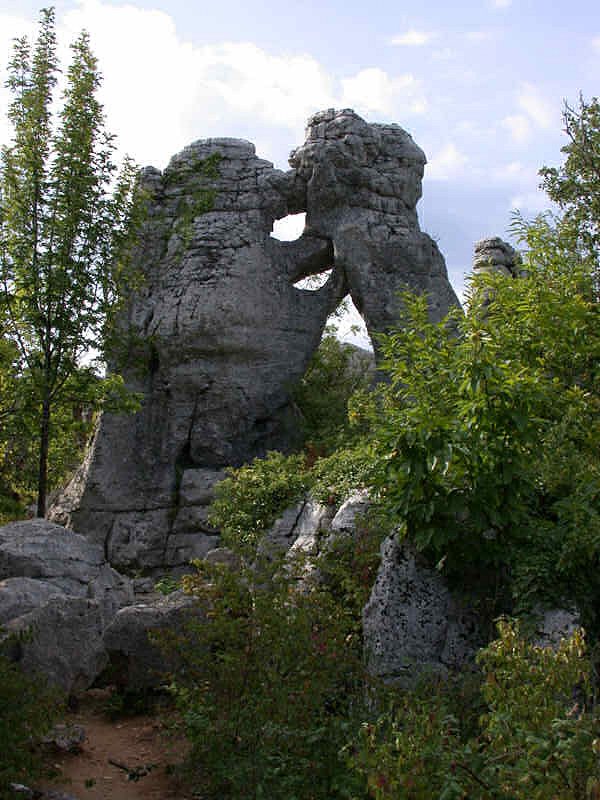
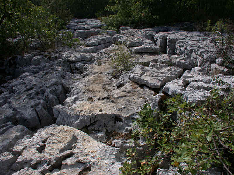
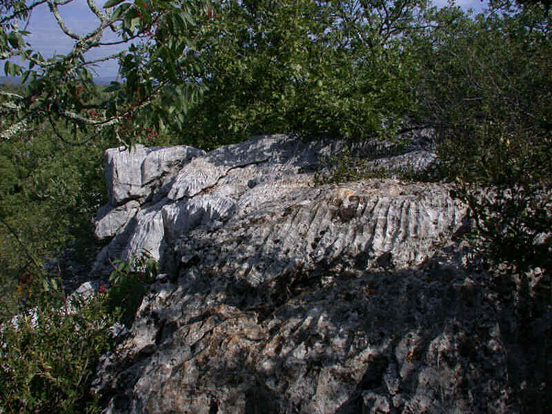
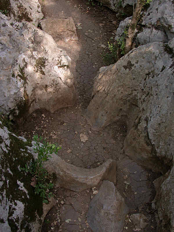
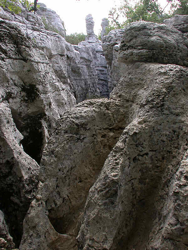
The Bois de Paiolïve (Païolive Wood) is a typical karst landscape: limestone rocks, cliffs, crevices, karren, and small caves. Only partly covered by shrubs, gras, and lichen, the landscape is dominated by the bright white colour of the limestone. The trail is meandering through a labyrinth of lapies and limestone pavements, at some points it follows the narrow cracks on the bottom in a zigzag course, at other points the trail runs across the limestone pavements with cracks not wide enough to enter. There are fantastic formations with strange names, and even a few small caves. The place is also nicknamed le bois des fados (fairy wood).
The limestone formation extends over 16 km² between the villages Les Vans, Banne and Berrias-et-Casteljau in the Ardèche Cévennes. It dates from the Jurassic period (180 Ma). The basement is dotted with caves and resurgences, many are connected and form vast cave systems.
The area is also of great biological importance, although this is not so obvious. Actually most of the surface is bare limestone, the water vanishes immediately underground, there is no soil to hold it. Plants grow only in the cracks and dolines. Nevertheless, the plants which grow are exceptional, quite rare outside this area. There is riparian forest, but also ancient forests of white oak and holm oak, as well as scrubland and dry grasslands on the semi-arid limestone outcrops. There are numerous protected rare endemic species. It is a nesting site for rare bird species such as the European kingfisher or the European eagle-owl. Birds of prey such as the peregrine falcon and the Bonelli’s eagle nest in the cliffs. A multitude of beetles such as the stag beetle and the Cétoine Bleue or Eupotosia mirifica, which are endemic, can be found. It is inhabited by the European beaver and almost 20 species of bats.
The site is known since Prehistoric times, although it was not very hospitable. But it was close to major natural passageways, and during the cooler cold age, it had rather mild climate. The oldest remains are from the Neanderthal, 52,000 years ago. Also Cro-Magnon (Homo sapiens) remains were found. During the protohistory or the metal ages, numerous dolmen were erected, also remains of pottery were found, although the area is not suitable for agriculture. In historical times the area was used, although it was actually not inhabited. They settled in the outskirts, in valleys, but not in the rocky area. The first to actually describe it was the French botanist, geologist, prehistorian, poet and politician Jules de Malbos.
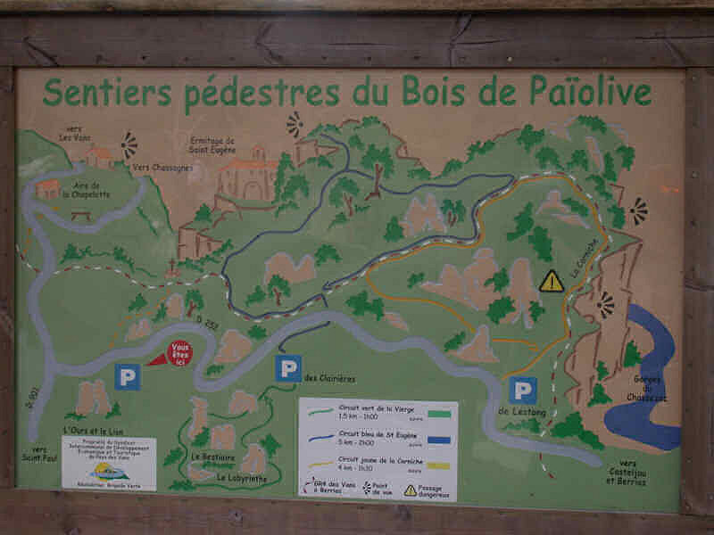
There are a few small roads across the area, and several trails like the sentier de la Vierge, the sentier de la corniche, or the loop du randonneur. The best starting point is the Parking des Clairières at the Route de Paiolïve D252. When you walk in the area, be aware it is a protected natural area, both Natura 2000 site and Sensitive Natural Area. Please keep to the marked paths, do not litter, do not use open fire.
The Sentier de la Corniche, or simply La Corniche (N°17B) is a 4 km long trail starting at the Parking de l'Estong. It offers an amazing view of the Chassezac River from the cliff path above. Please be careful at the edge, be aware that the limestone might crack due to erosion. Notable is the Grotte de la Gleysasse almost at the northernmost point of the loop. The trail is marked with yellow signs.
The Saint Eugène Hermitage (N°17A) trail passes the ruined Saint-Eugène hermitage which is perched on a cliff. The 4.5 km long trail starts at the Parking des Clairières and goes to the north. The trail is marked with blue signs.
The Circuit de la Vierge (N°18), The Virgin’s circuit, starts also at the Parking des Clairières but goes to the south. It is only 1.8 km long, mark with green signs, and particularly well-suited to children, which enjoy exploring the numerous small caves. The eastern section of rocks is called Le Labyrinthe, the western Le Bestiaire.
This are only the most popular trails which are marked with colors for the tourists. Actually the whole area is riddled with trails, some connect with other trails, others end at a special rock formation or cave entrance. We strongly recommend a good map, OpenSourceMap is quite detailed. And like always for hikes we recommend good walking shoes, a fleece jacket and raincoat for bad weather, sun protection for good weather, some water and probably a snack. However, the snack is not very important, the trails are rather short and there is a nice restaurant at the western end of the road.
Bois de Paiolïve
 Search Google for "Bois de Paiolïve"
 Google Earth Placemark
 Bois de Païolive
  Le Bois de Païolive
  Index
Index Hierarchical
 Countries
 Maps
Maps Search