Cenote


A cenote is a partly water-filled, wall-sided doline. It is formed by the collapse of a cave which is (today, not necessarily at the time of the collapse) filled with water.
This sort of doline is very common in Yucatán, México, where a large cave system with many entrances is filled with water. There are over 3,000 cenotes, with only 1,400 actually studied and registered. The cave system inside the Yucatán peninsula was formed during the Ice Ages, when the level of the sea was 100 m lower than today. The water drained to this level and the caves were slightly above sea level. When the glaciers melted and the sea level rose, the caves were filled with water. There is sweet water from the rains inside the country, but also seawater flowing in from the sea. Some cenotes contain two layers of water, the heavier seawater on the floor, the sweet water above and a visible border surface in the middle.
Cenote is hard for English speakers to pronounce, the right pronunciation is like say-NOH-tay. The term is based on the Yucatec Mayan word dzonot or ts’onot (sacred well). It was adopted by the Spanish who had no word for such circular lakes, as they are not common in Spain. That is why cenote is pronounced the Spanish way. And the term cenote just means well, as the Spanish ignored the "sacred" part. These places were very important to the ancient Mayas, as the karst plain of Yucatán is completely waterless, and those collapses were the only possibilities to reach the ground water. Some of them were sacred places and used for offerings.
While the cenotes are not considered sacred any more and used as bathing spots, they are actually part of a single huge aquifer. In other words, all water on the peninsula used for drinking, cooking and irrigation is from this aquifer! All managed sites have strict rules: shower before entering the water to remove all remains of sun lotion, soap, or other chemicals you may have on your skin. The same applies to unmanaged sites, but as they generally have no showers, please shower at you hotel before going. Its quite important or you will drink your own sun lotion!
The locals distinguish four types of cenotes, just by describing their characteristic form, in other words their morphology:
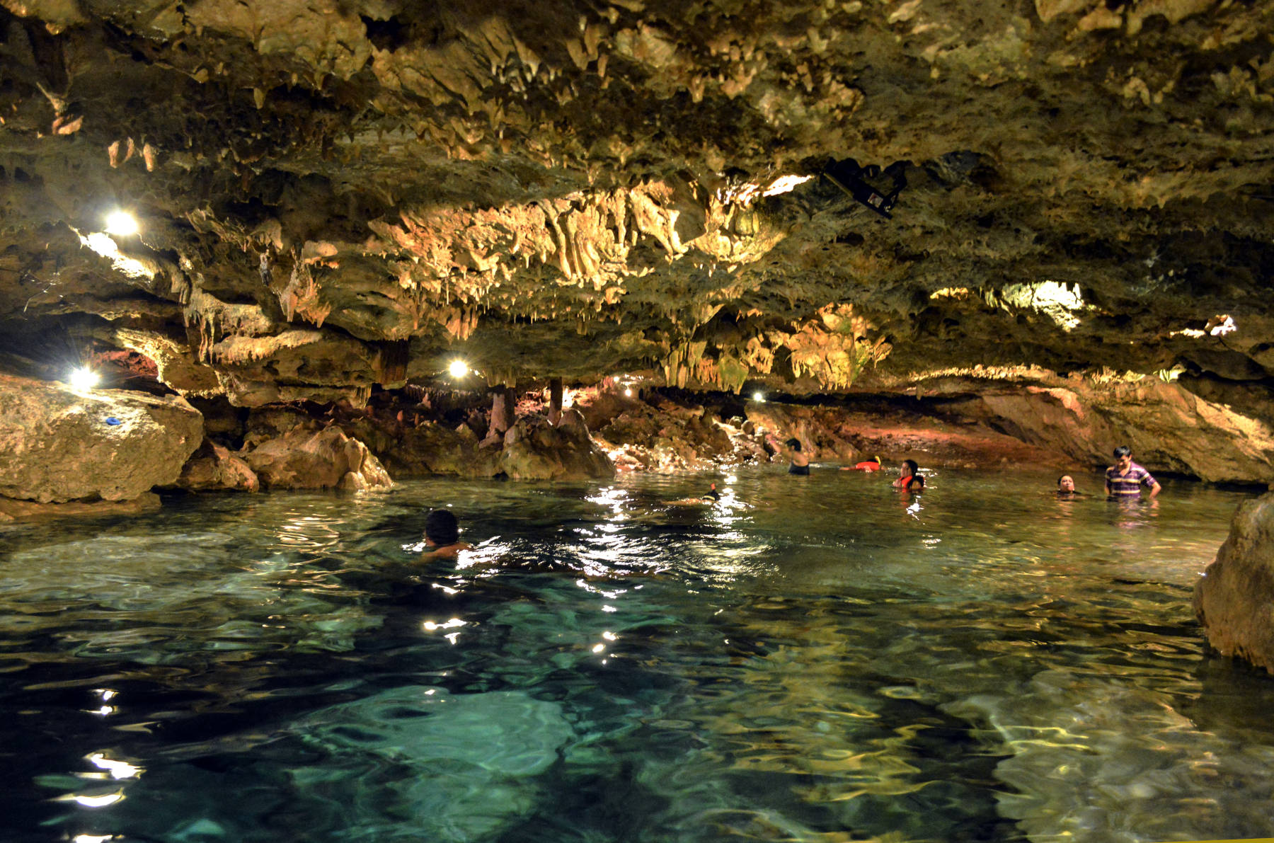
- Cerrados (completely underground): more or less cave lakes inside a cave, and actually no cenotes at all, as we define them. In geologic terms, caves without a collapse in the ceiling are not called dolines, they are called river caves or active caves.
- Semiabierdos (semi-open): at the bottom of a pit.
- Abiertos profundos (open): here the water runs out of the cenote, they form springs or wells (Chichen Itza). These are not considered dolines, they are simply karst springs, ore more exact karst springs of the Vauculsian type.
- Abiertos a flor de tierra (at surface level): like a normal lake, but with no surface rivers, filled by water from underground (Dzibilchaltun). These are also not considered dolines, they are called karst lakes.
A better classification was defined by H. G. Hall in 1936. It is also based on the morphology, on the form of the cenote.
- Cenotes-cántaro (Jug or pit cenotes) are those with a surface connection narrower than the diameter of the water body, in other word water filled chambers with a karstfenster.
- Cenotes-cilíndricos (Cylinder cenotes) are those with strictly vertical walls, which are the only actual cenotes.
- Cenotes-aguadas (Basin cenotes) are those with shallow water basins, whatever that means.
- Grutas (Cave cenotes) are those having a horizontal entrance with dry sections, in other words caves, and not cenotes at all.
All those classifications are only valid on Yucatán, and collide partly with the general speleological terms karst spring and river cave. We use the name cenote for such structures if they are used locally, but we do our best to classify them correctly.
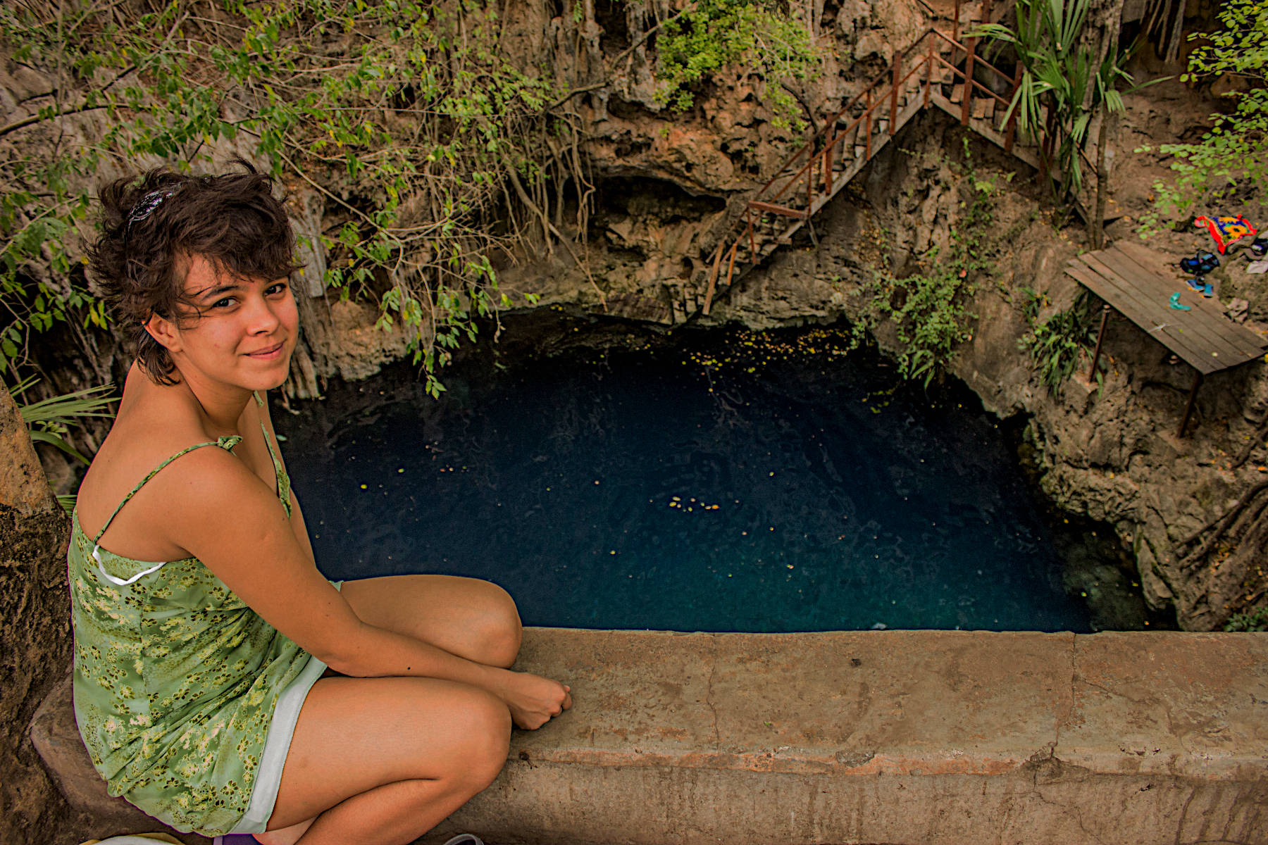
Some cenotes are accessible for swimming and cave diving. They are often developed with a trail, a staircase, railings, and a platform. Some have electric light, some cost a fee, but most of them are rather natural and freely accessible.
- Examples
 Cenotes Agua Dulce
- Cenote Angelita
- Cenote Azul
- Cenote Calavera
- Cenotillo
- Cenote Chac Mool
- Cenote Chemuyil
- Cuzamá Cenotes
- Dzibilchaltún Cenote
- Cenote Dzitnup
- Cenote Escondido
- Gran Cenote
- Hidden Worlds Cenotes
- Cenote Ik Kil
- Cenote LabnaHa
- Cenote Naharon
- Cenote Palomitas
- Cenote Sac Aua
- Cenote Sagrado
- Cenote San Ignacio
- Cenote Xcanahaltun
- Xel-Há
- Cenote Yaal Utzil
- Cenote Zací
 Yucatán
 Search DuckDuckGo for "Cenote"
 Cenote - Wikipedia (visited: 04-JUN-2020)
 Discovering the Yucatán’s secret cenotes (visited: 25-JAN-2025)