Ardèche Gorge
Gorges de l’Ardèche
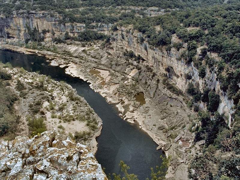
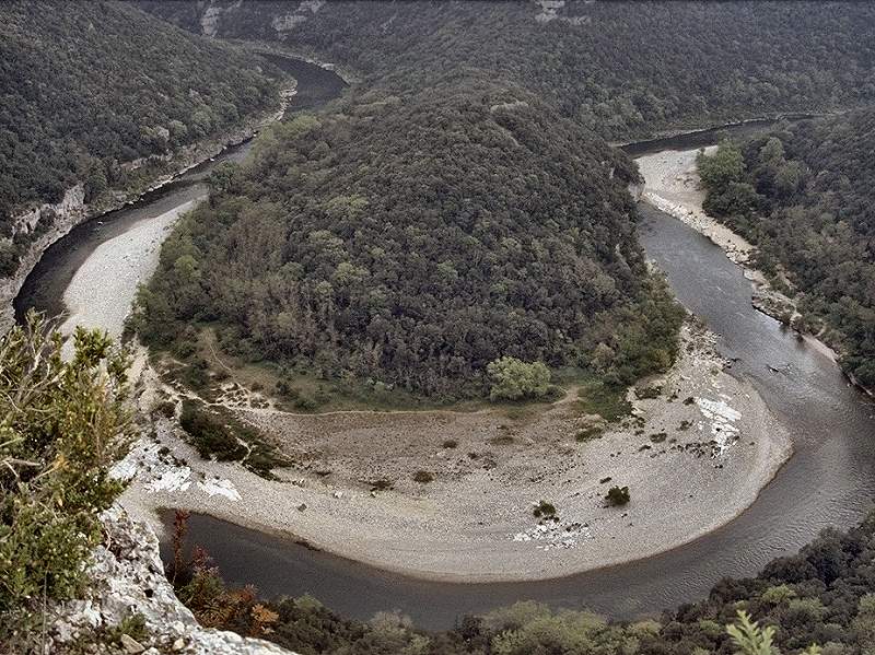
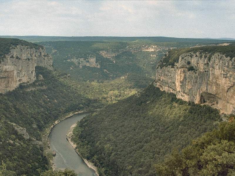
The Gorges de l’Ardèche (Ardèche Gorge) is about 30 km long and up to 300 m deep. The gorge has very steep sides, with many vertical limestone cliffs, but the floor of the gorge is rather flat and typically 200 m wide, sometimes even wider. Typical are the incised meanders, several small and big horseshoe bends, including the Combe d’Arc with the famous Pont d’Arc. The gorge is a popular tourist destination, mostly for swimming and kayaking in the gorge, but there are also lodges and a campground in the gorge. The kayak tours start at the Pont d’Arc and end at Sauze, there are several operators renting out the kayaks and transporting the participants to the other end of the gorge. During the summer the water level is very low and the kayak tour is very simple and is mostly a very calm floating down the calm river. There are also numerous climbing routes available which makes the gorge quite popular among climbers.
The river Ardèche has its source in the Massif Central. The source is near the village of Astet and flows into the Rhône north-west of Orange near Pont-Saint-Esprit. The river is 125 km long and descends from 1,467 m asl to 36 m asl, so it flows rather fast. It has an average discharge of 65 m³/s, which makes it one of the biggest rivers south of the Massif Central. But there are severe floods called coups de l’Ardèche (Blows of the Ardèche) in spring and autumn, usually following storms in the Cevennes. During such flood events the discharge reaches 7,800 m³/s and the water level in the gorge may rise up to 21 m.
In its lower course it crosses a limestone plateau, right before it flows into the river Rhone. The Ardeche once flowed on top of the plateau, but it was slowly uplifted and the erosion cut an impressive gorge. All this time, the river was the drainage of this area, and as soon as it ran deeper than the plateau, the subterranean drainage of the plateau started. The development of caves is always connected with the level of the ground water table. Cave formation begins a few meters below the ground water table widening cracks and forming caves. The water flows through those water filled caves, but when the ground water goes down, the water flows through those caves as a cave river. Later, when the river cuts its bed deeper into the plateau, the cave level becomes dry and the next level is formed some meters below.
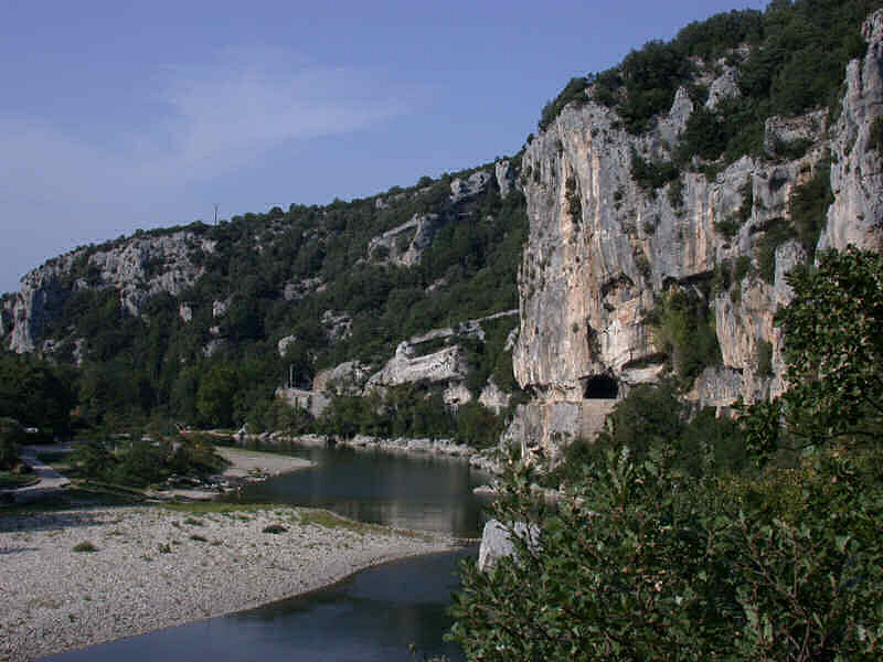
Many caves are accessible from the valley, through the former resurgences of the cave systems, which are now the lower entrance of a cave. Some more can be found on top of the plateau, they are accessible through roof collapses or shafts. In the whole area more than 500 caves are known, seven are show caves, six are open on a daily basis. Other sites are the natural bridge Pont d’Arc and several semi wild caves which may be visited by walkers. On the plateau there are numerous quite spectacular areas of karren fields or limestone pavements. And last but not least there is Grotte Chauvet, with the rather new cave replica near Vallon Pont d’Arc.
 Grotte Chauvet
 Exposition Grotte Chauvet
- Grotte d’Ebbou
 L’Aven Grotte de la Forestière
- Grotte des Huguenots
- Grotte de la Madeleine
- Aven Marzal
- Aven d’Orgnac
 Pont d’Arc
- Baume de Ronze
- Grotte de Saint-Marcel d’Ardèche
- Grottes des Tunnels
 Search DuckDuckGo for "Ardeche Gorge Cave"
 Gorges de l’Ardèche - Wikipedia (visited: 22-APR-2021)
 Index
Index Topics
 Hierarchical
 Countries
 Maps
Maps