The Burren
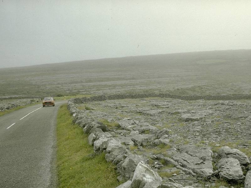

The Burren Area in Co. Clare is an extremely impressing karst area. It is a region of about 100 square miles in the north of County Clare which is almost completely covered by limestone. It is about 15 km from North to South and 20 km from East to West.
The name Burren is derived from the Irish Boirinn, which means rocky place, quite similar to the Slovenian word Karst.
Geologists call karst areas like this
 Bare Karst
because of the lack of vegetation.
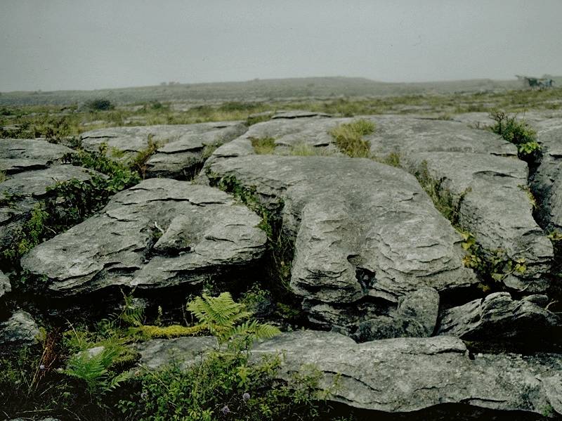
The typical feature of the Burren is
Limestone Pavements
or
Karren.
Bare Karst
because of the lack of vegetation.
The typical feature of the Burren is
Limestone Pavements
or
Karren.
The largest Irish cave so far discovered, Pollnagollum, is over 11 km long. It is situated in the Burren, in an area called Slieve Elva, about 20 km West of the Aillwee cave. More than 300 caves are known in the Burren.
The Burren has no rivers and no trees, but the flora is nevertheless very interesting. Alpine, scandinavian and mediterranen plants are found side by side. This area has a great number of megalithic remains. Dolmen and ring forts are frequent, about 2500 archaeological sites are known. Very interesting are single granite blocks, left by the glaciers of the ice age, which are called glacial erratics.
The Burren and Cliffs of Moher Geopark was created in 2011, it is part of the Global Geoparks Network (GGN) and was recognized by UNESCO in the same year. It supports education, community engagement and sustainable tourism. The geologist Dr. Eamon N. Doyle is employed fulltime by the Geopark. The Burren National Park is one of six National Parks in the country, and consists of 15 km² of land which was purchased by the Irish government. THis is actually only a small part of the Burren, which measures about 530 km², and the smallest of the six National Parks in Ireland. There were plans to construct a visitor center, but after protests they were shelved, and there is only an information point at Corofin.
 Aillwee Cave
 St. Colman’s Cell
 The Burren - Wikipedia
 The Burren / Irland by Franz Lindenmayr
  (visited: 28-JUL-2011)
 Index
Index Topics
 Hierarchical
 Countries
 Maps
Maps Search