Planinsko polje
Planina Karst Polje and Seasonal Lake
Useful Information

| Location: |
6232 Planina, Slovenia.
(45.835731, 45.835731) |
| Open: |
No restrictions. [2025] |
| Fee: |
No restrictions. [2025] |
| Classification: |
 Polje
Karst Lake
Ponor Polje
Karst Lake
Ponor
|
| Light: | n/a |
| Dimension: | |
| Guided tours: | self guided |
| Photography: | allowed |
| Accessibility: | yes, access by road |
| Bibliography: | |
| As far as we know this information was accurate when it was published (see years in brackets), but may have changed since then. Please check rates and details directly with the companies in question if you need more recent info. |
|
History
Description


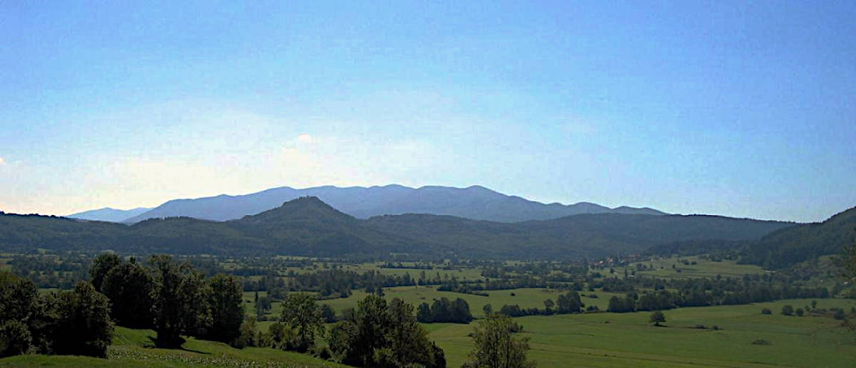
The Planinsko polje (Planina Polje) is a flat area with a river, named after the village Planina, and there is a river named Unica flowing through this plain. The polje is 6 km long and 2 km wide, has an irregular shape and about 16 km² of fields. The word ’polje’ is the Slovenian word for ’field’. The Unica flows out of the huge portal of Planinska Jama, which is located right at the village Planina, at the foot of a limestone cliff. It has two small tributaries, the Malenščica springs from the large valley near the hamlet of Malna and the Škratovka near the ruins of Haasberg Castle. The river meanders through the huge plain, and after a weird turn it finally vanishes underground in ponors not far from the tiny village Laze. Laze is rather famous with cavers, as here is the Speleo Camp, a campground and Bed & Breakfast for cavers. Those two villages were traditionally living from the fertile fields in the small polje, which are intensively used for agriculture.
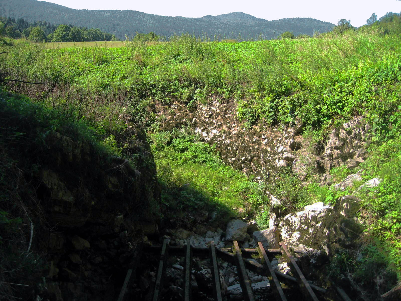
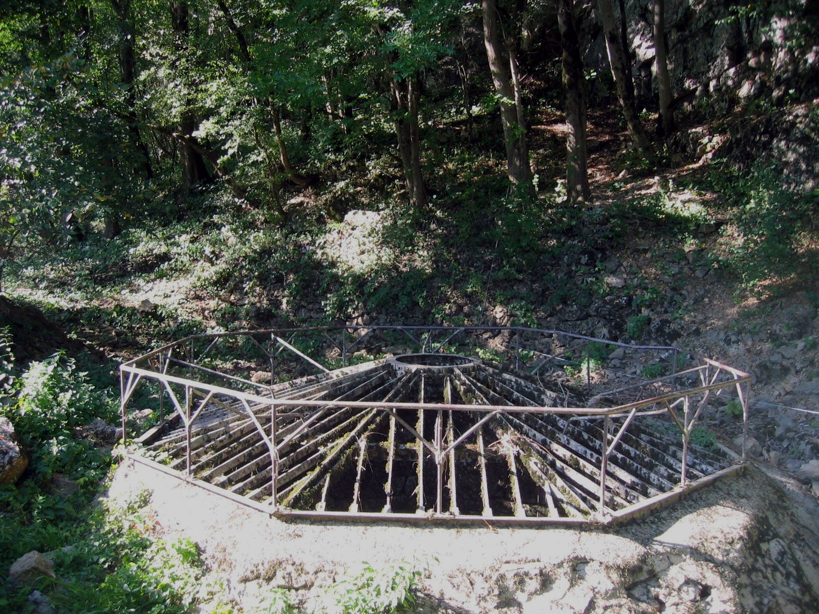
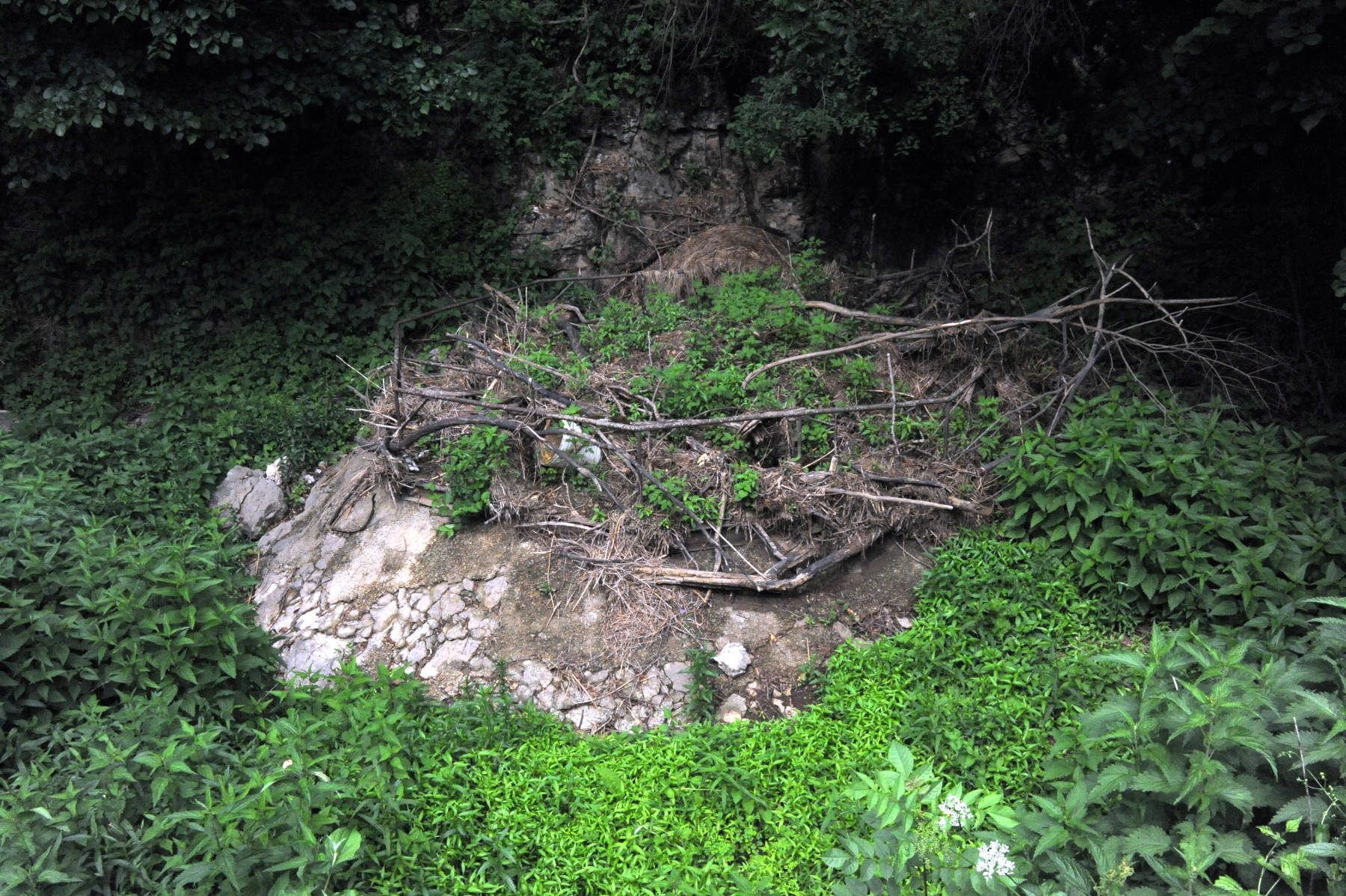
However, despite being fertile there is a big drawback: the amount of water in the river changes massively over the year. In late summer it may completely fall dry, which is actually not really a problem. But after snow-melt, in spring, it might rise and flood the whole polje, which then becomes a seasonal lake or karst lake, similar to nearby Cerknizko Jezero. The water level raise up to 10 m. That’s the reason why the villages were built on the rim, high enough, so they are not reached by the water. If it takes too long for the water in the karst lake to drain away, the time for growing wheat or potatoes will probably be too short. And then there was the possibility that the plain was flooded again later in the year, which destroyed the growing plants. So the drainage was an important problem of the two villages. And they knew where the water vanished, in the dry part of the year it is possible to walk to the ponors, which are located about 1 km northwest of Laze. It’s a short hike over fields to the massive shafts, and easy to see how the riverbed leads to the cave opening and then ends. The people soon realized that an important problem with the outflow of the water was the fact that the ponors were often blocked by plants. Bushes and trees floated with the water into the caves, where they blocked the passage and thus massively reduced the flow rate. As early as the late 19th century the ponors were protected by massive steel grates which were filtering the larger objects, avoiding that they were swallowed by the ponor. So they could be removed later, or in cases of emergency men with a boat remove the larger pieces of wood. However, it seems they have
The regular flooding makes arable farming and intensive agriculture difficult. Today the polje is dominated by extensively farmed grassland, such as wet meadows and calcareous grassland. The fauna and flora are unique, and the whole polje is protected by Natura 200 as a bird sanctuary, and it is protected as a landscape park.
The visit of the polje is simple, from Postojna take the road to Planina and then follow the road towards Logatec. The road crosses a low pass, once this was the last pass when people traveled from Vienna to the only harbour of the Austro Hungarian Empite at Trieste. This old road winds up the hill in serpentines from the plain of the polje. If you drive the other way round, you can see the polje lying at your feet. There are car parks and viewpoints. In Planina there is a sign to the right for Planinska Jama. It’s possible to visit the show cave which is also the resurgence of the river. After the village a road to the right leads to a bridge across the Unica and Grad Haasberg, where one of the tributaries can be seen. Returning to Planina, follow the road to the other side to Laze. From here it’s a 1 km hike on a level gravel road to the ponors.
In other words, this karst feature is very easy to visit, mostly by car, a show cave tour and two short and very easy hikes. If you want a little more, there is also a possibility to visit a series of very easy wild caves above the ponors. This hike is offered as an excursion on the Karst School in Postojna. From Laze follow 640 to Logatec. After 550 m there is the first turnoff on the left. Follow this gravel road for 900 m to a small car park, then turn left for another 100 m. A trail leads down into the huge Vranja jama, which is a through-cave. At the other end there is a vertical decent which is equipped with a steel ladder. Finally, the ponors are reached. The walk is not longer but a little tricky and quite spectacular.
This whole forest is riddled with caves, and there is a trail connecting many entrances which is dubbed Cave Walk or karst trail. More details are available from the Speleo Camp in Laze, who also created the trail. Most caves are only for cavers though, if they stay at the camp, they have caves to visit for at least a week without driving anywhere else.
 Search DuckDuckGo for "$CaveName$"
 Google Earth Placemark
 OpenStreetMap
 Planinsko polje
  - Wikipedia (visited: 25-FEB-2025)
 Speleo Camp Laze - Things to do (visited: 25-FEB-2025)
 Index
Index Topics
 Hierarchical
 Countries
 Maps
Maps