Ehnbachklamm

Useful Information
| Location: |
Geistbühelweg 19, 6170 Zirl.
(47.274888, 11.251263) |
| Open: |
no restrictions. Closed during storms and heavy rain. [2021] |
| Fee: |
free. [2021] |
| Classification: |
 Gorge Gorge
|
| Light: | n/a |
| Dimension: | L=750 m, D=30 min, VR=300 m. |
| Guided tours: | self guided |
| Photography: | allowed |
| Accessibility: | no |
| Bibliography: | |
| Address: | Ehnbachklamm, Weinbergweg 11a, 6170 Zirl. |
| As far as we know this information was accurate when it was published (see years in brackets), but may have changed since then. Please check rates and details directly with the companies in question if you need more recent info. |
|
History
Description


The Ehnbachklamm (Ehn Brook Gorge) is located at the foot of the Zirler Berg, a quite famous (or infamous) connection between Germany and Austria. It is only a few kilometers west of Innsbruck, and despite being in the middle of things, it is quite unknown. This area seems to have a sort of transit status, everybody has been there on his way to somewhere else. But this small gorge is definitely worth a break.
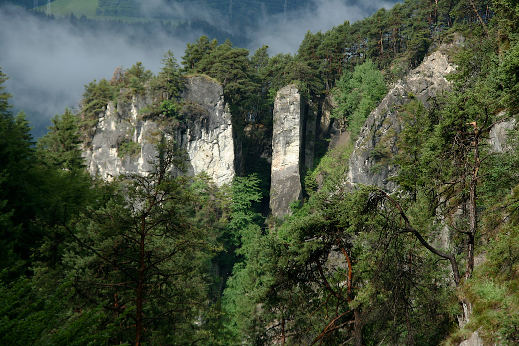
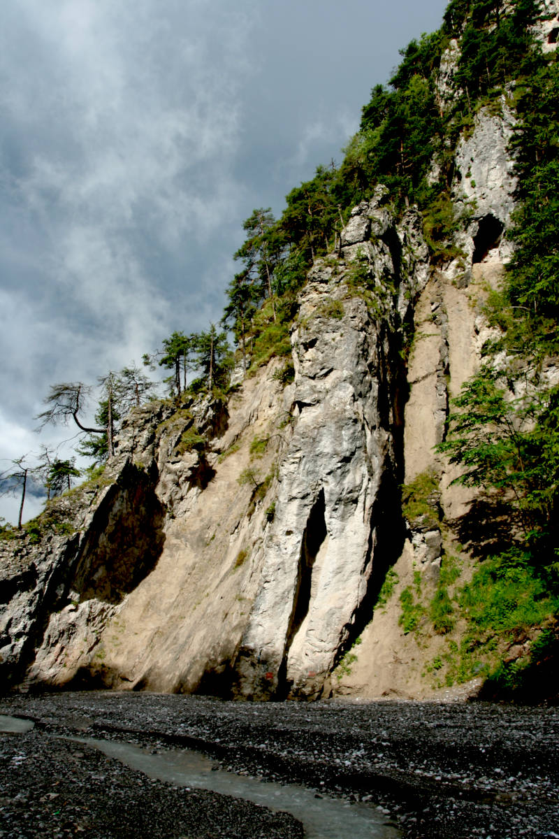
The Ehnbachklamm starts at the northern side of Zirl, where the village ends at the foot of the cliff face. The Inn river valley is one of the most spectacular valleys in the Alps, with vertical walls on the southern and northern side, and a two to three kilometers wide completely flat floor. This is the northern side and the gorge was cut by the Ehnbach, a tiny left side tributary of the Inn. The upper part of the valley is quite normal, but the lower end is a slot canyon, vertical walls, sometimes only 10 to 20 m apart, with a wild river at the bottom. This is not a classical tourist gorge, the trail is a normal hiking trail, and thus it is free, there are no restrictions at all. Nevertheless, it’s a good idea to visit the gorge between May and October and not during or after heavy rains.
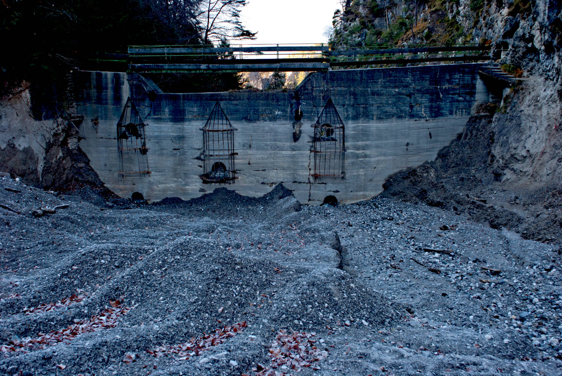
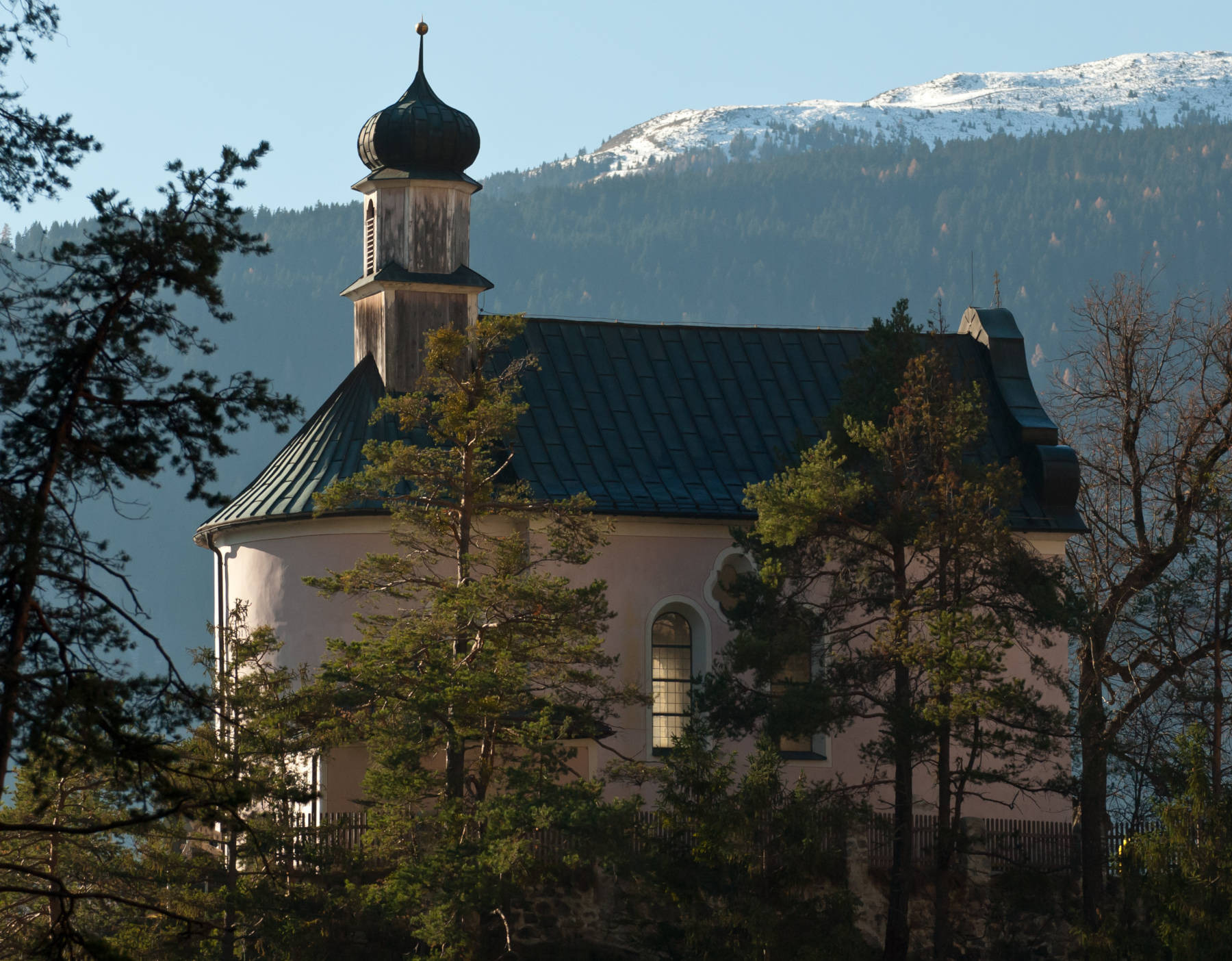
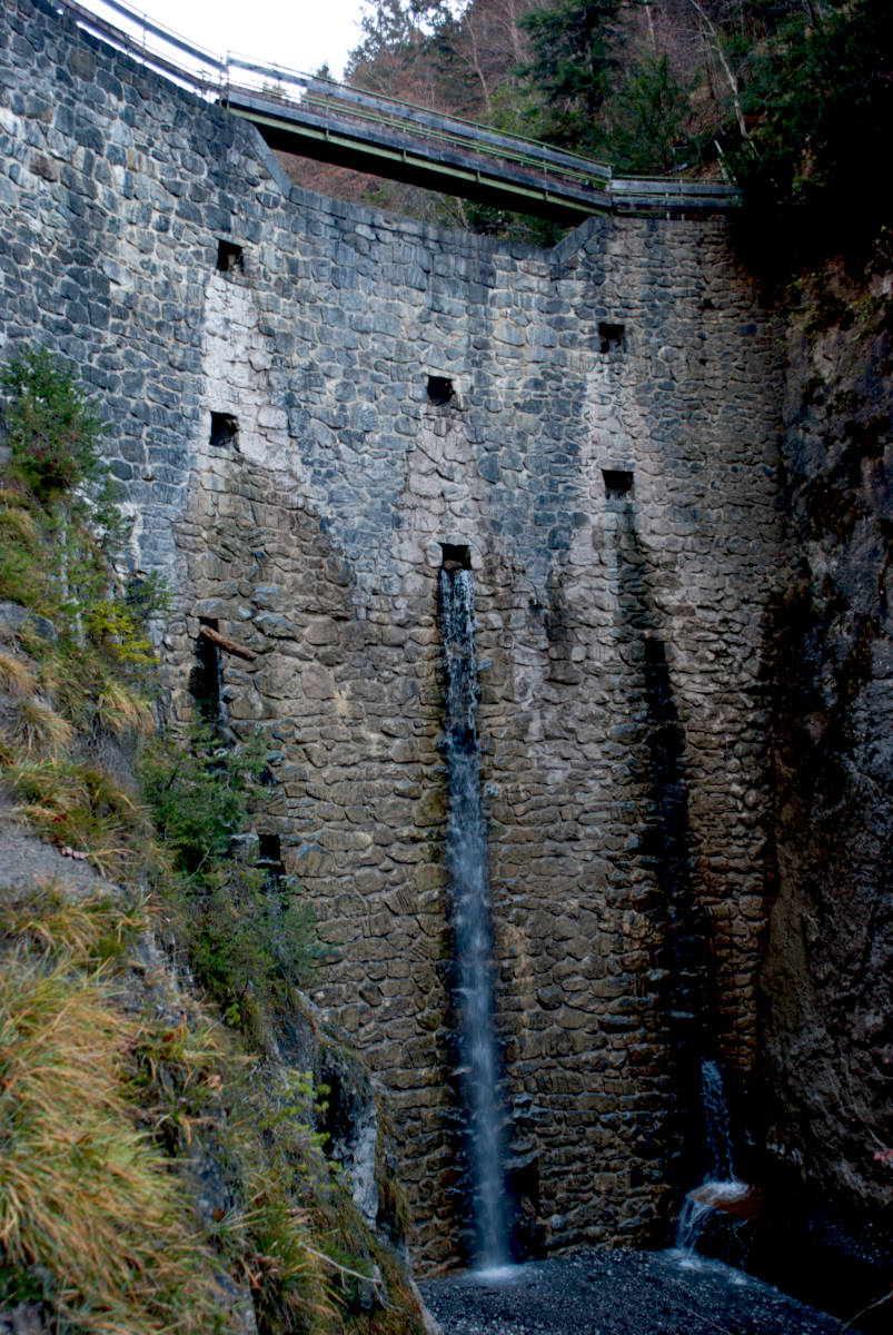
The tour starts at a small parking lot in Zirl, which is actually for the red cross station. There is a small fee for parking, the follow the paved road toward cliff face. From here follow the trail marked Ehnbachklamm. On the first rock on the left side, which is called Kalvarienberg, is a small chapel, which is accessed from the road to Hochzirl. It offers also a view into the gorge, and there is very steep a trail from the gorge to the chapel. The gorge is steep, the trail cut into the wall has no railings, only a steel rope along the wall. It is not actually difficult, but it is demanding. The end of the trail is a huge dam, which was built to catch debris, which was once transported down the gorge and into the plain with every flood. Now the dam collects the gravel and fills slowly. The staircase up the vertical dam wall is quite spectacular. After the dam the gorge wides and becomes a normal valley caled Brunntal.
The gorge is only 750 m long to the dam.
If you continue another 800 m you will reach the tracks of the Karwendelbahn railroad.
It emerges from a tunnel, crosses the river on a stone bridge and then enters the next tunnel.
Not as spectacular as the Glacierexpress in Switzerland, but close.
The trail continues, but it’s now a regular mountain trail, the next interesting stop is the Jausenstation Brunntal at 1140 m asl.
The easiest way back to Zirl is to return through the gorge.
If you turn east at the dam, there is a single lane road which leads up to the Brunntalweg.
Following this road for 20 minutes you will reach the trail for nearby
 Kaiser-Max-Grotte.
Both together are a nice half day trip.
Kaiser-Max-Grotte.
Both together are a nice half day trip.

- See also
 Search DuckDuckGo for "Ehnbachklamm"
 Google Earth Placemark
 OpenStreetMap
 Ehnbachklamm
  (visited: 24-OCT-2022)
- EHNBACHKLAMM ZIRL (visited: 24-OCT-2022)
- Zirler Kalvarienberg – Ehnbachklamm Rundwanderung (visited: 24-OCT-2022)
- Ehnbachklamm - Brunntal (visited: 24-OCT-2022)
- Ehnbachklamm bei Zirl (visited: 24-OCT-2022)
 Index
Index Topics
 Hierarchical
 Countries
 Maps
Maps