Raggaschlucht
Useful Information
| Location: |
Schmelzhütten 37, 9831 Flattach.
B106 Mölltal Straße, exit Flattach/Schmelzhütten, towards Schmelzhütten. Signposted. (46.928912, 13.141134) |
| Open: |
MAY daily 10–16. JUN to mid-SEP daily 9-17. Mid-SEP to mid-OCT daily 10-16. OCT daily 11-15. Closed during thunderstorms and heavy rain. [2025] |
| Fee: |
Adults EUR 9, Children (6-18) EUR 6. Groups (15+): Adults EUR 6, Children (6-18) EUR 4. [2025] |
| Classification: |
 Gorge Gorge
|
| Light: | n/a |
| Dimension: | L=800 m, VR=200 m. |
| Guided tours: | self guided, D=2 h, L=3.4 km, VR=270 m. V=50.000/a [2018] |
| Photography: | allowed |
| Accessibility: | no |
| Bibliography: | |
| Address: |
Raggaschlucht, Schmelzhütten 37, 9831 Flattach, Tel: +43-4785-333.
E-mail: |
| As far as we know this information was accurate when it was published (see years in brackets), but may have changed since then. Please check rates and details directly with the companies in question if you need more recent info. |
|
History
| 1882 | first trails installed and opened to the public. |
| 1978 | declared a Natural Monument. |
| 2003 | trails damaged by flood. |
| OCT-2018 | a storm with flood destroys most of the wooden trails. |
| 2019 | trails restored for 230,000 EUR and gorge reopened. |
Bemerkungen
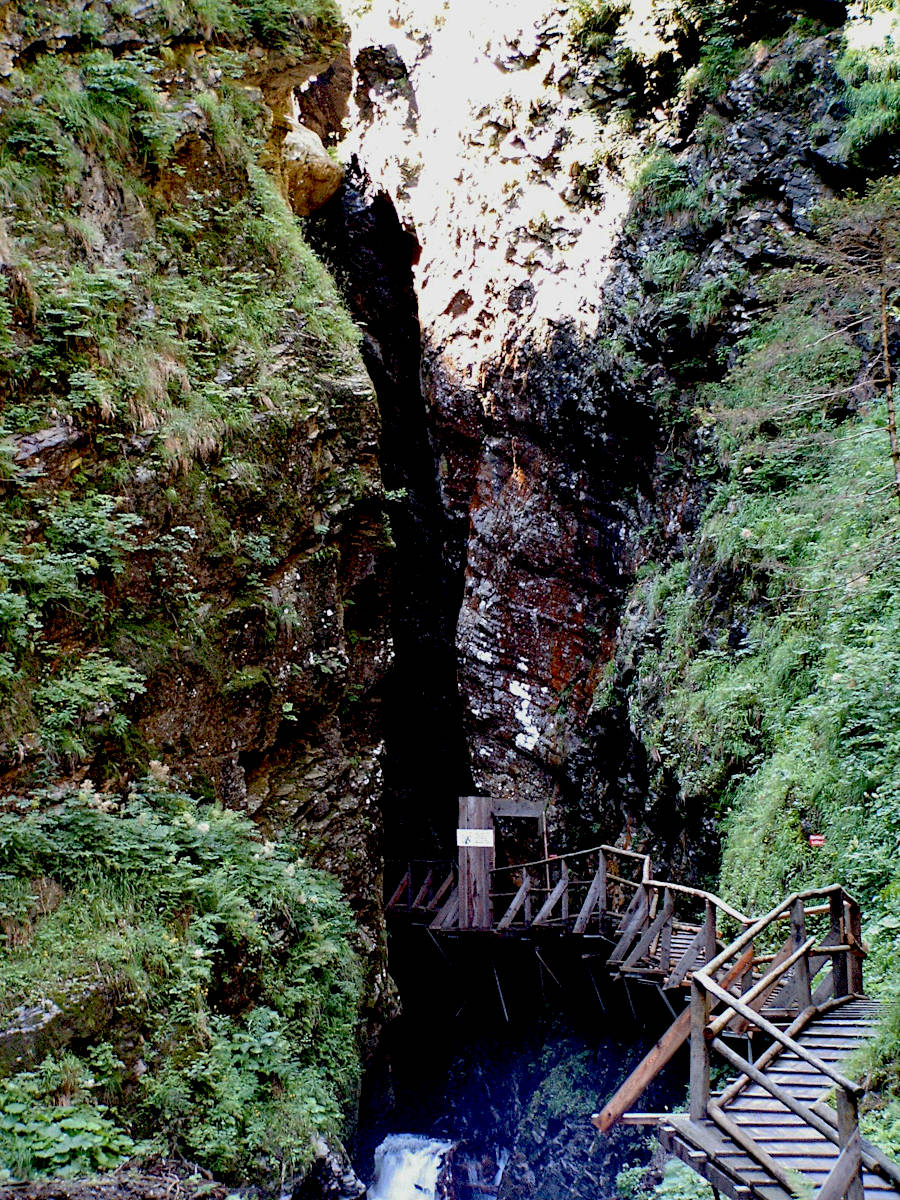
The Raggaschlucht (Ragga Gorge) is a narrow canyon with a wooden trail which is built along the cliff face high above the water.
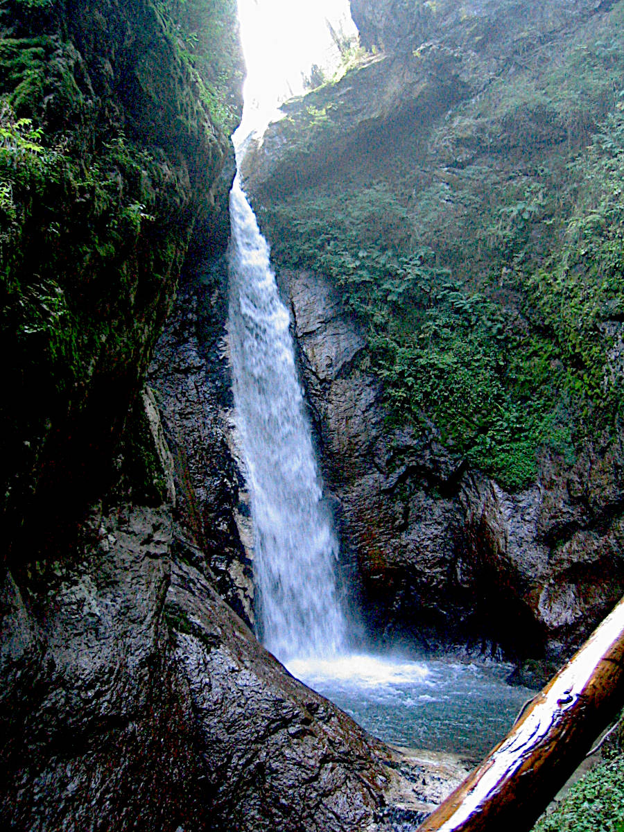
There is a roaring river with numerous small waterfalls and spectacular cliffs.
Educational signs along the trail make this a geological trail, explain the formation of the Alps and the erosion of the gorge.
Despite all that is extraordinary, now something humorous, the Hohe Tauern National Park has awarded it the tongue-in-cheek title of Imposanteste Naturschlucht Kärntens (Carinthia’s most impressive natural gorge).
Apart from the fact that the word Naturschlucht does not exist in German and "impressive" not measurable is, this is a non-existent ranking and the award must surely be one of the
 Fake Statistics.
In other words: marketing-babble.
Fake Statistics.
In other words: marketing-babble.
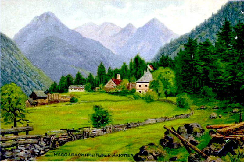
From the parking lot at the Gasthof Raggaschlucht in the small village Schmelzhütten it’s a 10 minutes walk to the entrance of the gorge. Behind the ticket office the wooden footbridges start almost immediately. The gorge is 800 m long and the trail climbs 200 m to the upper end of the final waterfall. At the end of the gorge the trail goes up the side of the mountain on the right side. The way back along the pastures offers great view, then it enters the forest and leads back down to the village. There are no toilets and no shop except for Anita’s Kiosk at the ticket office. And there is the Gasthof Raggaschlucht where you can have a drink or meal after the visit.
The gorge was named after the Slovenian word Rak which means crab, obviously there were once crabs in the river. The gorge is 65 km from the Slovenian border, but both countries were in the Austro-Hungarian empire and so there was no border and a lot of connections. It is located in the Kreuzeckgruppe (Kreuzeck mountains) and was created by the melting water of the last ice age. In other words it is quite young, less than 12,000 years old. There are numerous educational signs along the trail which explain the geology of the mountains, the ice age, and the formation of the gorge. The dominant rocks of the gorge are paragneiss and mica schist, metamorphic rocks from the core of the Alps. At the upper end of the gorge, a pegmatite intrusion forms a 10 m high step over which the Raggabach falls into the gorge in an impressive waterfall.
During winter ice and snow, and especially the melting water in spring often damage the trails. They were built high above the river, but nevertheless there are repairs necessary every year. The entrance fee is more or less for this continuous work. But in October 2018 there was a storm with extremely strong wind and heavy rainfall which caused damages, floods, mudslides, and power outages. The hurricane-like storm caused destruction in Italy, Croatia, Austria, and Switzerland. A 12 m high flood in the gorge also destroyed most of the wooden trails, which was much worse than the normal damages. The repair works were difficult and cost 230,000 EUR, long sections of the wooden bridges hat to be rebuilt, the other parts were damaged. The communal workers and specialists were able to restore the trail so the gorge was reopened in May 2019.
There is a 2.5 km long round trip, and the trail has some ups and downs, so we guess you should allow 90 minutes for the walk. Good walking shoes are strongly recommended, also a little surefootedness. In summer a hat and a rucksack with water and probably a snack are also a good idea. In autumn and spring a warm jacket and a raincoat are recommended. The canyon can only be walked in one direction, upstream, the last section of the way back through the forest is a little steep. While there is no restriction for young children, a minimum age of 6 is recommended, although this obviously depends on the child.
- See also
 Search DuckDuckGo for "Raggaschlucht"
 Google Earth Placemark
 Raggaschlucht
  - Wikipedia (visited: 17-OCT-2022)
 Raggaschlucht - wild water - masterpiece of creation, official website (visited: 17-OCT-2022)
- Raggaschlucht, virtual tour (visited: 17-OCT-2022)
- Raggaschlucht Waterfalls (visited: 17-OCT-2022)
- Raggaschlucht: 200.000 Euro für Sanierung (visited: 17-OCT-2022)
 Index
Index Topics
 Hierarchical
 Countries
 Maps
Maps