Blauer See
Blue Lake
Useful Information

| Location: |
38889 Elbingerode.
Garkenholz Quarry. Near Rübeland, 14 km south of Wernigerode. From Wernigerode F244 to Elbingerode, turn left, F27 to Rübeland, through the village, turn right towards Hüttenrode. (51.7636434, 10.8693023) |
| Open: |
no restrictions. [2025] |
| Fee: |
free. [2025] |
| Classification: |
 Karst Lake,
artificial Karst Lake,
artificial
|
| Light: | n/a |
| Dimension: | L=95 m, W=47 m, D=17 m. |
| Guided tours: | self guided |
| Photography: | allowed |
| Accessibility: | yes |
| Bibliography: | |
| Address: | |
| As far as we know this information was accurate when it was published (see years in brackets), but may have changed since then. Please check rates and details directly with the companies in question if you need more recent info. |
|
History
| 1885 | Start of limestone quarrying. |
| 1945 | Quarry closed. |
Description
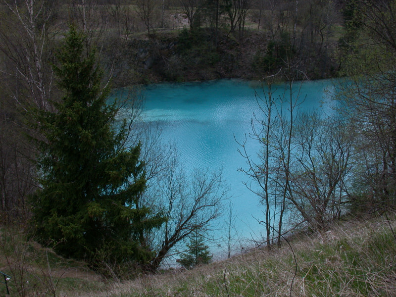

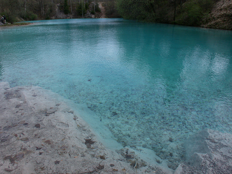
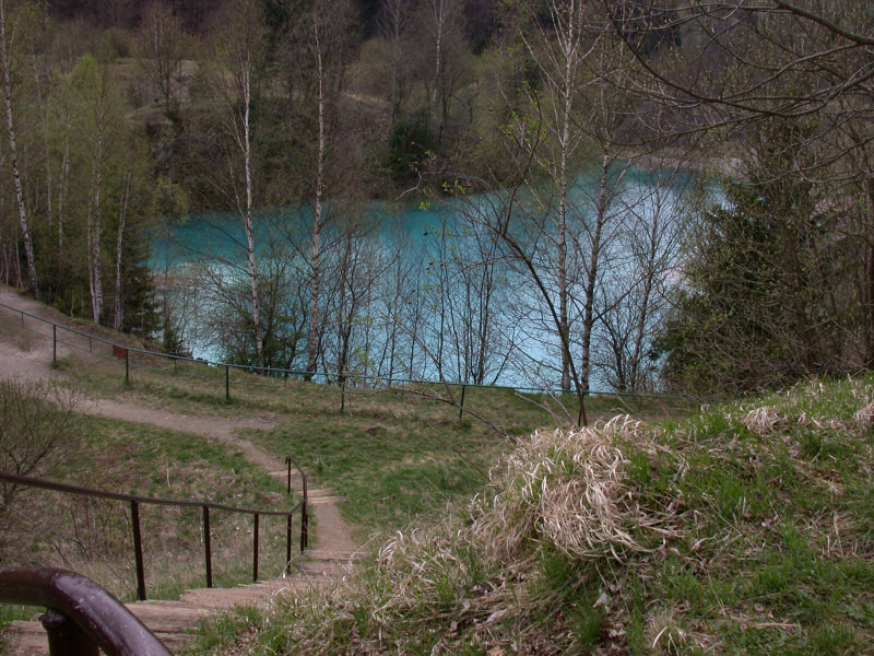
The Blue Lake is a small lake of extremely deep blue colour. Although it looks like any other lake - despite the colour - it is artificial. The open pit quarrying of limestone in this area a huge pit with various levels and piles of overburden. The lowest mining level was flooded by the ground water after the quarry was abandoned. This water from the karst body, and probably also surface water which seeps through the overburden of the quarrying, is extremely rich in dissolved limestone and thus glows in this extreme blue colour. The principle is rather simple: the water filters all colours of the white sunlight except the blue wavelengths, which are reflected by the ground.
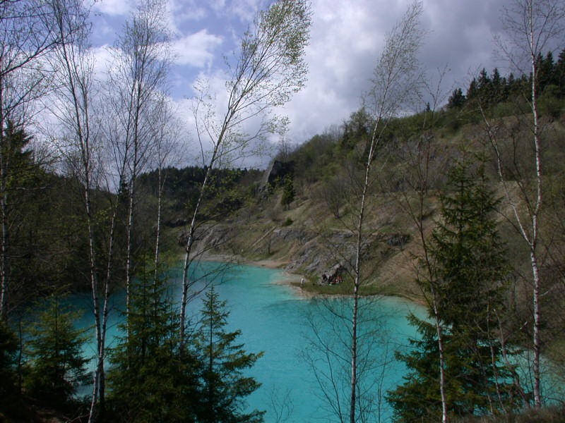
Today this lake is a famous tourist spot. It is best visited during sunny weather, as the blue colour is much less impressive in bad weather. The road leads up a little valley from Rübeland to Hüttenrode, to the left is a sign "Blauer See" and the gate to a huge parking lot. During summer there is a kiosk selling beverages and fast food. Now the visitor has to walk down to the lake.
There is a trail around the lake. If you start at the upper end of the parking, a narrow trail leads through bushes and over piles of overburden. You will reach the lake at the side where the cliffs are highest. Following the trail you circle the lake counterclockwise and finally reach the water at the far end. On the other side a gravel single-lane-road leads up to the parking again. If you want to minimize the distance of the walk, use this road for downhill too.
Although it is artificial, the lake is a genuine karst lake. This means that the lake level corresponds to the karst groundwater. The water flows through fissures in the limestone and when the karst water level fluctuates, the lake level changes. In dry years, when the karst water level is very low, the lake can dry out completely. In wet years, it can reach a depth of up to 17 metres. This geological peculiarity is the reason why the lake is a GeoParks geotope, even though it is artificial.
 Search DuckDuckGo for "Blauer See"
 Google Earth Placemark
 OpenStreetMap
 Blauer See (Hüttenrode)
  - Wikipedia (visited: 23-MAY-2025)
 Index
Index Topics
 Hierarchical
 Countries
 Maps
Maps