Jons Kapel
Useful Information
| Location: |
Jons Kapelvej 4, Hasle, 3790.
7 km north of Hasle. (55.2332685, 14.7206502) |
| Open: |
no restrictions. [2025] |
| Fee: |
free. [2025] |
| Classification: |
 Sea Cave Sea Cave
|
| Light: | bring torch |
| Dimension: | A=41 m asl. |
| Guided tours: | self guided |
| Photography: | allowed |
| Accessibility: | no |
| Bibliography: | |
| Address: | Jons Kapel, Jons Kapelvej 4, Hasle, 3790, Tel: +45-. |
| As far as we know this information was accurate when it was published (see years in brackets), but may have changed since then. Please check rates and details directly with the companies in question if you need more recent info. |
|
History
| 1907 | rock formation of Jons Kapel placed under nature protection. |
Description
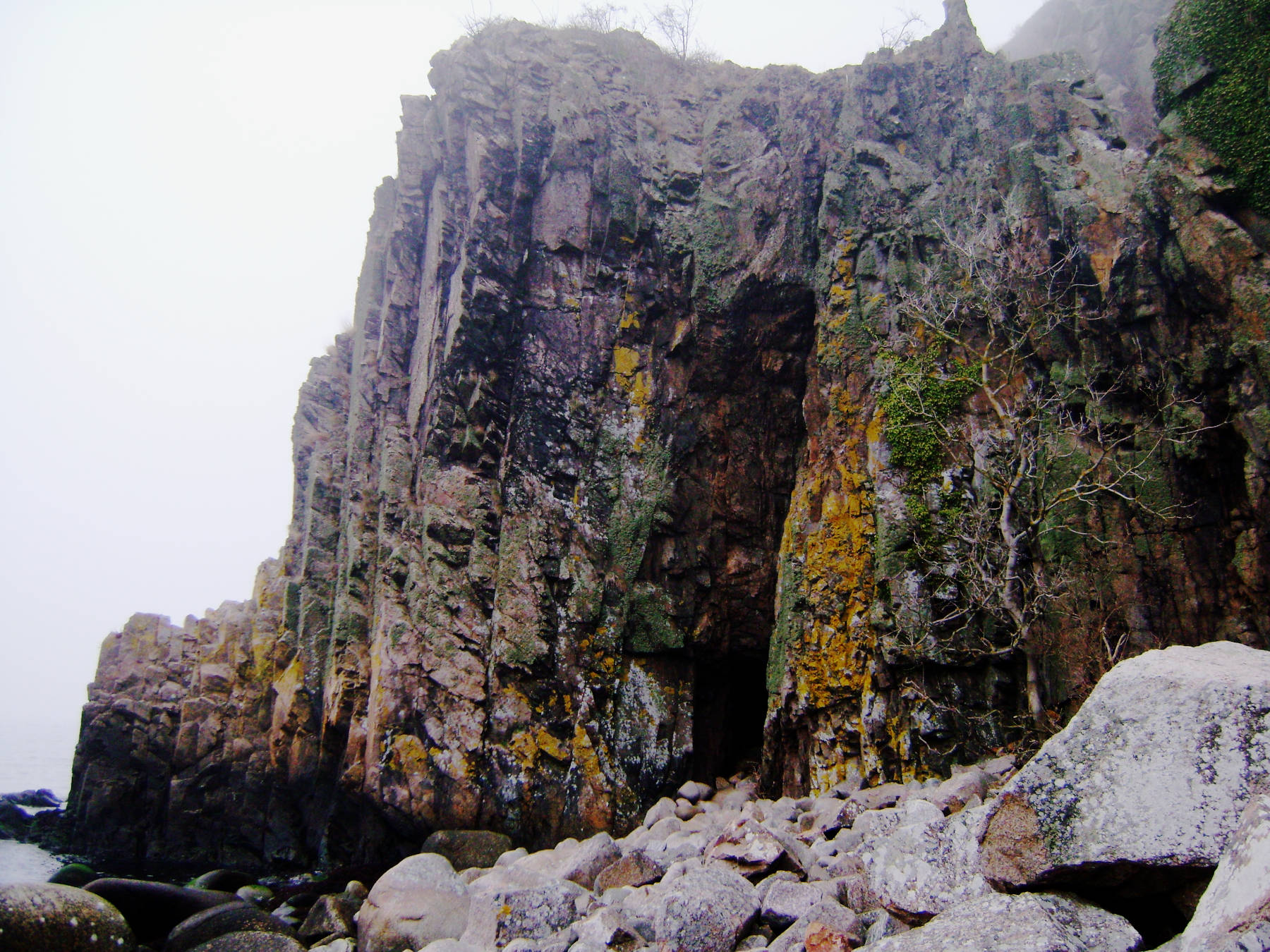
Jons Kapel (Jon’s Chapel) is a sea cave which is located on the western coast of the small island Bornholm. It was named after the monk Jon who, according to local legend, was sent to Bornholm with the mission of spreading Christianity.
The monk Jon was sent to Bornholm with the mission of spreading Christianity. He preached from inside his cave daily, even if nobody was there, so he preached to the sea gulls and surf waters of the sea. But the locals slowly became curious. One after the other flocked to the cave, until finally the cave was too small for all attendees. So he eventually moved his service outside. Further south along the coast there are four more caves, which were named after their use: Jons Sovekammer (Jon’s Bedroom), Jons Spisestue (Jon’s Dining Room), Jons Sakristi (Jon’s Sacristy). and Jons Madkælder (Jon’s Food Cellar).
Some call Jon a missionary, others call him a hermit. Actually its unclear if he really existed as there are no documents, probably it’s just a local legend to explain the name.
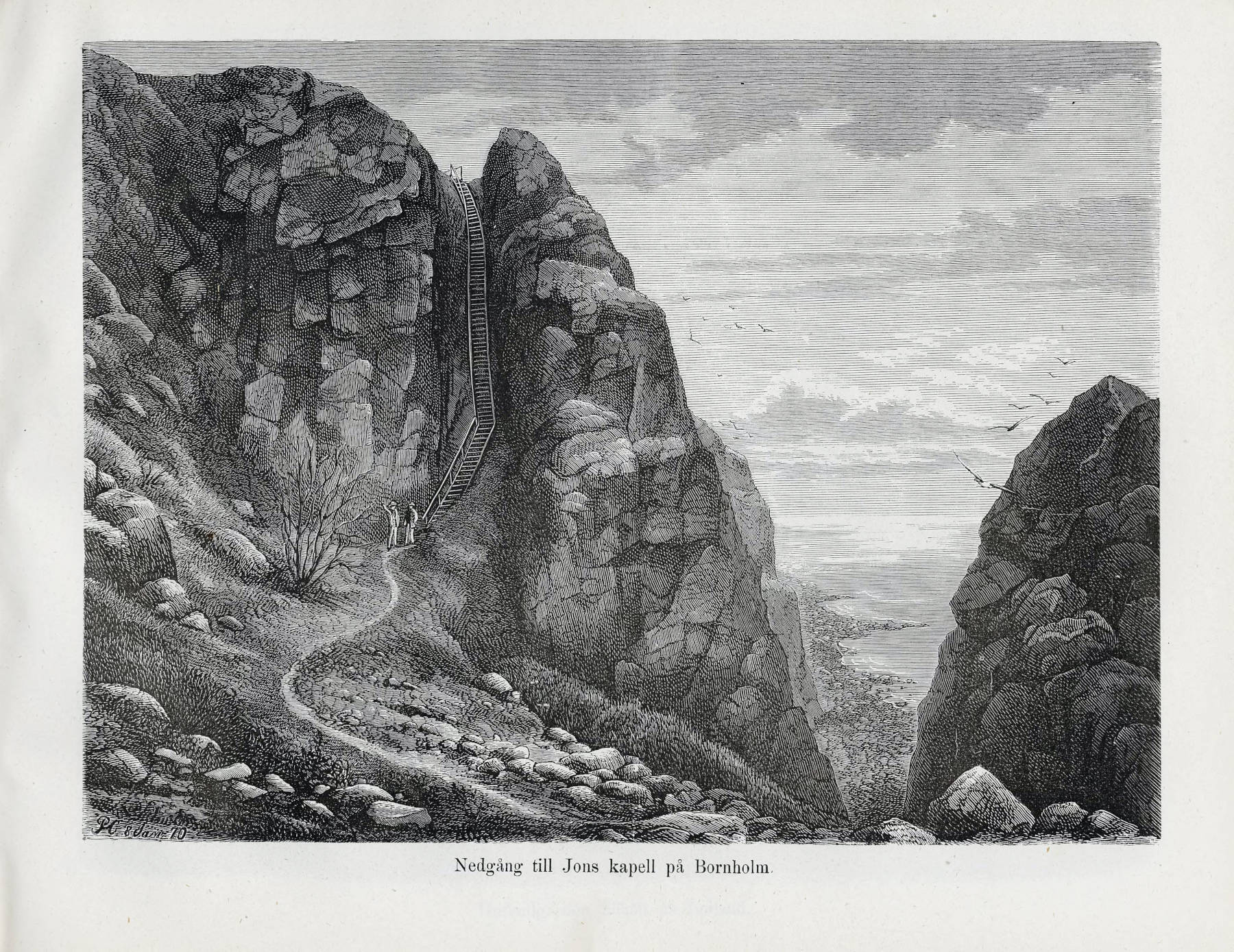
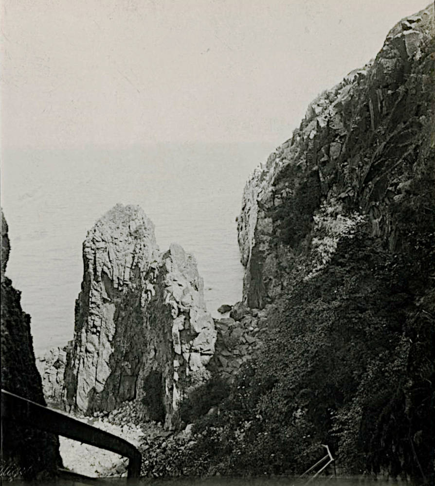
The sea caves are located at the foot of a cliff, the main cliff is sometimes named Jons Kapel, sometimes Jons Kirke (Jon’s Church). The site is reached on three different hiking trails, which meet on the plateau above the cliff. A long and straight wooden staircase leads down the valley of the Askebækken brook to the chapel with 172 steps. Some say the number of steps is not countable, as everybody has a different number after trying to do so. Numbers between 108 and 183 steps have been counted. The most common access is from Highway 159, turn into Jons Kapelvej and follow it to the end. There is a parking lot with the trailhead (400 m). Alternatively it’s possible to walk along the coast either from Vang Havn in the north (2 km) or from the end of Teglkåsvej in the south (800 m). Though longer both routes are praised to be worthwhile because they offer great views of Denmark’s most spectacular cliffs.
The cliffs consist of Vang granite, named after the fishing village Vang to the north. The cave is located high above the sea at the foot of the Hvidkleven (White Cliff). The granite is quite resistant, but it has dykes of diabase, which is much softer and less resistant to weathering. Those gangues are typically eroded much faster and most sea caves were formed this way. Even the descent, this straight gorge with the wooden staircase, was formed this way. It also explains why those forms are straight, the caves often have almost rectangular portals.
At the cave climbing is not allowed. But about 50 m south of it, there are some climbing routes up to grade 6 (UIAA). The over 70 m long climbing route ‘Jons long marchen’ is the longest climbing route on Bornholm and in Denmark.
 Search DuckDuckGo for "Jons Kapel"
 Google Earth Placemark
 OpenStreetMap
 Jons Kapel - Wikipedia (visited: 11-MAR-2025)
 Jon’s Chapel (visited: 11-MAR-2025)
 Jons Kapel (Jon’s Chapel) - Atlas Obscura (visited: 10-MÄRZ-2025)
 Index
Index Topics
 Hierarchical
 Countries
 Maps
Maps