Caminito del Rey
Desfiladero de los Gaitanes - Gaitanes Gorge - Camino del Rey
Useful Information


| Location: |
Either start at the train station in El Chorro, or at the restaurant El Kiosko in Ardales.
(36.932819, -4.788506) |
| Open: |
All year Tue-Sun 9-16. Tickets must be booked online on website! Arrive at Control Point at least half an hour earlier. Closed ß1-JAN, 24-DEC, 25-DEC, 31-DEC. [2020] |
| Fee: |
Adults EUR 19.55, Children (0-7) not allowed. (includes entrance fee, guide, shuttle bus ticket) [2020] |
| Classification: |
 Gorge Gorge
|
| Light: | n/a |
| Dimension: |
Total: L=7,700 m. Boardwalks: L=2,900 m. Northern Gorge: L=380 m, W=5 m, H=100 m, A=280 m asl. Southern Gorge: L=200 m, W=10 m, H=80 m. |
| Guided tours: | L=7,700 m, D=4 h. |
| Photography: | allowed |
| Accessibility: | no |
| Bibliography: | |
| Address: | Desfiladero de los Gaitanes, 29550 Ardales, Málaga, Tel: +34-952-458145. |
| As far as we know this information was accurate when it was published (see years in brackets), but may have changed since then. Please check rates and details directly with the companies in question if you need more recent info. |
|
History
| 1901 | beginning of construction. |
| 1905 | trail completed. |
| 1921 | crossed by King Alfonso XIII for the inauguration of the dam Conde del Guadalhorce. |
| 2001 | trail closed due to dangerous conditions. |
| 2006 | plan to reconstruct the trail officially approved. |
| 2015 | reopened after renovation. |
Description
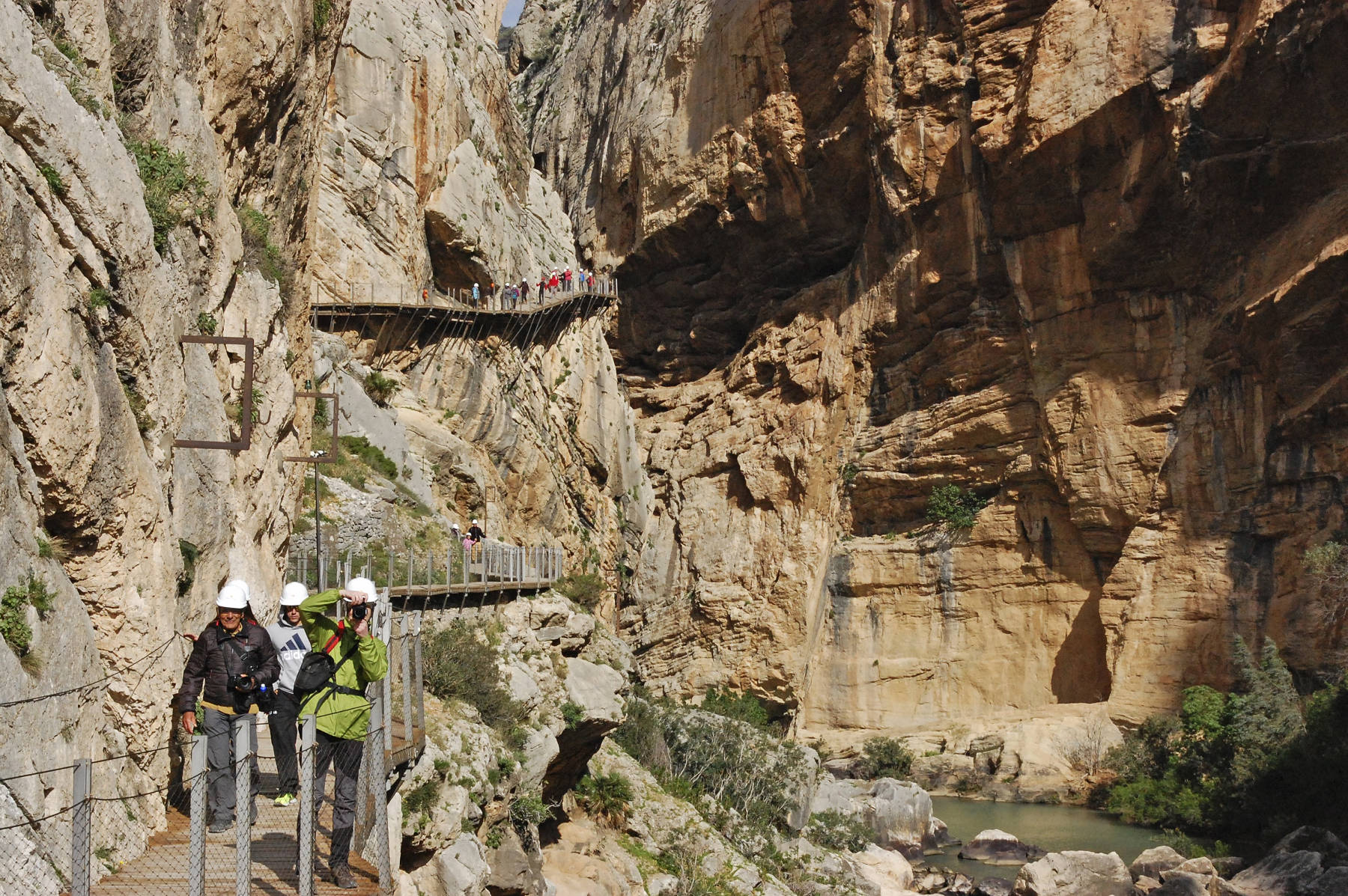
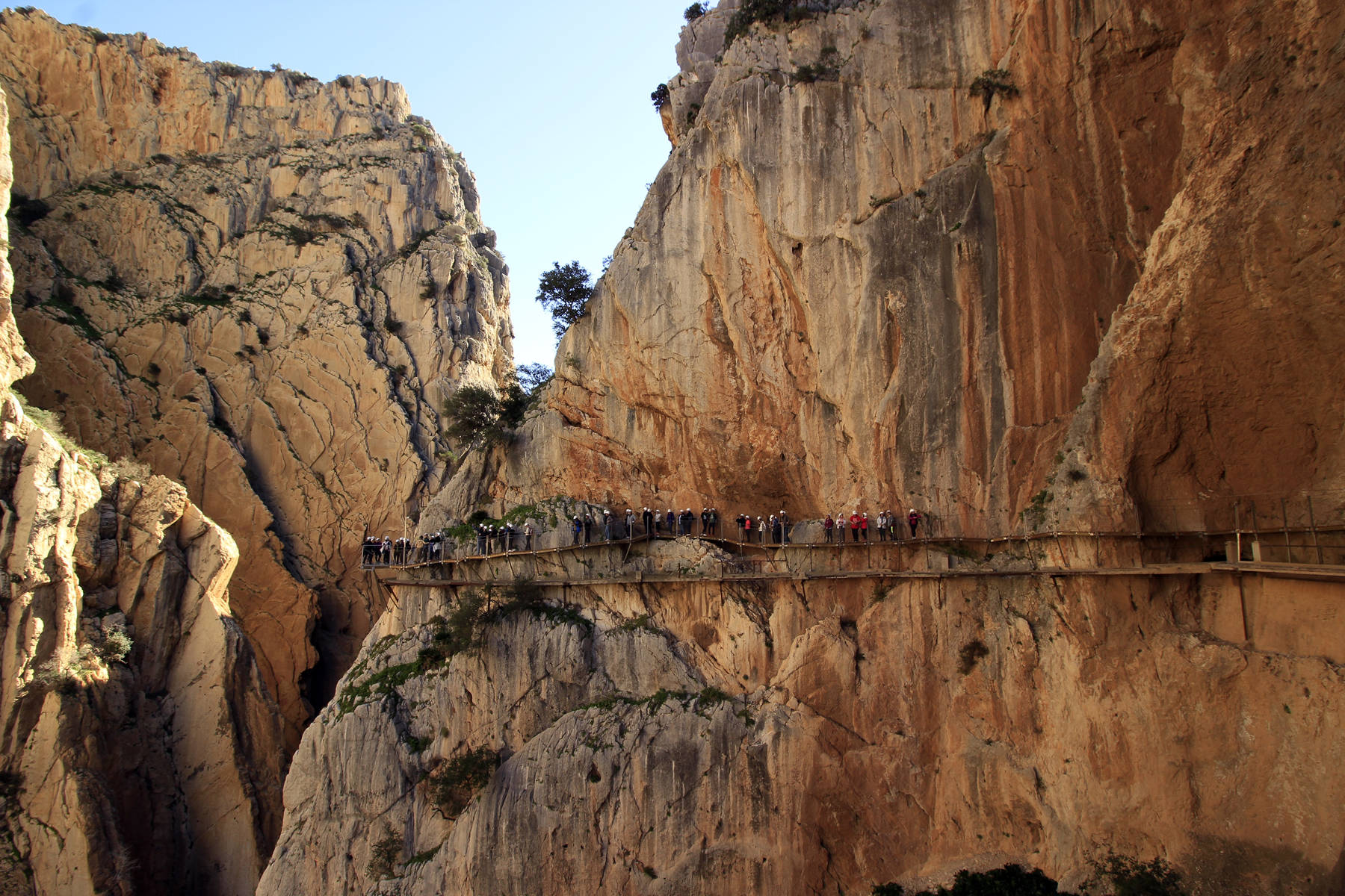
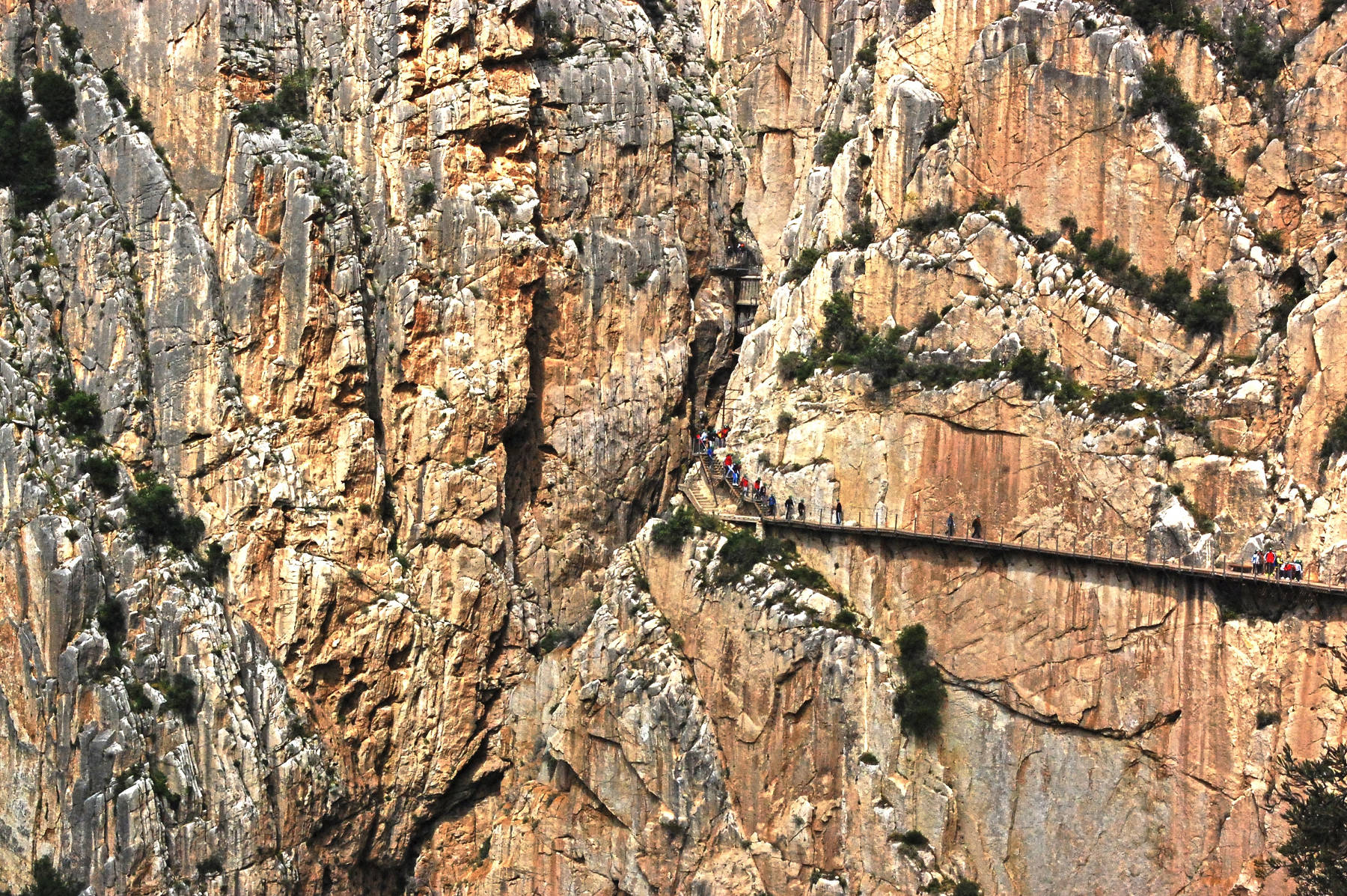
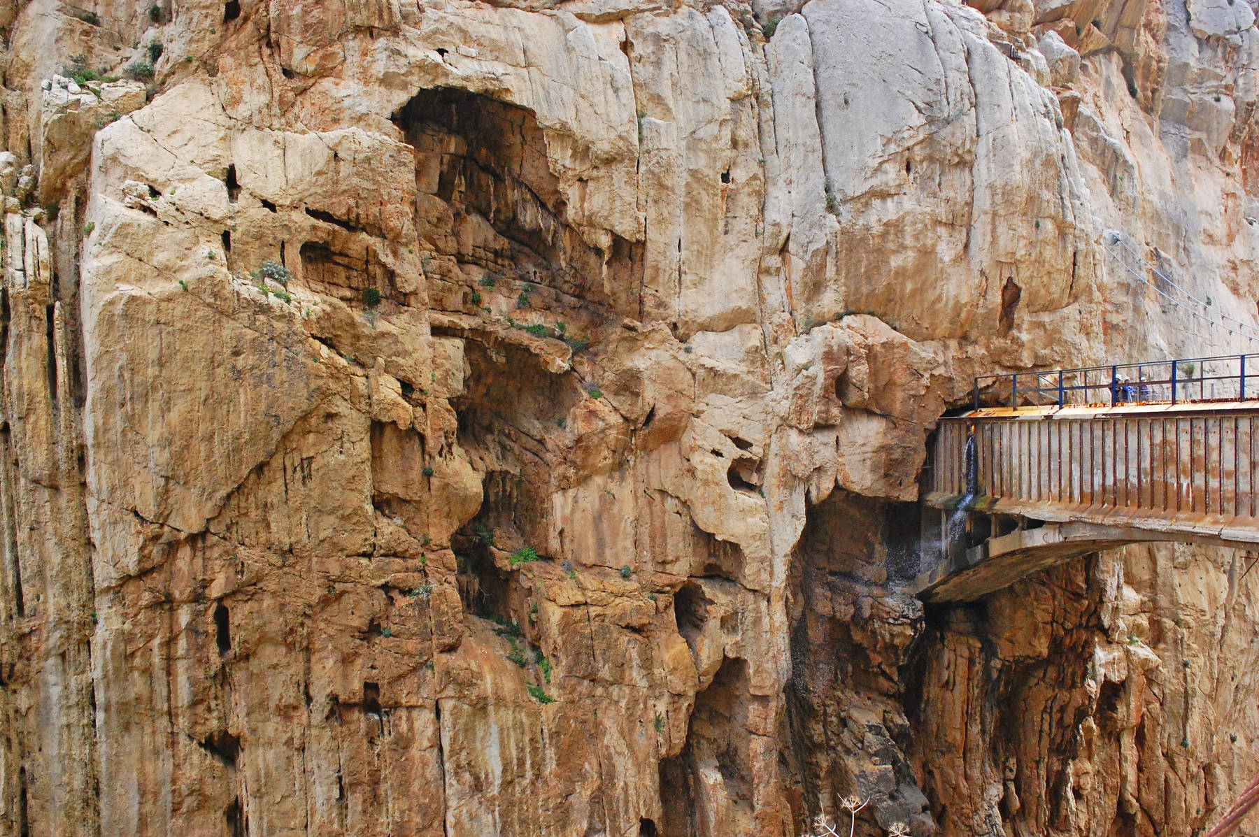
Caminito del Rey (The King’s Little Path) is the most dangerous trail in Europe. It is bolted on the vertical cliff walls 100 m above the river Guadalhorce. It was built from 1901 to 1905 during the construction of the hydroelectric power plants at the Chorro and Gaitanejo waterfalls. It allowed the workers to cross between the two sites and even transport material. And it was intended as inspection route for the canal through the gorge which is part of the power scheme. It was named Camino del Rey (King’s Pathway) after it was crossed by King Alfonso XIII for the inauguration of the dam Conde del Guadalhorce in 1925. The original path was constructed of steel rails supported by 45° stanchions bolted to the limestone wall. On the rails was a path of concrete slabs and the trail had a railing.
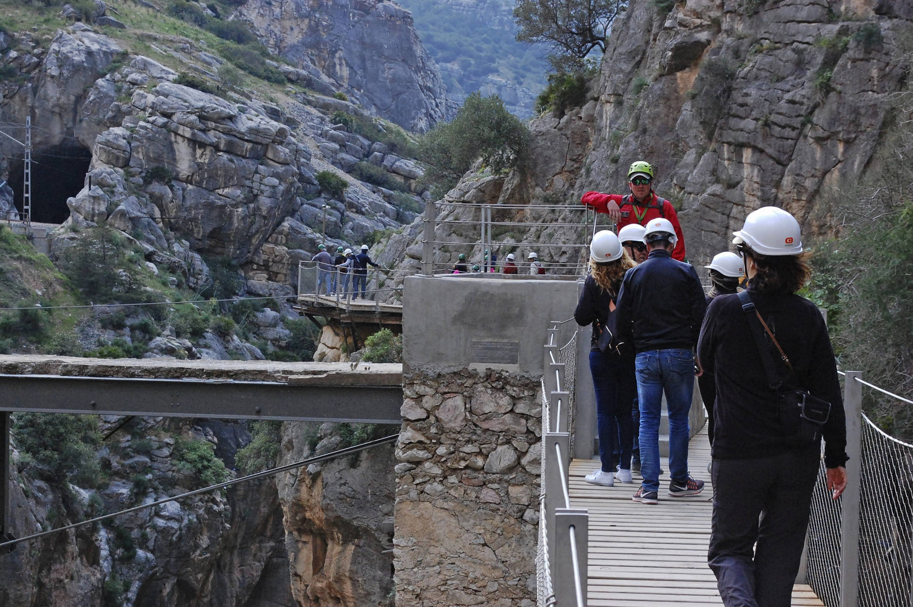
But at the end of the 20th century the trail was in disrepair and had many gaps in the concrete slabs and the railing was missing almost completely. There was a safety wire along the wall for the full length of the trail, but obviously it was not used by all visitors. In the years 1999 and 2000 five visitors died on the trail and many were injured. As a result the trail was closed to the public in 2001, but the situation became even worse. Danger seekers found an alternative entry point by climbing iron bars in the vertical wall to reach the trail. And so the government decided to renovate the trail instead and reopen it in a safe condition. The spanish government invested 2 Million EUR (or 5.5 Million EUR, depending on the source) on the renovation which took almost 10 years. Now the trail is complete again, there is a complete new trail 1 m above the old one with safe railings.
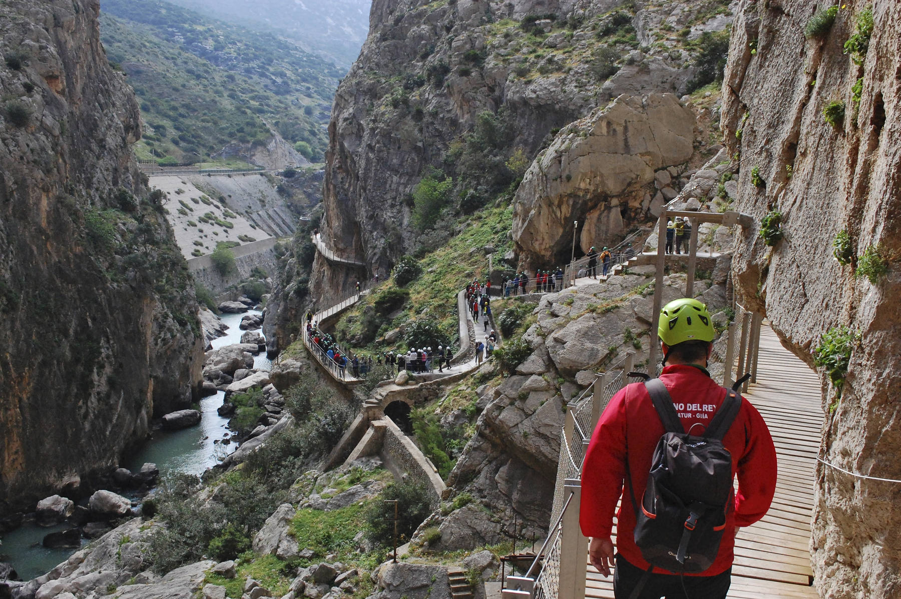
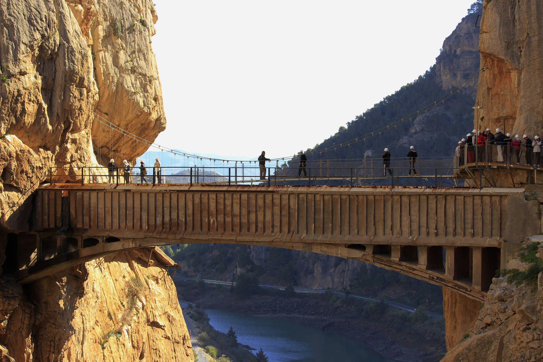
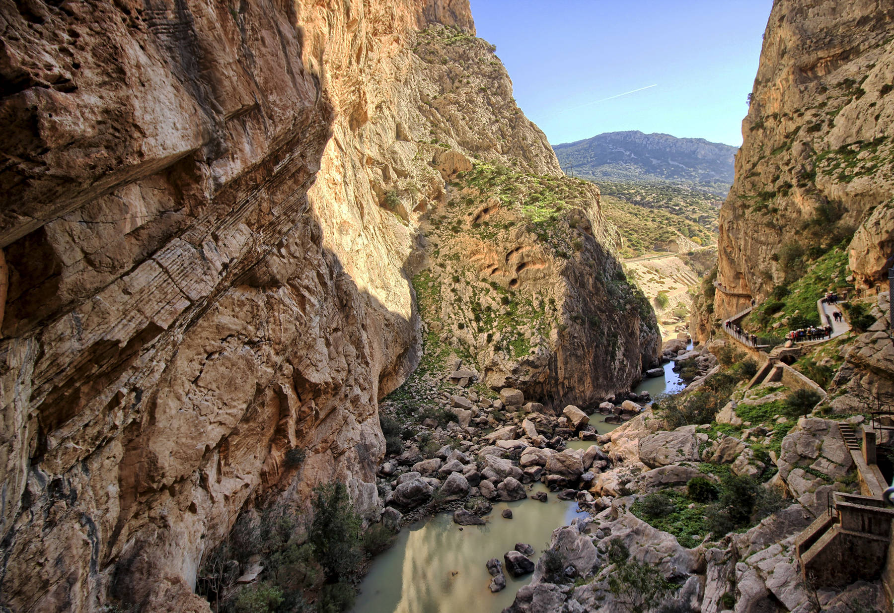
The Desfiladero de los Gaitanes is a nature park with a size of 2,016 hectares. The gorge has two spectacular narrow parts with steep cliffs. The most spectacular part is the northern gorge, desfiladero de Gaitanejo (Gaitanejo Gorge), which is almost 400 m long and has 100 m high vertical walls, only 5 m apart. The park was named after this gorge. A steep valley inbetween named El Lugar del Soto (The Place of the Thicket) connects the two gorges. The park is famous for its fauna and flora, and there is much to see along the trail, especially in this central part. The second gorge named Tajo de las Palomas (Las Palomas Cliff) is much shorter, only 200 m and less narrow. It has the often photographed bridge, which is actually an aqueduct and it serves as an outlook. Since the renovation there is a second bridge to reach the eastern side, so it is now a dead end. There is also a new foot tunnel along the second gorge, which has two outlooks in the cliff. A single track railroad line was built through the gorge, but it misses the spectacular parts because the tracks are inside tunnels.
The area has numerous artificial lakes where the water of river Guadalhorce is damed and used for a hydro-eclectric power scheme. The Embalce del Guadalhorce and the Embalce del Conde de Guadalhorce have their dams close by. After the water produced electricity it flows together and is immediately dammed again. This dam is located right at the upper or northern end of the gorge, where the Gaitanejo Hydroelectric Power Station is located.
The gorge is only accessible in one direction, from the north to the south, which is also downstream. In other words it is necessary to close the loop on normal roads. For this reason there is a shuttle bus from the small village El Chorro to Ardales, which is included in the ticket. From Ardales there is a tunnel at the restaurant El Kiosko at road MA-444. On the other end a gravel trail leads along the river offering views on both dams and cave houses. The trail is 2.7 km long and requires about 50 minutes walk. The shorter trail starts 200 m from the restaurant through a short tunnel, its 1.5 km or 20 minutes walk to the gorge. It has a second tunnel named Tunel de los Tafonis, which shows several small caves which are a result of weathering. Both trails lead to the Control Point at the power plant, where the gorge trail starts. Visitors are equipped with helmets and security leashes, the shoes are checked, and whether they carry any forbidden objects like umbrellas, hiking sticks, or selfie sticks.
|
|
| Caminito del Rey Gallery |
- See also
 Search DuckDuckGo for "Caminito del Rey"
 Google Earth Placemark
 Caminito del Rey - Wikipedia (visited: 25-AUG-2020)
 The entrance to the Caminito del Rey (visited: 25-AUG-2020)
- It’s a Man’s World (visited: 16-MAY-2020)
- El Chorro: El Camino del Rey reopens in Spain (visited: 16-MAY-2020)
- Desfiladero de los Gaitanes (visited: 26-FEB-2020)
 Index
Index Topics
 Hierarchical
 Countries
 Maps
Maps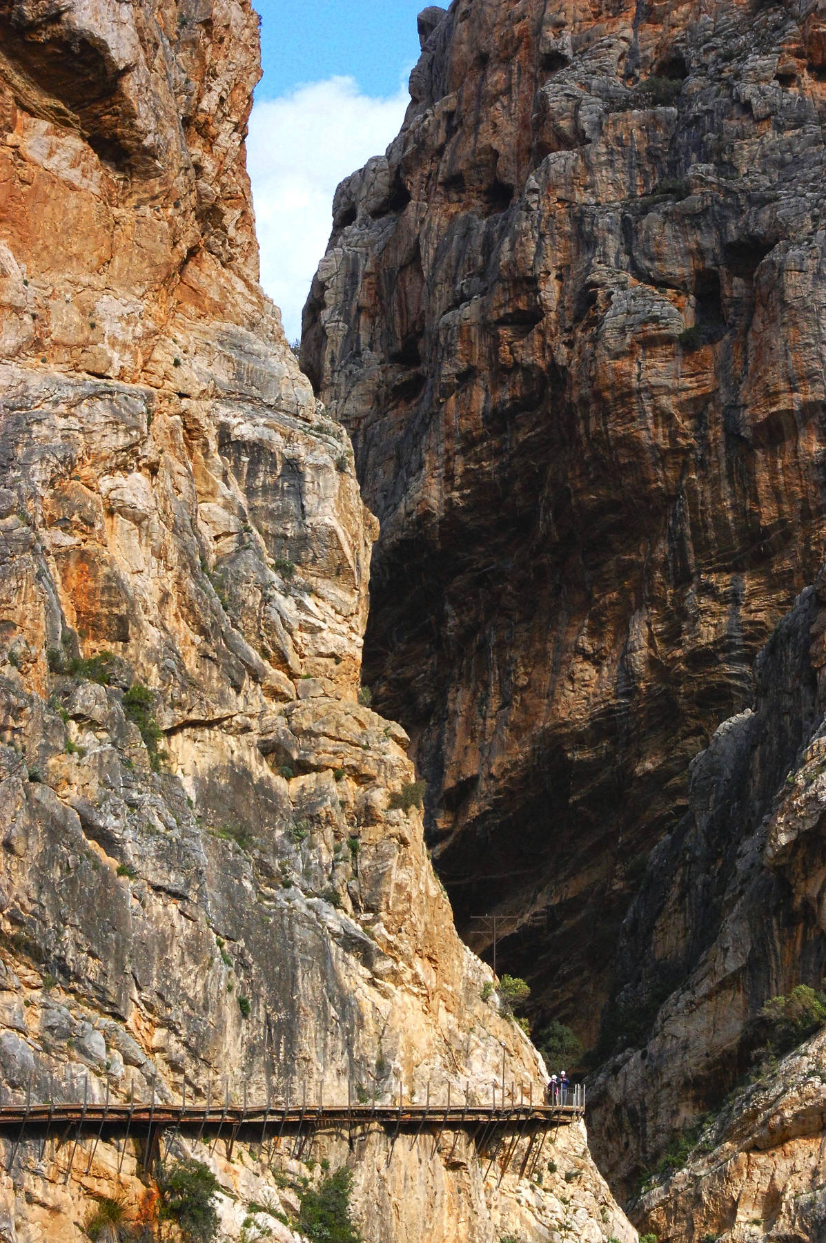