Grotte des Druides
Useful Information

| Location: |
A35 exit 13 Mont St Odille, follow signs to Mont St Odille.
(48.4258740, 7.4017117) |
| Open: |
no restrictions. [2023] |
| Fee: |
free. [2023] |
| Classification: |
 Talus Cave
Lower Triassic sandstone Talus Cave
Lower Triassic sandstone
|
| Light: | bring torch |
| Dimension: | L=5 m, A=770 m asl. |
| Guided tours: | self guided |
| Photography: | allowed |
| Accessibility: | no |
| Bibliography: |
Claude Chabert, Jean-Yves Bigot (1993):
À travers les grès des Vosges. Matériaux pour servir à la connaissance du Bas-Rhin,
Grottes & Gouffres, bull. S. C. Paris, n° 129, p. 4-9.

|
| Address: | Grotte des Druides. |
| As far as we know this information was accurate when it was published (see years in brackets), but may have changed since then. Please check rates and details directly with the companies in question if you need more recent info. |
|
History
| 1991 | survey by J.-Y. Bigot and C. Chabert. |
Description
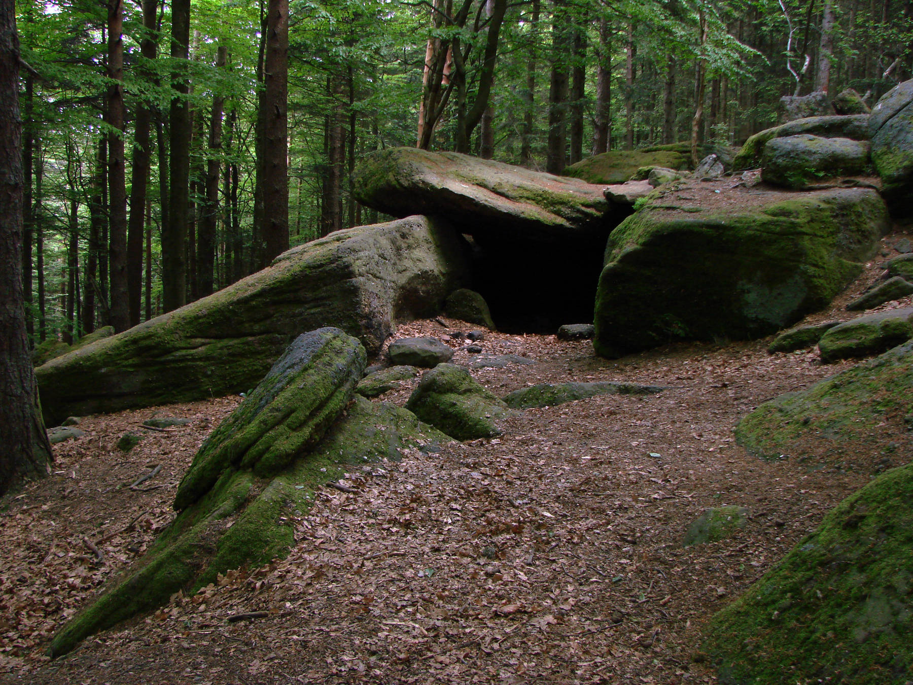
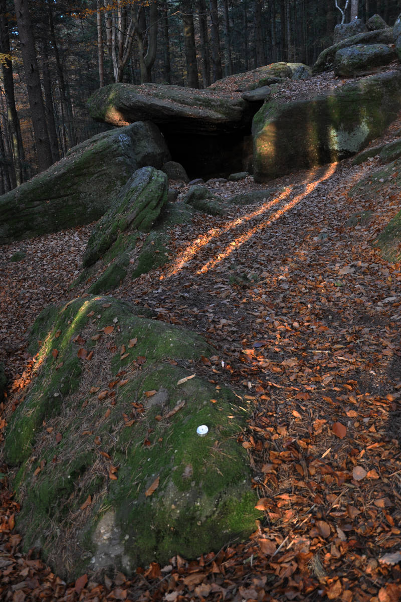
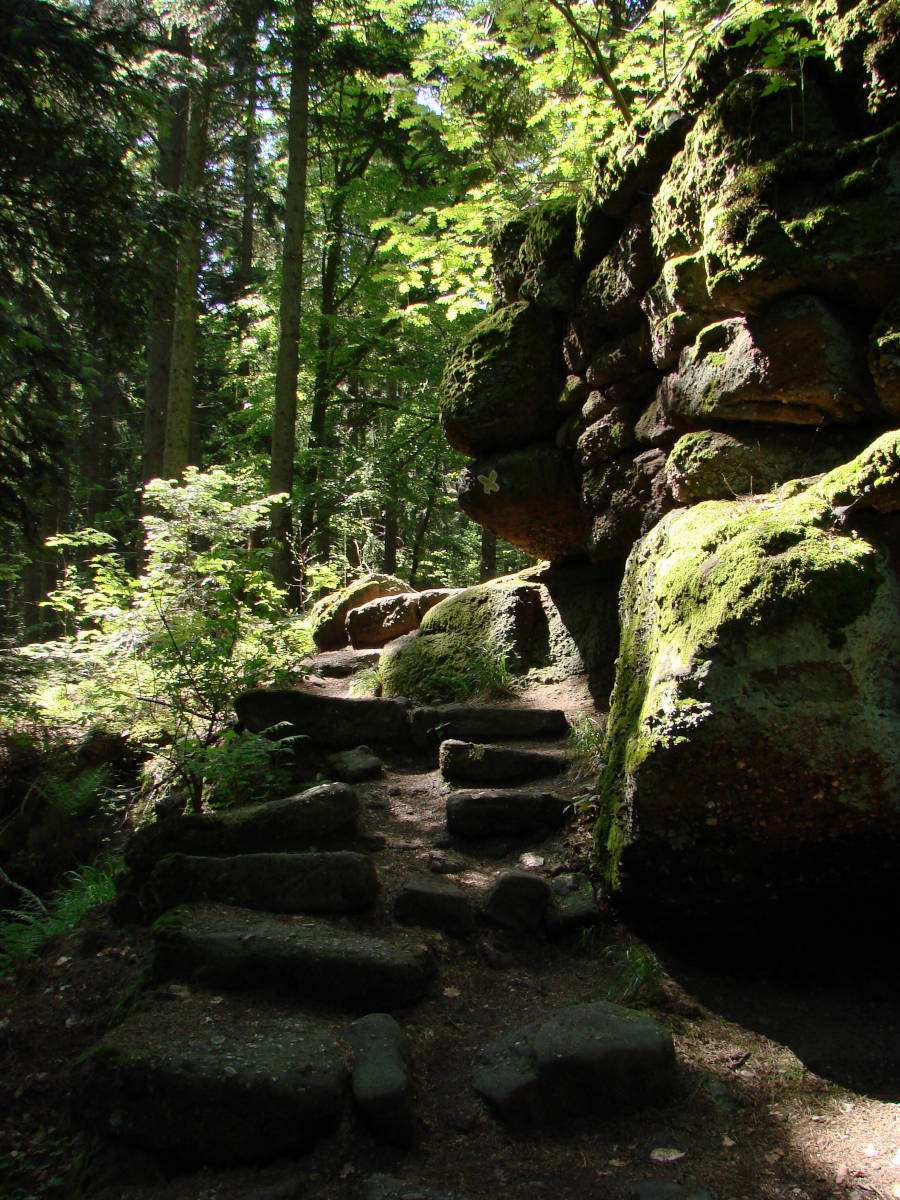
The Grotte des Druides (Cave of the Druids) is a small but exceptional cave. It looks like a prehistoric dolmen, blocks on the side covered by a horizontal slab. But actually it is a far rarer sight: a tectonic cave of the talus or boulder cave type. Movements of rock are caused by steep slopes, in this case the erosion of the valley, and the rocks on top of the valley slope started to slide downhill on the weaker rock layers below. This caused the widening of a crack in the rock wo a width of about 3 m. The block on the downhill side moved further than the one on the uphill side. But that’s only the first part of the story. Such cracks are far more frequent than actual caves. However, here an overlying block was also moved. Sliding on top of the blocks below, it came to a standstill right on top of the crack, forming the cover of the cave.
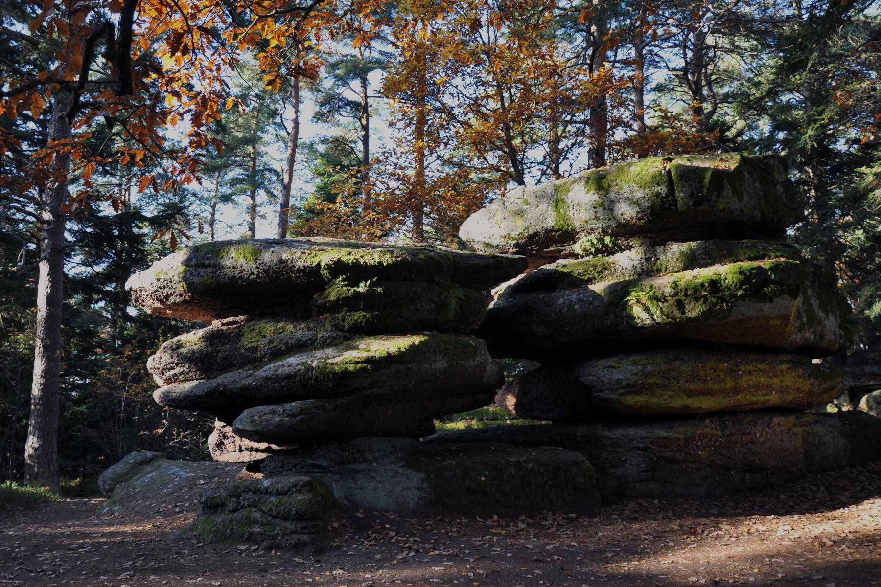
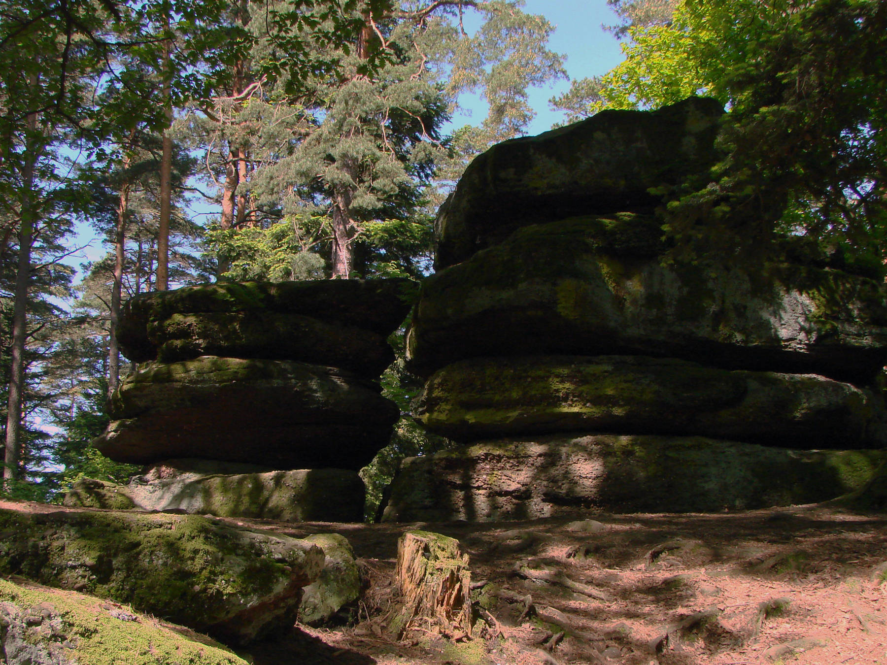
The outcrops of red lower triassic sandstones in the Vosges are quite spectacular. There are strange rock formations, shelters and caves, and lots of towers, balancing rocks and outlooks. This sandstone mountain is called Mont Sainte Odile (Odilienberg), and is famous for its monastery. The reddisch sandstone is called Buntsandstein in German because of its reddish colour. The green colour is typically biogene, moss or lichen, whitish patches are a result of recrystallization of calcite or in rare cases quartz.
The cracks in the rock, especially at the crossing with bedding planes, are often the beginning of erosional caves. The water removes sandstone from the surface. The edges are rounded. The resulting caves have a typical profile, which shows the structure of the relevant cracks and bedding planes.
Along the reddish rock face there is also and artificial wall called the Mur Païen, in German Heydenmauer (Wall of Heathens). This is a protective wall over 10 km long and up to 3 metres high, probably from the Bronze Age, which has puzzled archaeologists. As far as we know, it was originally 5m high, 1.80 m wide, and was built by the Celts before the arrival of the Romans. 2,000 people would have needed 5 years to build it. It enclosed a whole city including stables, barns, and fields, such celtic fortified cities were called oppidae. The remains of this enclosure were restored by the Romans and used as an observation post for the Rhine plain. The Romans called the site Altitona, which became Hohenburg under the Merovingians, who left several burial sites on the Odilienberg.


 Search DuckDuckGo for "Grotte des Druides"
 Google Earth Placemark
 OpenStreetMap
 Grotte des Druides
  Index
Index Topics
 Hierarchical
 Countries
 Maps
Maps