Gorges du Verdon
Grand Canyon du Verdon
Useful Information
| Location: |
Between the towns of Castellane and Moustiers-Sainte-Marie.
(43.8016706, 6.2494422) |
| Open: |
no restrictions. [2023] |
| Fee: |
free. [2023] |
| Classification: |
 Gorge Gorge
|
| Light: | n/a |
| Dimension: | |
| Guided tours: | self guided |
| Photography: | allowed |
| Accessibility: | no |
| Bibliography: | |
| Address: | Office de Tourisme Intercommunal Lacs et Gorges du Verdon,242 avenue Albert 1er, 83630 Aups, Tel: +33-4-94-70-21-64. |
| As far as we know this information was accurate when it was published (see years in brackets), but may have changed since then. Please check rates and details directly with the companies in question if you need more recent info. |
|
History
| 1782 | first written mention of the gorge. |
| 1804 | written mention. |
| 1905 |  E. A. Martel makes the first through trip through the Gorges du Verdon. E. A. Martel makes the first through trip through the Gorges du Verdon. |
| 1926-1928 | Martel Trail equipped by the Touring Club of France. |
| 1928 | Robert de Joly is the first to completely cross the Gorges du Verdon. |
| 1929 | first hydroelectric dam errected. |
| 1975 | fifth and last hydroelectric dam errected. |
| 10-JUL-2006 | installation of a high-voltage line through the canyon annulled by the Council of State. |
| 2022 | the European draught dried up the river completely in some parts of the gorge. |
Description
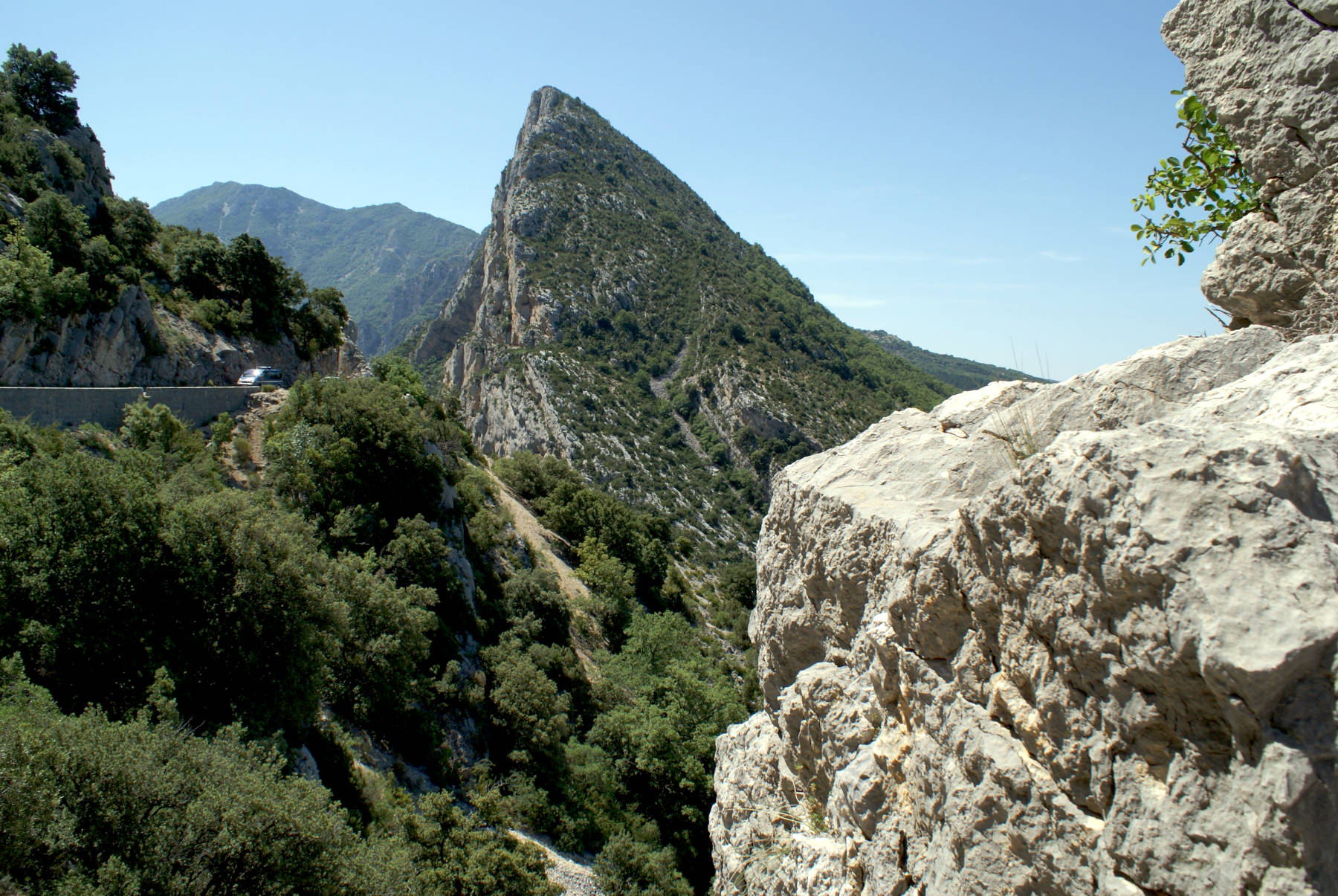

Gorges du Verdon (Verdon Gorge) is often dubbed Grand Canyon du Verdon alluding to the Grand Canyon in the U.S.A.
This is the most spectacular gorge in France, and a famous tourist destination.
First explored by the famous French speleologist
E. A. Martel
in 1905, it is today accessible by two roads, the D952 and D23 on the northern side and the D71 on the southern side.
Today a trail through the canyon is named after Martel.
Martel was a cave explorer, and there are actually two reasons why he explored the gorge.
Although this is not a cave, the tour was very similar to exploring a water cave, his skills and equipment fitted quite well.
And then the gorge cuts through a karst area and the cliffs are full of caves, karst springs and spectacular tufa deposits.
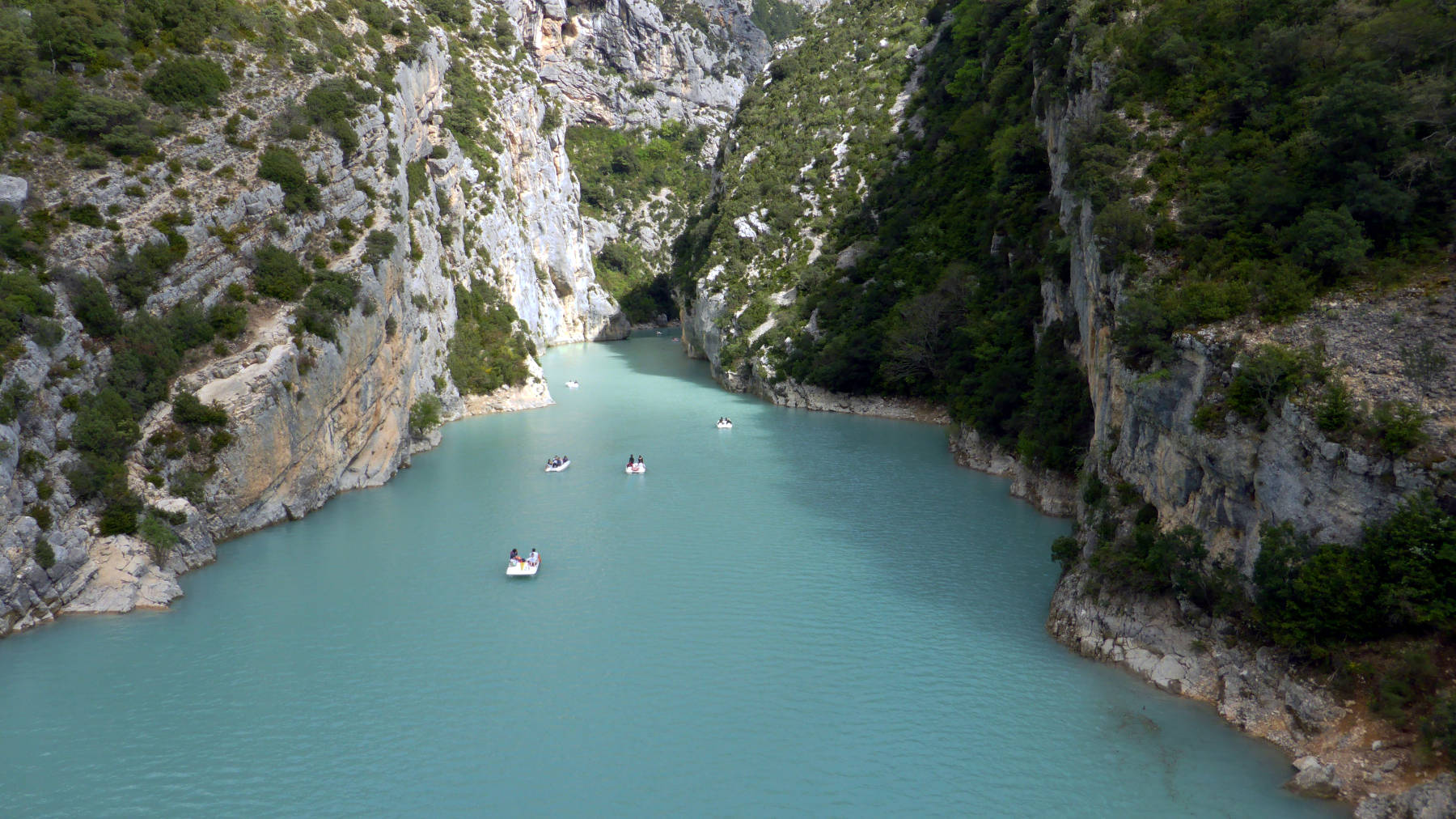
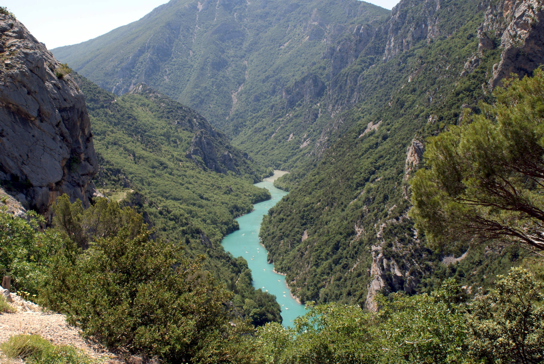
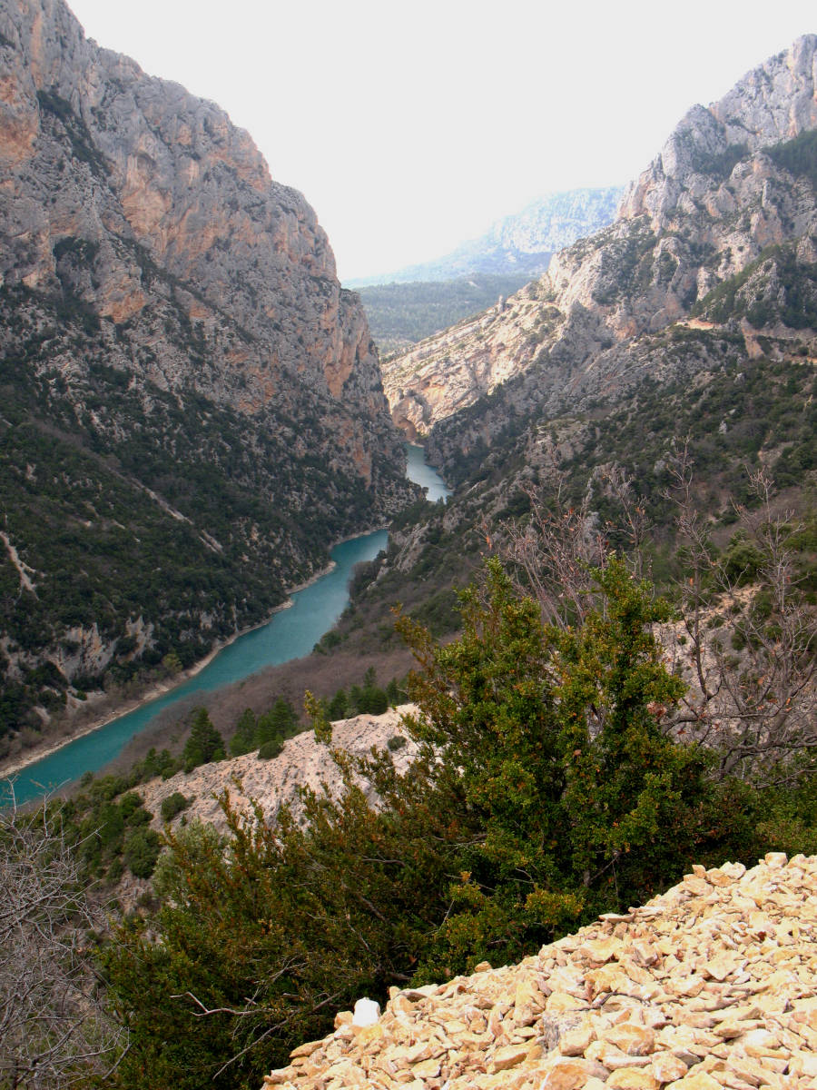
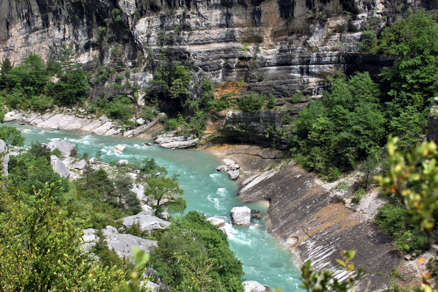
The Verdon River is named for its turquoise-green colour, which is a result of the high limestone content typical for karst area.
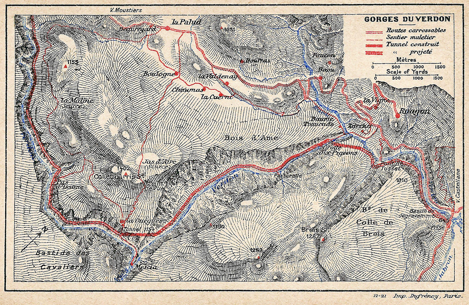
The Verdon river is 166 km long and its source is at an elevation of 2,819 m asl in the southwestern part of the French Alps. It is a left tributary of the Durance river, which is left tributary of the Rhône. The spectacular gorge is located between the towns of Castellane and Moustiers-Sainte-Marie. It is up to 700 m deep, and between 6 and 100 m wide. There are actually three distinct sections, the Prégorges (’pre-gorge’), from Castellane to Pont de Soleils, the main gorge to l’Imbut, and finally the canyon to the Pont du Galetas. At the end of the gorge the artificial Lac de Sainte-Croix is located. It is one of the five dams which were erected between 1929 and 1975 to produce electricity. The lake is also a popular bathing and boating location, and many visitors enter the gorge by boat from the lake.
This gorge extends for some distance, and there is not a single entrance. Actually there are three ways to visit the gorge. We already mentioned the visit by boat from Lac de Sainte-Croix, but that’s only the lower end. Of course its possible to drive down the gorge with a boat, like Martel did. This requires the right boat and some skills, but is still popular. The main way to see gorge is nevertheless by car. It’s possible to drive up on one side, and back on the other, and there are about a dozen spectacular outlooks along the road which are signposted. And the third is by hiking, there are numerous hiking trails, although there is actually no trail along the full length. AllTrails lists about 40 trails along the gorge, the area is quite popular. Hiking trails are not our topic so we actually recommend to check a good hiking portal.
The most spectacular hiking trail is probably the already mentioned Sentier Blanc Martel (Martel White Trail), which is located at D23 southeast of La Palud-sur-Verdon. It follows the most spectacular central part of the gorge and has two ends. The lower end is at the restaurant Chalet de la Maline, it is the steep access and so it is recommended to start here, and leave the trail on the other end which much easier. The trail takes about 6 to 8 hours, so this is a full day hike, and after walking a full day you will be happy that the exit is not steep and difficult. The trail goes down in serpentines, then follows the river on its right side upstream. There are caves along the trail, the Baume aux Boeufs, the Beaume aux Hirondelles, the Baume aux Chiens and others. But as the name "Baume" says, they are more or less shelters or overhanging cliff faces of some size. The northern end of the trail is a series of tunnels, the canals of an abandoned hydroelectric power project. It ends at Point Sublime on the D952. You should have two cars, so you can place one at each parking lot. Also, we recommend snacks and 2 litres of water for the full day tour. Sun protection is essential, as well as good hiking shoes.
 Search DuckDuckGo for "Gorges du Verdon"
 Google Earth Placemark
 OpenStreetMap
 Verdon Gorge - Wikipedia (visited: 31-MAR-2025)
 Discover the Verdon (visited: 31-MAR-2025)
 Index
Index Topics
 Hierarchical
 Countries
 Maps
Maps