Kullaberg Grottor
Useful Information

| Location: |
Italienska vägen 335, 263 77 Mölle, Sweden.
From Helsingborg follow 111 along the coast north to Mölle. Follow road to the end. (56.2994936, 12.4514338) |
| Open: |
No restrictions. Naturum: MAY to AUG daily 11-16. SEP to APR Sat, Sun 11-16. School holidays daily 11-16. [2025] |
| Fee: |
free. Naturum: free. [2025] |
| Classification: |
 Sea Cave Sea Cave
 Natural Bridge
Tectonic Cave Natural Bridge
Tectonic Cave
|
| Light: | bring torch |
| Dimension: | |
| Guided tours: | self guided |
| Photography: | allowed |
| Accessibility: | no |
| Bibliography: | |
| Address: |
Kullaberg Grottor, Italienska vägen 335, 263 77 Mölle, Tel: +46-42-34-7056.
E-mail: |
| As far as we know this information was accurate when it was published (see years in brackets), but may have changed since then. Please check rates and details directly with the companies in question if you need more recent info. |
|
History
| 1561 | German miner Jürgen Langenau mines for silver in Silvergrottan (Silver Cave). |
| 09-AUG-1868 | Oscarsgrottan visited by later King Oscar II who had his name carved on the cave wall. |
| 1965 | east part of the nature reserve founded. |
| 1971 | west park of the nature reserve added. |
Description


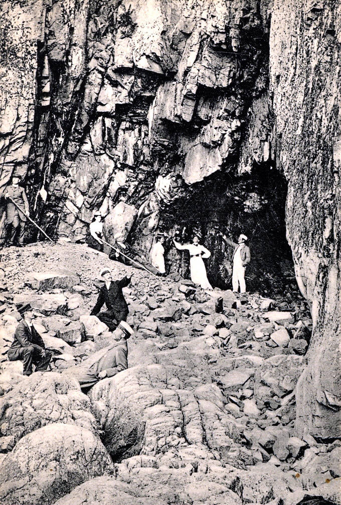
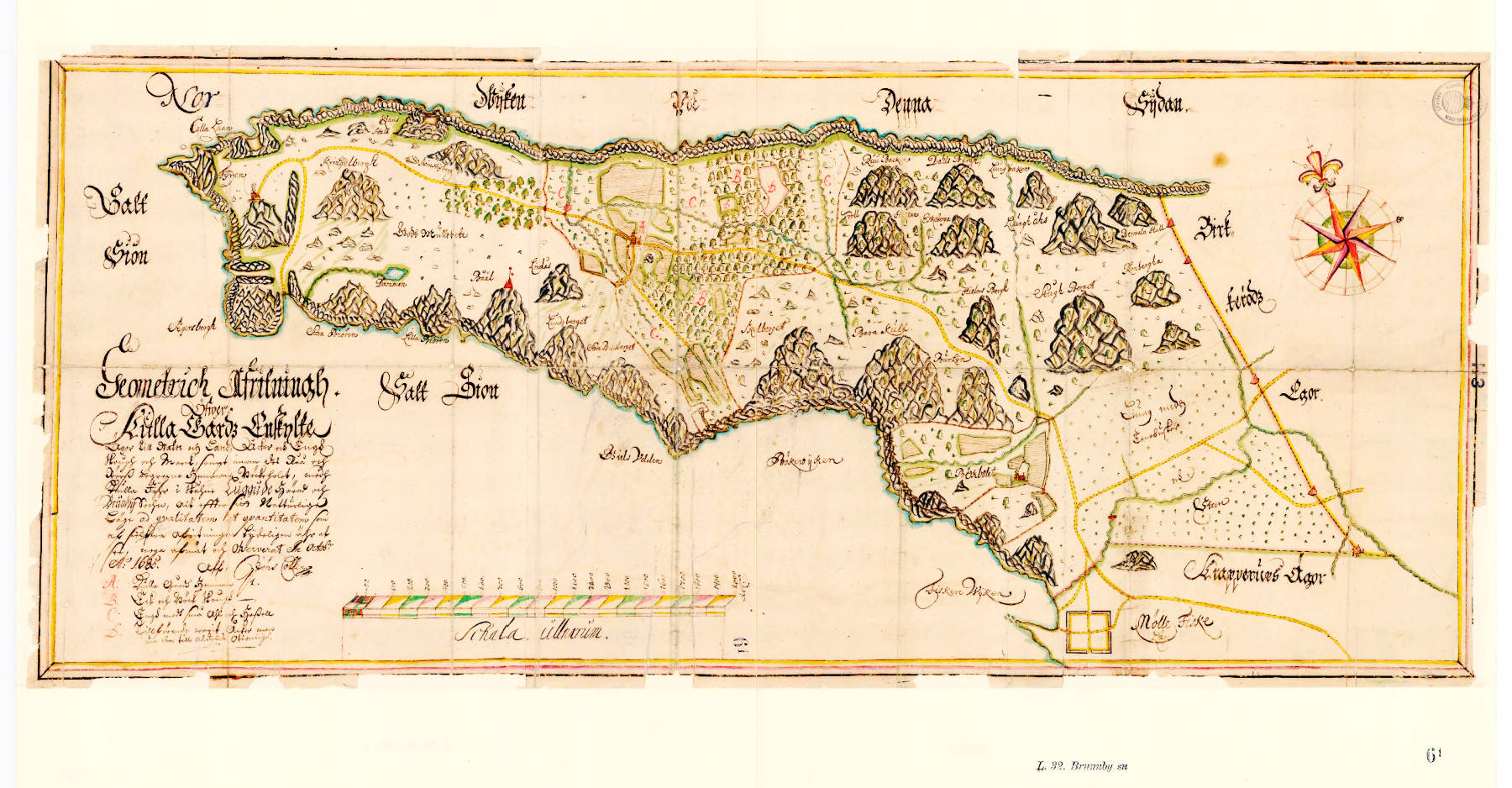
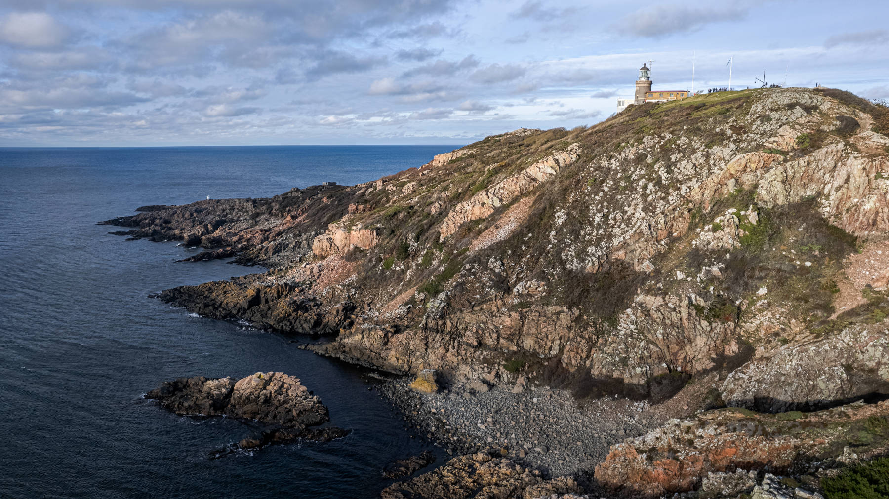
Kullaberg Grottor are 24 similar sea caves and a natural bridge around the Kullaberg peninsula in the Kullabergs naturreservat. This peninsula is protruding to the northwest about 30 km north of Helsingborg. A road leads through Mölle to the tip of the peninsula and ends at the Kullensfyr, the lighthouse. There is a parking lot, a restaurant and the small museum of the nature park which is named Naturum and definitely worth a visit. It has exhibitions on flora and fauno of the peninsula and the sea, the geology and the history. A number of trails start at the parking lot in all directions, leading to outlooks and down to the numerous caves. Each one is spectacular and a descent of about 55 m to the sea level.
The peninsula not only has a great number of sea caves, there are some geological specialties with a few caves. Only the larger caves actually have a name, in general the cave must be more than 3 m long to be considered a cave. Numerous locations have traditional names which differ from the name under which they are known today. In the early 20th century the photographer Peter P. Lundh renamed several places on the mountain with more romantic names. As the caves became known after the names on his photographs, those names stuck. That’s what you call artistic freedom. But the caves were visited for centuries, and even the Swedish Kings frequented the site.
First a basic thing, which applies to most caves: although they were formed by the waves, they are located several meters above sea level. This is rather common in this area due to the uplift movement. 12,000 years ago this whole area was covered by a 3.5 km thick glacier. This weight pressed the continental plate down for almost 100,000 years, and after the weight was gone, the plate moved up again. This effect is called isostatic rebound, crustal rebound or post-glacial rebound. Think about a ship which is low in the water and moves up when the goods are unloaded. Magma and crust are not as liquid as water, so this movement is quite slow, but here in this area it is nevertheless several millimeter per year. That’s the reason why sea caves which were formed at sea level are now several meters above.
This means that the caves are not very big, as the time for their formation is limited. But the fact that they are not reached by the waves any more is quite important. Archaeological excavations revealed remains from Neolithic, Iron Age and Middle Ages in some caves. Also, a lot of animal bones were found.
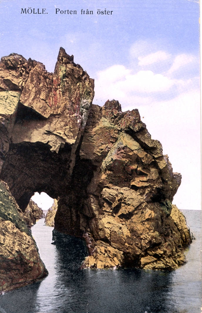
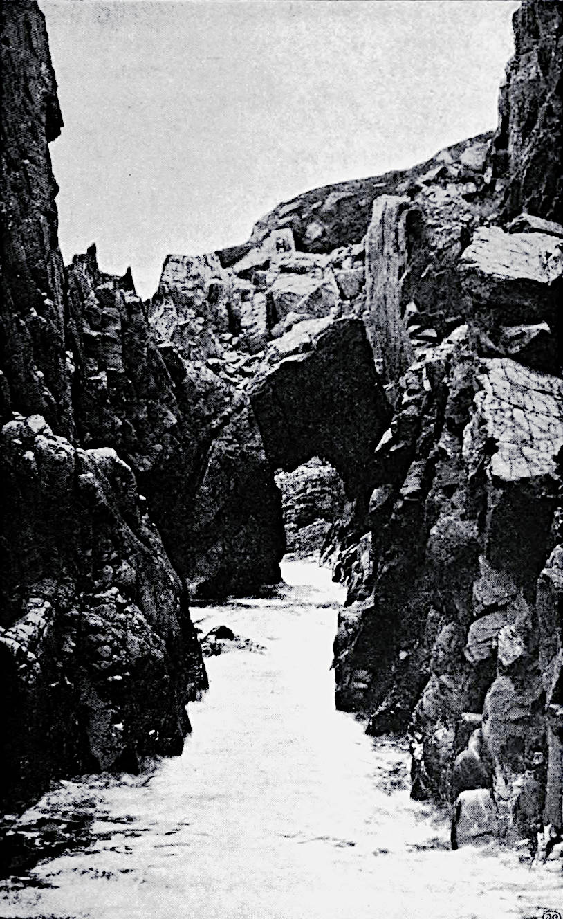
We do not list all 24 caves, but only the most important ones. Despite the caves there is also a natural bridge which is named Porten (Gate). The opening is 2.5 m wide, 4.5 m high and 12.5 m long. It is still at sea level, so the floor is covered by seawater. But now lets start with caves clockwise from the south.
- Lahibiagrottan is a sea cave which is located south of the parking lot. It is 9 m long and contained Neolithic remains. If you follow the road to the end it becomes a hiking trail, after a short walk there is an educational sign where the trail to the cave turns off on the right. There is a height difference of 55 m, the descent is quite steep but the trail has a rope. Once down, keep left.
- Nearby are two small caves which are less accessible and much smaller, the lower one is 4.5 m long, the upper 5 m. The caves are named Bagarugnen (Bakers Ovens), formerly known as Stenstugorna (Stone Huts).
- About 180 m to the northwest, at the tip of the peninsula, lies Silvergrottan (Silver Cave). But if you want to visit this cave, you have to take a different way down. From the parking lot follow the narrow road to the Kullen Västra Lighthouse. This one differs from all other caves, as the 15 m long cave is actually man-made. It was a mine where the Danish King Fredrik II searched for precious metals. He commissioned the German miner Jürgen Langenau in 1561. After him the cave was originally named Sölvepickarhålet (Silver Pecking Hole). He found a white mineral which he thought was silver, but it was actually muscovite. The mining was stopped after a few months.
- Visitgrottan is the cave with the largest portal on Kullaberg, with a width and length of 10 m and a height of 6.5 m. Its original name was Klasas stall, but it was renamed after the strange behaviour that tourists used to stick their business cards into the cracks in the walls. In Swedish the business cards are called visitkort, hence the name Visitgrottan.
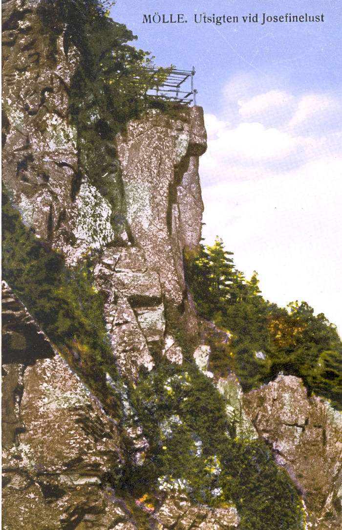
- Further east is the outlook Josefinelust, and below are another five caves. Fredrik VII’s Grotta is named after the Danish king who visited the area in the 1850s. It is 6 m long and contained archaeological remains. Josefinelustgrottan (Josefinelust Cave) is very popular, probably because the cave has two comfortable benches which invite to sit down and enjoy the view. Actually there are two caves which bear this name, the smaller has been visited since the Early Stone Age. Trollhålet is Kullaberg’s longest cave, with a surveyed length of 50 m, because it is not a sea cave, it is a tectonic cave. Its probably neotectonic, which means that it was created quite recently by the melting of the glaciers and the resulting movements. Oscarsgrottan was named after King Oscar II, who visited the cave on 09-AUG-1868 and had his name carved on the cave wall. At this time he was not yet king, he was still crown prince. The cave partially collapsed later.
- Jungfrukamrarna (Maiden Chambers) or Jungfrugrottan is the result of two different rocks. The peninsula consists of gneiss, a metamorphic crystalline rock which is rather resistant to weathering and responsible for the cliffs. It is crossed by a vertical dyke of diabase, which is softer and less resistant to weathering, and also massively cracked which weakens the rock further. So erosion worked much faster on the dyke and created a narrow and high passage, which divides into two chambers 4 m inside. The diabase is typical for this peninsula Kullaberg and is called kullaiten. Really strange is the formation of dripstones, a result of the solution and redeposition of minerals from the diabase. This is extremely rare in igneous rock.
- Söftingsgrottan is 22 m long and 5 m high and wide at the entrance, but narrowing to the end. So its one of the largest sea caves here, located about 4 m above the sea.
- Valdermarsgrottan was named after King Valdemar Sejr sometime in the 19th century. With a length of 11m and two 4 m high domed rooms it is very spacious. It is located below Håkulls mosse.
 Search DuckDuckGo for "Kullaberg Grottor"
 Google Earth Placemark
 OpenStreetMap
 Kullaberg
  - Wikipedia (visited: 10-MAR-2025)
 Kullabergs naturreservat
  Index
Index Topics
 Hierarchical
 Countries
 Maps
Maps