Karain Mağarası
Black Cave
Useful Information
| Location: |
Yağca, 07190 Antalya Merkez/Antalya.
In Yağca village. 30 km NW of Antalya. From Antalya follow the old road to Burdur, turn left after 5 km at Karain sign. (37.076300, 30.570700) |
| Open: |
APR to OCT daily 8-19. NOV to MAR daily 8-17. Last entry 1 h before closing. [2021] |
| Fee: |
Adults TRL 10, Children free, Seniors free, Teachers free. [2021] |
| Classification: |
 Karst Cave Karst Cave
 Limestone Pavements Limestone Pavements
|
| Light: |
 Electric Light
bring torch Electric Light
bring torch
|
| Dimension: | A=430 m asl., VR=40 m. |
| Guided tours: | self guided |
| Photography: | allowed |
| Accessibility: | no |
| Bibliography: |
Manfred Korfmann (1980):
Karain In: Dietz Otto Edzard u. a. (Hrsg.): Reallexikon der Assyriologie und Vorderasiatischen Archäologie. Band 5: Ia... − Kizzuwatna. de Gruyter, Berlin u. a. 1980, ISBN 3-11-007192-4, S. 403–404. 
Marcel Otte, Işin Yalçinkaya, Janusz Kozłowski, Harun Taskiran, Ofer Bar-Yosef (1996): Paléolithique ancien de Karain (Turquie) Early Palaeolithic at Karain (Turkey) In: Anthropologie et Préhistoire. Bd. 107, ISSN 0777-6187, 1996, S. 149–156. 
Metin Kartal (2008): Karain Mağarası Kazıları 2007/Excavations at the Karain Cave in 2007 In: Anadolu Akdenizi Arkeoloji Haberleri/News of Archaeology from Anatolia’s Mediterranean Areas Nr. 6, 2008, S. 24–28. I. Kiliç Kökten (1955): Ein allgemeiner Uberblick über die prähistorischen Forschungen in Karain-Höhle bei Antalya, Belleten, July 1955, Volume XIX - Issue 75 Pages: 284-293.
pdf
|
| Address: | Karain Mağarası, Yağca, 07190 Antalya Merkez/Antalya, Tel: +90-242-423-1334. |
| As far as we know this information was accurate when it was published (see years in brackets), but may have changed since then. Please check rates and details directly with the companies in question if you need more recent info. |
|
History
| 1946–1958 | first archaeological excavations by Prof. İsmail Kılıç Kökten. |
| 1967–1973 | archaeological excavation by Prof. İsmail Kılıç Kökten and Işın Yalçınkaya. |
| 1994 | on the UNESCO Tentative List. |
Description
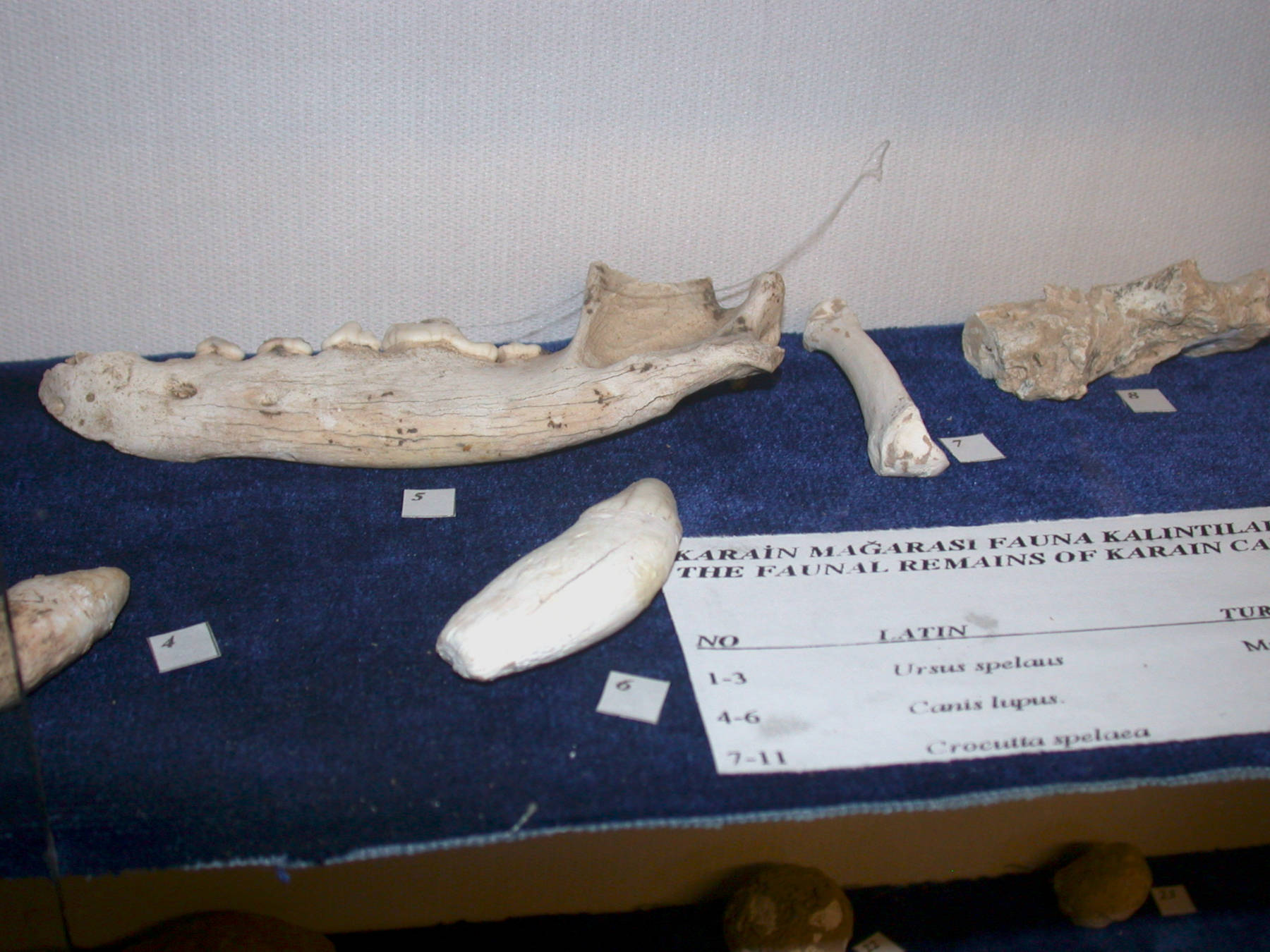
Karain Mağarası (Karain Cave) is located north of Antalia, not far from the Antalya Hipodromu, the horse racecourse. This cave is famous for the numerous paleolithic remains found here, some dated to be 200,000 years old. The oldest remains include a Neanderthal cranium, and according to recent discoveries, the cave was probably visited by Homo erectus for 500,000 years. Since 50,000 years ago, the number of finds increases, and for 25,000 years, from the Mesolithic, through the Neolithic and the Chalcolithic, to the Bronze Age, the cave has continuous human presence. Nevertheless, the cave was always a shelter for nomadic people for some time and not inhabited year round. Quite exceptional is the carving of a human face, stylistically similar to the products of the Natufian culture, which flourished in the Palestine area during the Mesolithic period. This probably indicates a commercial relationship between the population of southern Asia Minor and Palestine. Neolithic findings demonstrate a connection with the nearby Hacılar culture. Beneath human remains, the bones of cave bear (Ursus spelaeus) and horses were discovered. Some findings can be visited in a little museum at the entrance of Karain Cave, but most of the artifacts are now in various museums throughout Turkey. The pre-history section of the Antalya Museum shows more finds. The Anadolu Medeniyetleri Müzesi (Museum of Anatolian Civilizations) in Ankara has an extensive collection of Karain artifacts.
With the time of Greek colonization of Asia Minor, during the Iron Age, the cave was probably used as a religious shrine, decorations were carved into the rock in front of the cave entrance.
The cave was more or less discovered and excavated by Prof. İsmail Kılıç Kökten from the Ankara Üniversitesi (Ankara University). He discovered the cave in 1946 and excavated different parts in several campaigns, between 1946 and 1958. Together with Prof. Işın Yalçınkaya he continued the excavations between 1967 and 1973. Prof. Işın Yalçınkaya continued his work after his death from 1985 to 2008 in cooperation with the University of Liège in Belgium.
The cave is since 1994 inscribed on the UNESCO tentative list, which is well deserved. While the cave remains are quite exceptional and their importance comparable to those of France and Germany, the text which was provided for the UNESCO application is - surprising. It reads like the essay of an eight-year-old. We can only guess that Cratese actually means Cretaceous. And while intended to explain the importance of the cave, it actually describes the surroundings and ignores the results of the excavations completely. They even mention the beauty of the non-existing speleothems. Fortunately, they fail to mention that it is the largest cave in the world and cures asthma. But now they plan to actually get the site listed, and we are convinced anyone at the WHL committee is eagerly awaiting their latest statements.
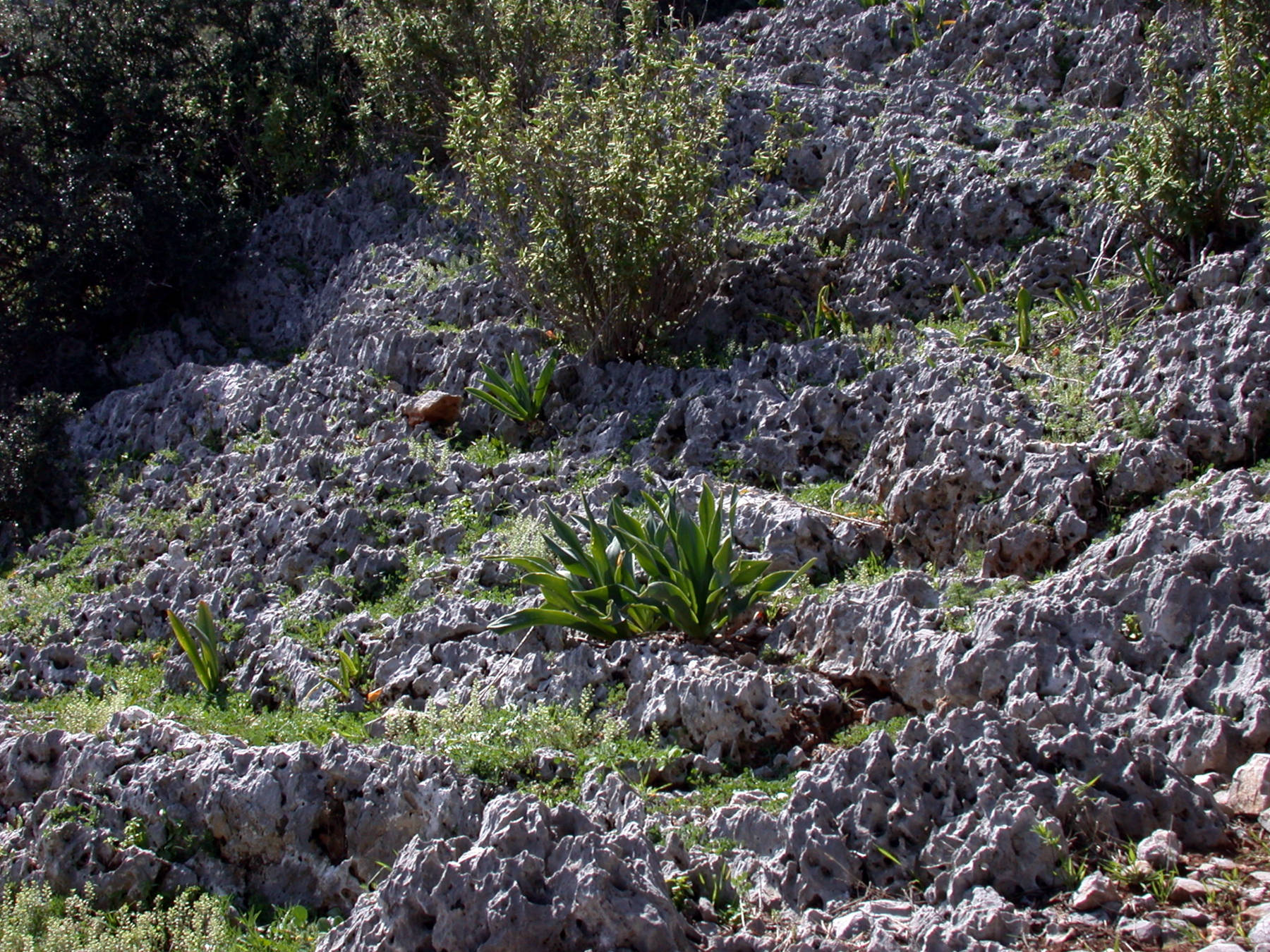
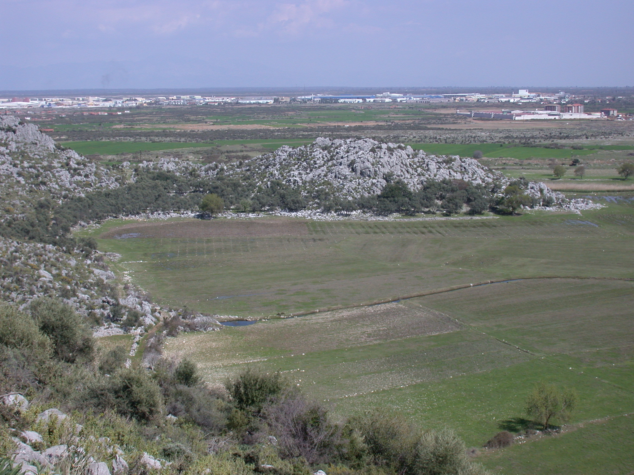
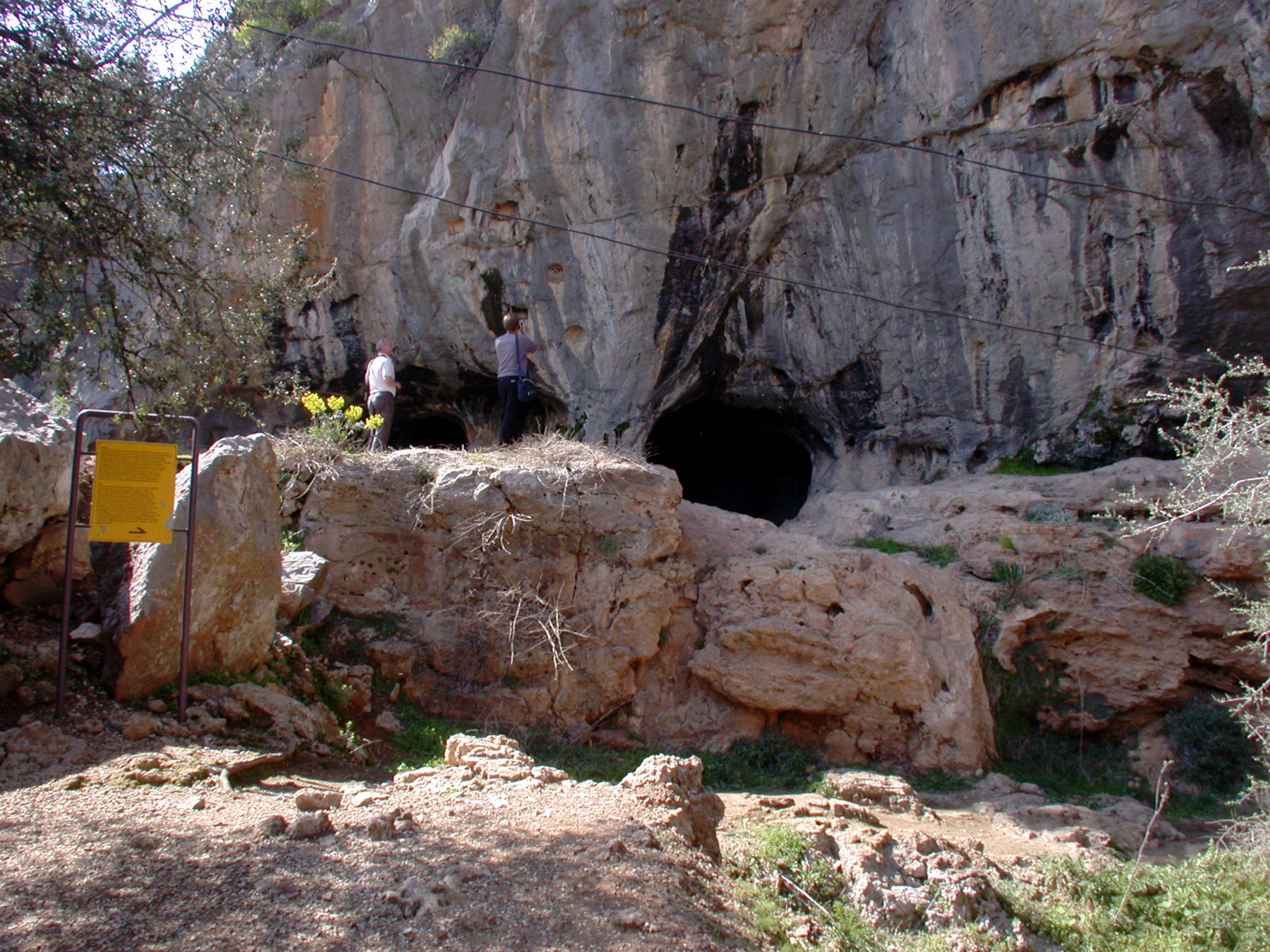
The cave is located about 100 m above the travertine plains at the foot of a cliff on the eastern slopes of Sam Dağı mountain. The old Antalya-Burdur highway crosses the fertile plain, following the chain of mountains which rise abruptly from the plain. Actually, it is the other way round: the mountain valley was filled by travertine, which was precipitated from the limestone rich water from the mountains. At the end of the road is a car park with a small museum. After paying the fee and a visit to the museum, the building is left through the rear entrance where the trail to the cave starts. It takes about 20 minutes to walk up the steep path with 500 steps to the cave 100 m higher. The view becomes more and more impressive, the karst springs and dolines at the foot of the mountains are easily visible. The surrounding rocks are typical for karst, showing karren, limestone pavements and other traces of dissolution. Because of the lack of soil, the limestone gives the mountains the typical grey colour.
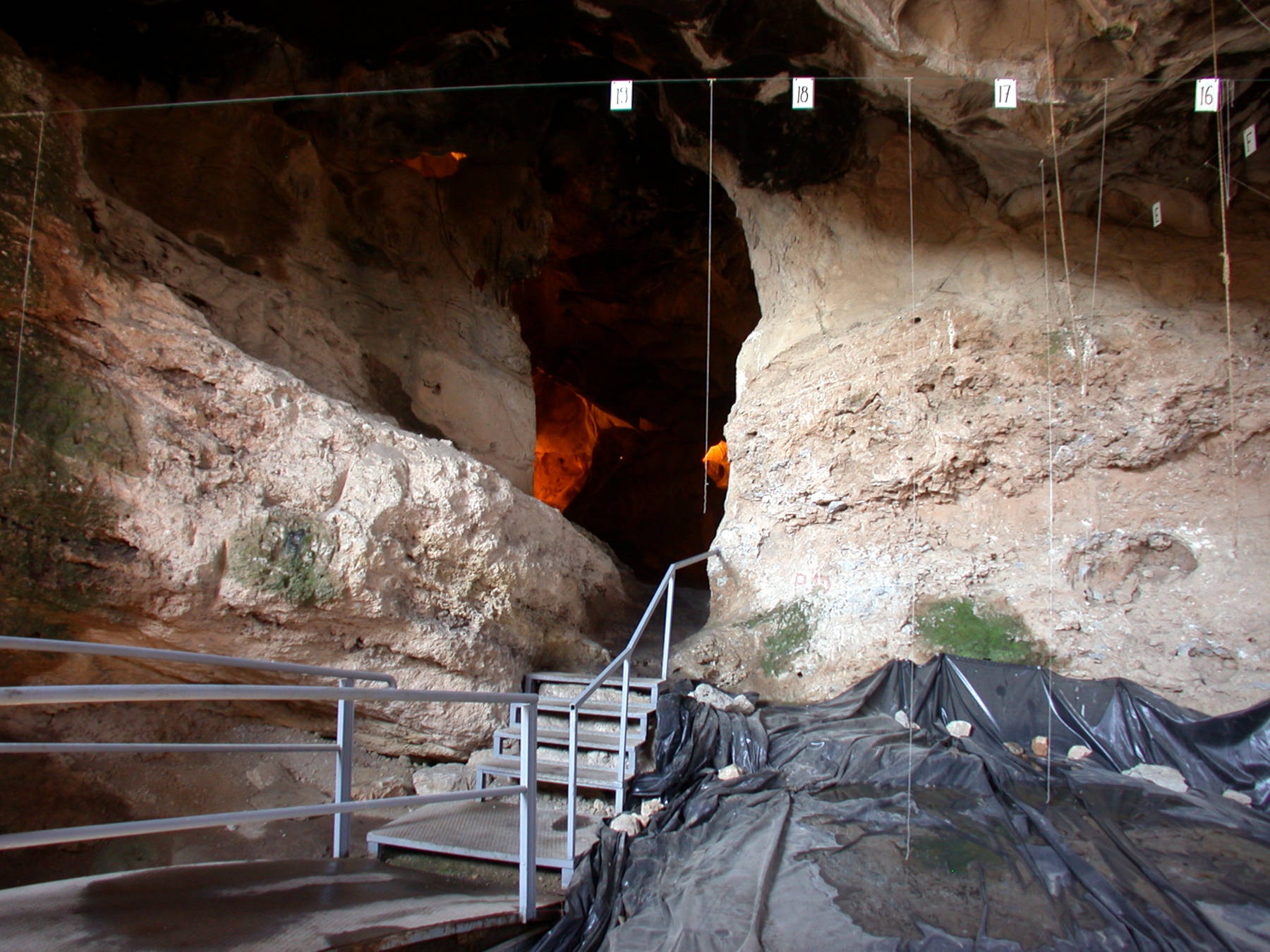
The cave is protected by a high fence. In front of the cave, at the foot of a cliff, is a sort of terrace. In its current form it is a result of the excavations, but it is easy to understand why prehistoric man used this place, with its view, the protection from weather by the cliff and by the cave. It provided excellent protection against attacks of enemies, a good view on the movements of prey in the fertile plain, which was an excellent food source for hunters and gatherers. The excavations took place in front of the cliff and in the first section of the cave. Actually, there are several small caves in the cliff face, one has two entrances, but the passages meet after five meters. The biggest cave entrance on the right is probably the most intensively excavated part, as about eight to ten meters of the cave sediment have been removed by now.
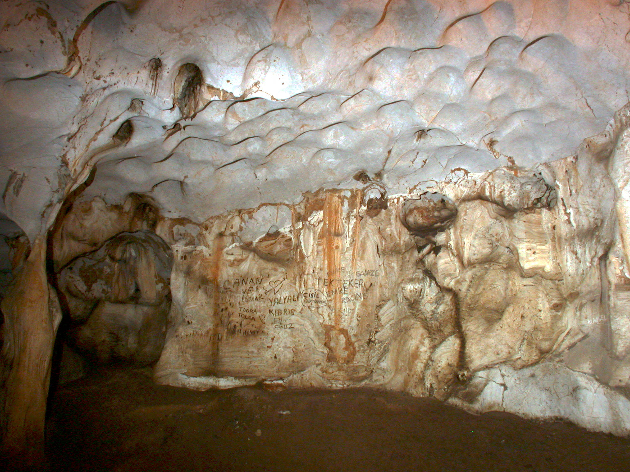
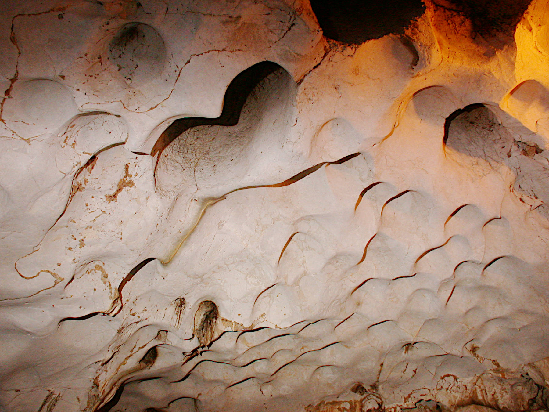
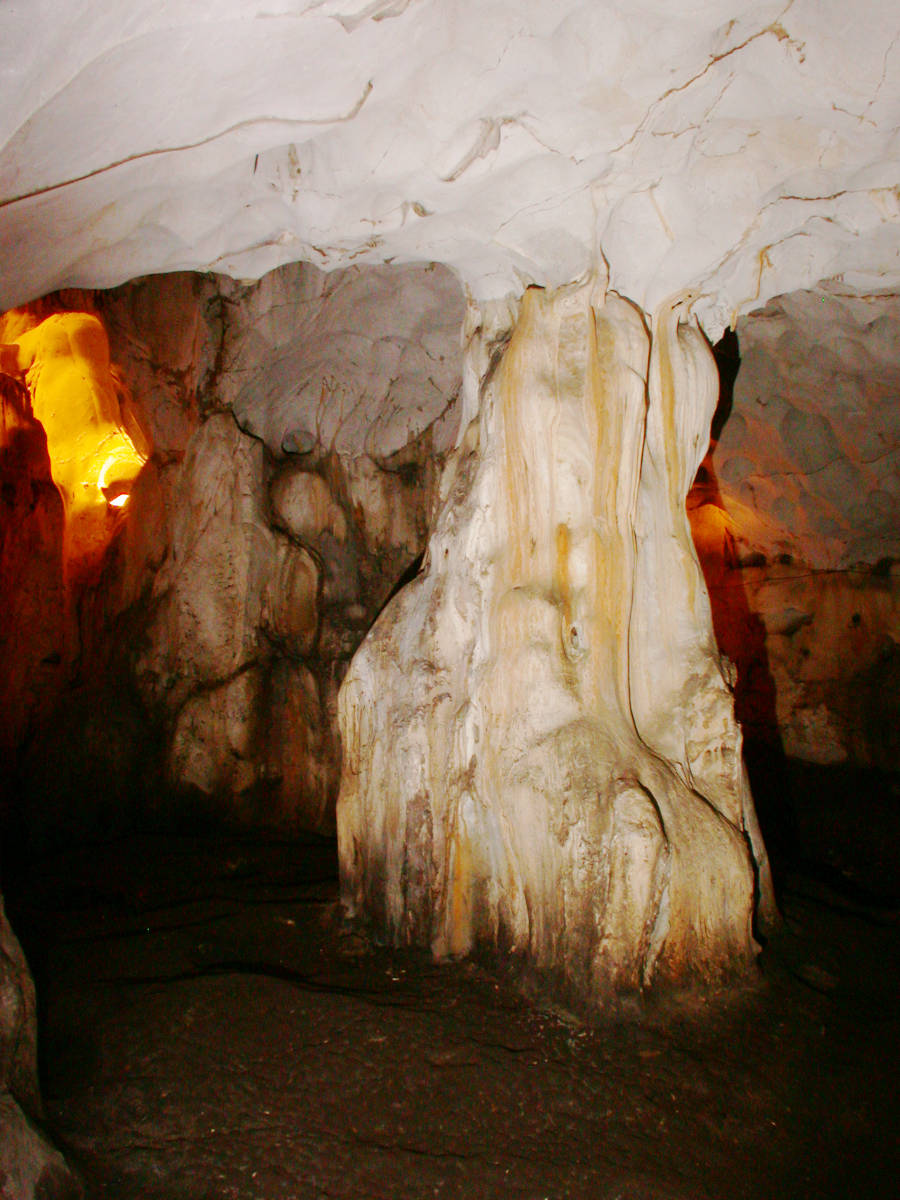
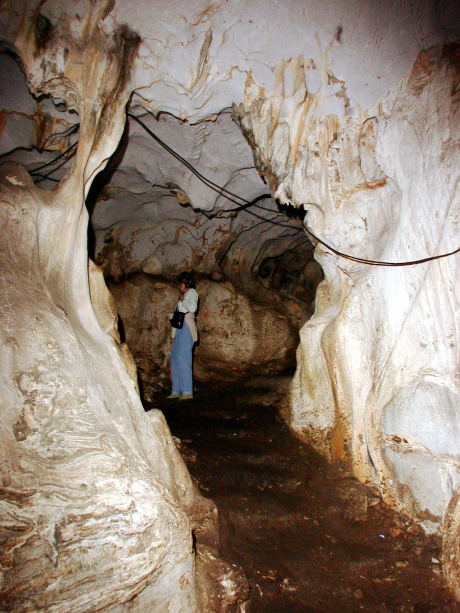
The huge pits, which were dug by the archaeologists, are crossed on a bridge, and the interior chambers can be visited. The cave consists of three chambers, which are quite spacious, irregular, and show very little speleothems. The first is the entrance chamber with the excavations, the second is the biggest chamber right behind, and the third is on a lower level. Impressive are the huge scallops caused by the flowing water, sometimes there are huge irregularly shaped domes. There are some side branches with similar scallops. One passage leads steeply down, in a huge spiral, and ends in a lower level with another chamber. The floor is mostly covered with dry clay or sand, sometimes wet and slippery. This cave is quite different from the normal dripstone caves, much drier and with a completely different character. But although it has only very few speleothems, there are some quite massive pillars.
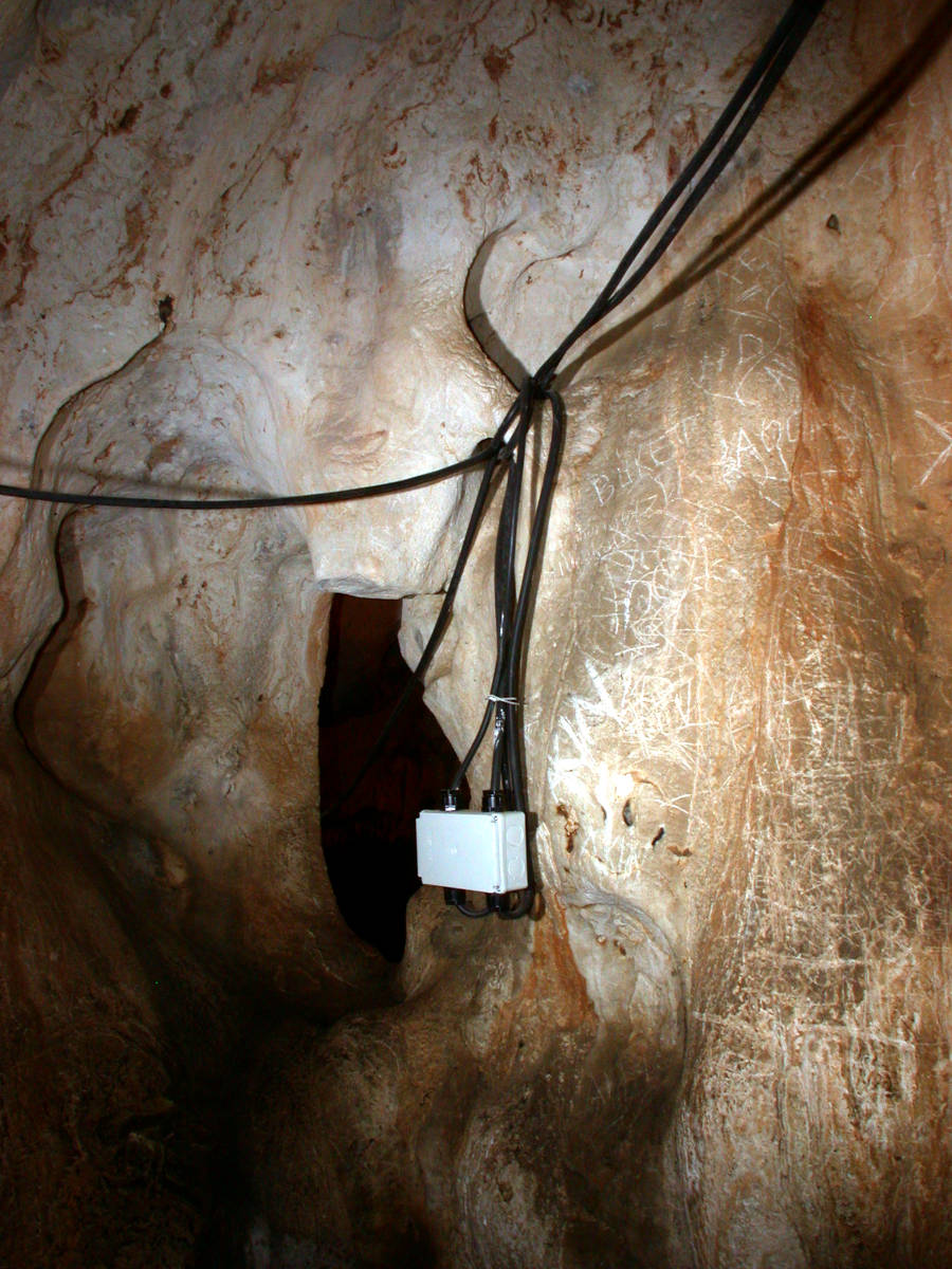
The light system is a little ramshackle, it seems it was not intended for the show cave. It was most likely installed as a temporary system for and by the archaeologists. Even in rather new descriptions, the low reliability of the light is mentioned. Another problem is the lack of trails, only in the entrance section there is a bridge across the excavation. The rest of the cave has no trails, visitors walk on the dark brown clay, which may be slippery. We strongly recommend bringing your own torch and good walking shoes.
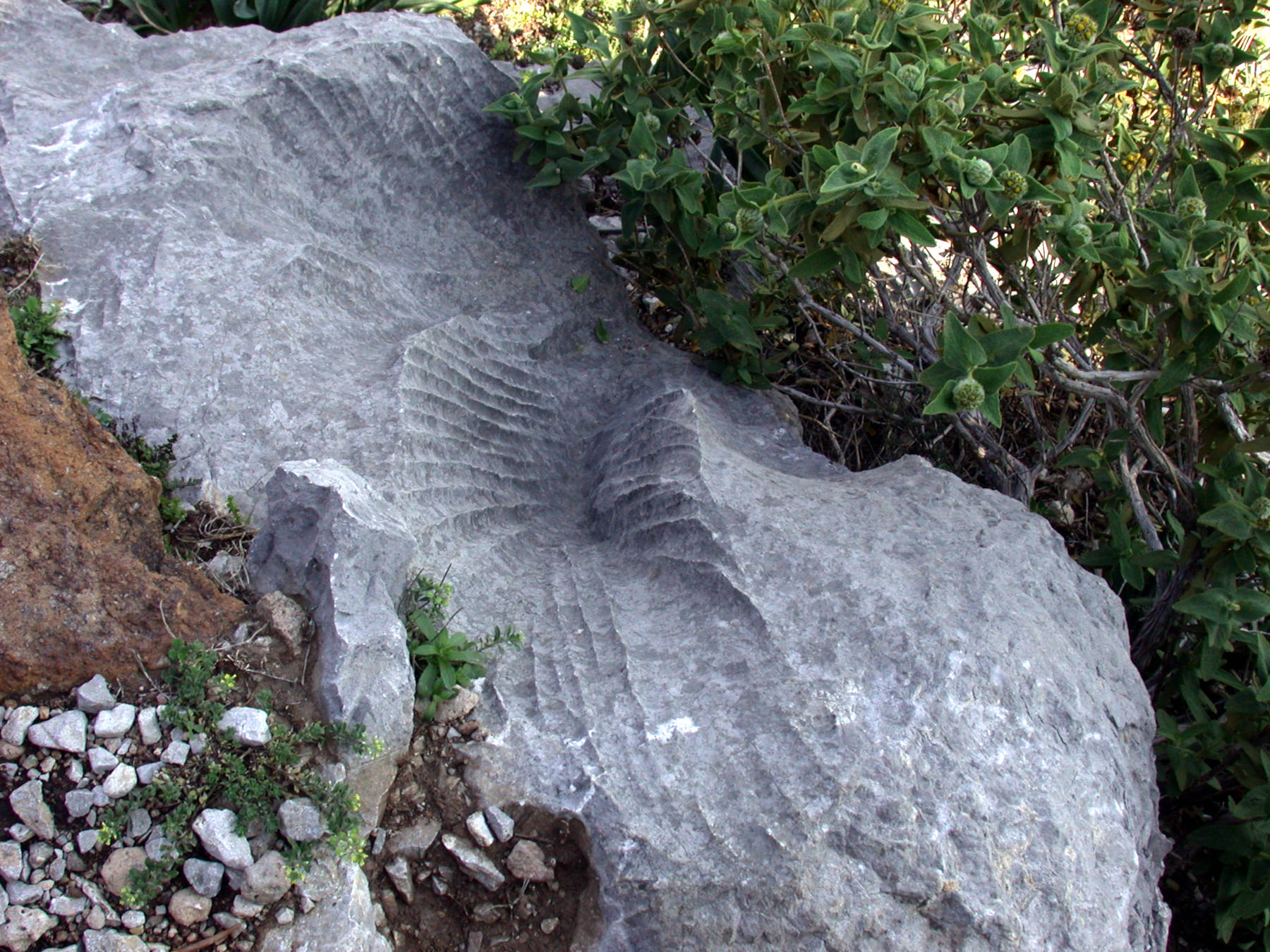
The site has a lot to offer on the outside. The trail which leads up in serpentines to the cave entrance offers views across the plain to the south and the east. The limestone rocks on this hille are dissolved by the rainwater and have karren. There are strange karren patterns and even limestone pavements can be seen. Actually there are all forms which are caused by limestone dissolution along the short trail. Cracks are widened, and weaker spots in the rock are hollowed out forming sponge-like structures.
- See also
 Search DuckDuckGo for "Karain cave"
 Google Earth Placemark
 OpenStreetMap
 Karain Cave - Wikipedia (visited: 05-MAR-2021)
 Karai̇n Mağarasi, official website (visited: 22-NOV-2024)
 Karain Cave - UNESCO WHL Tentative List (visited: 05-MAR-2021)
- Karain Cave (visited: 05-MAR-2021)
- Karain Mağarası Nerededir? Karain Mağarası Oluşumu, Özellikleri, Giriş Ücreti Ve Ziyaret Saatleri (2020)
 (visited: 07-MAR-2021)
 Index
Index Topics
 Hierarchical
 Countries
 Maps
Maps