Watkins Glen State Park
Useful Information
| Location: | In the village Watkins Glen. South of Seneca Lake in Finger Lakes region. (Latitude 42.375896, Longitude -76.871078) |
| Open: |
no restrictions. [2019] |
| Fee: |
Vehicle Entrance Fee:
Mid-MAY to mid-OCT daily sunrise to sunset. Vehicle USD 8, non-commercial Bus USD 35, commercial Buis USD 75. [2019] |
| Classification: |
 Gorge Gorge
|
| Light: | n/a |
| Dimension: | D=120 m. |
| Guided tours: | Watkins Glen Gorge Tour: L=1,600m |
| Photography: | allowed |
| Accessibility: | no, many steps |
| Bibliography: | |
| Address: | Watkins Glen State Park, Rt.14, Franklin St., Watkins Glen, New York 14891, Tel: +1-607-535-4511. |
| As far as we know this information was accurate when it was published (see years in brackets), but may have changed since then. Please check rates and details directly with the companies in question if you need more recent info. |
|
History
| 1863 | opened to the public as a privately run tourist resort. |
| 1906 | purchased by New York State and renamed Watkins Glen State Reservation. |
| 1924 | managed by the Finger Lakes Region of the New York State Office of Parks, Recreation and Historic Preservation. |
Description
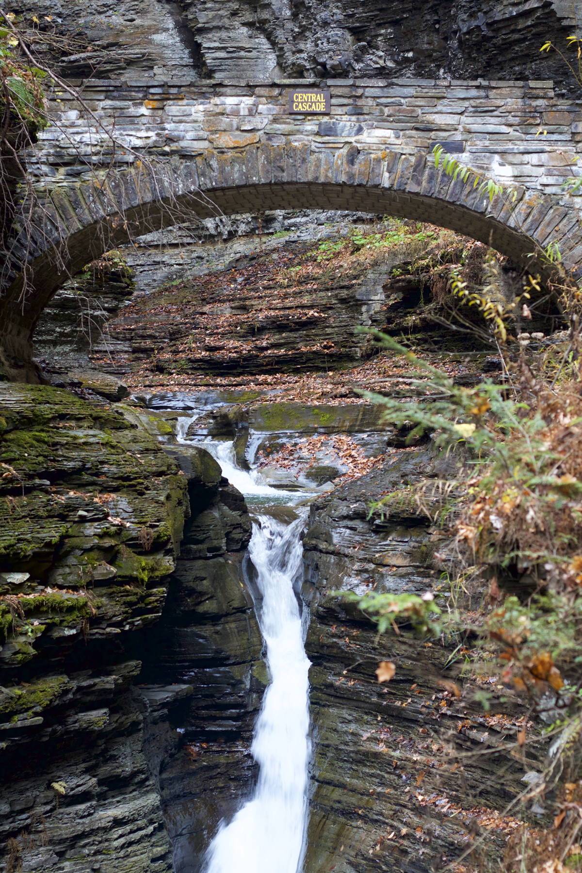
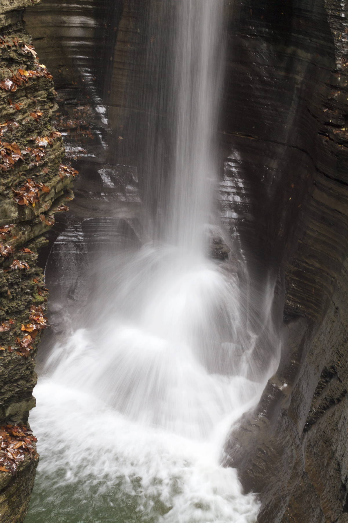
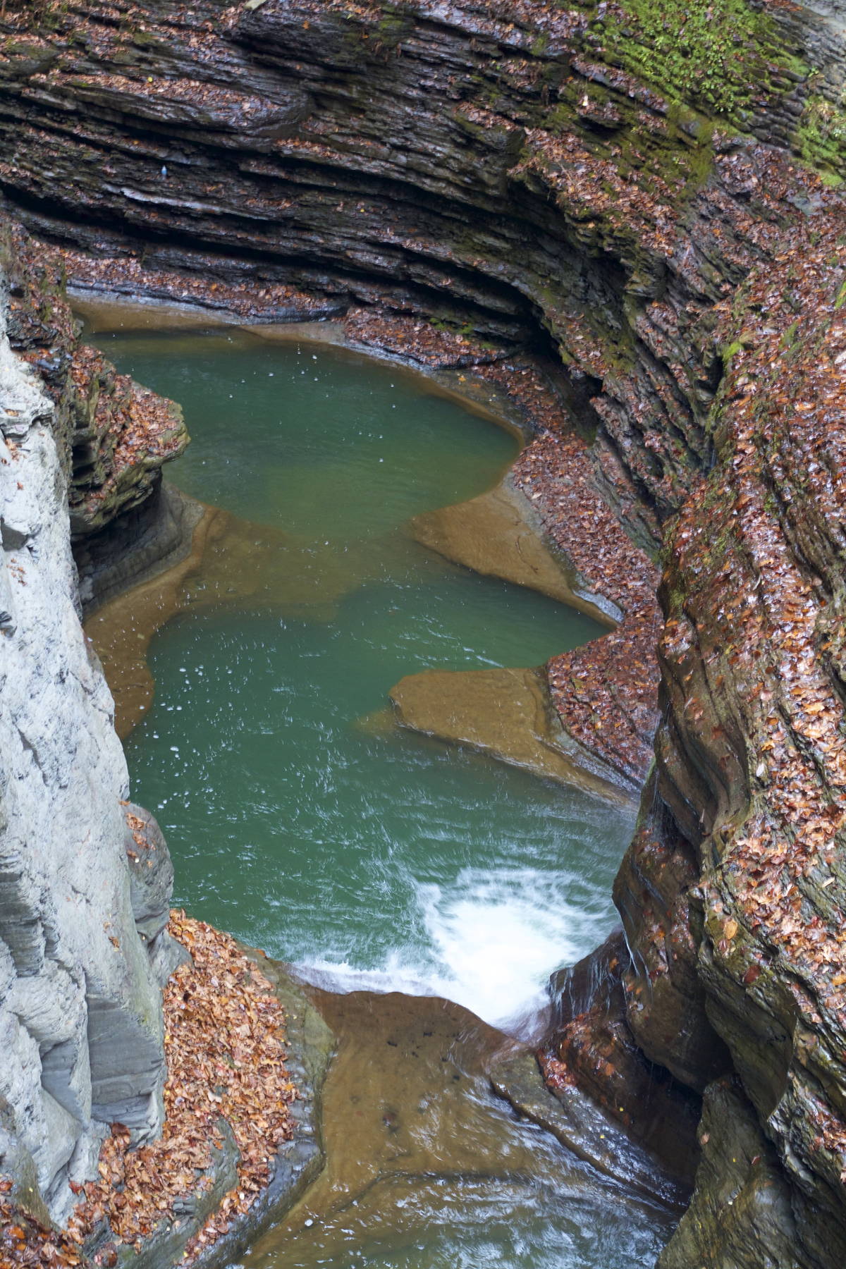
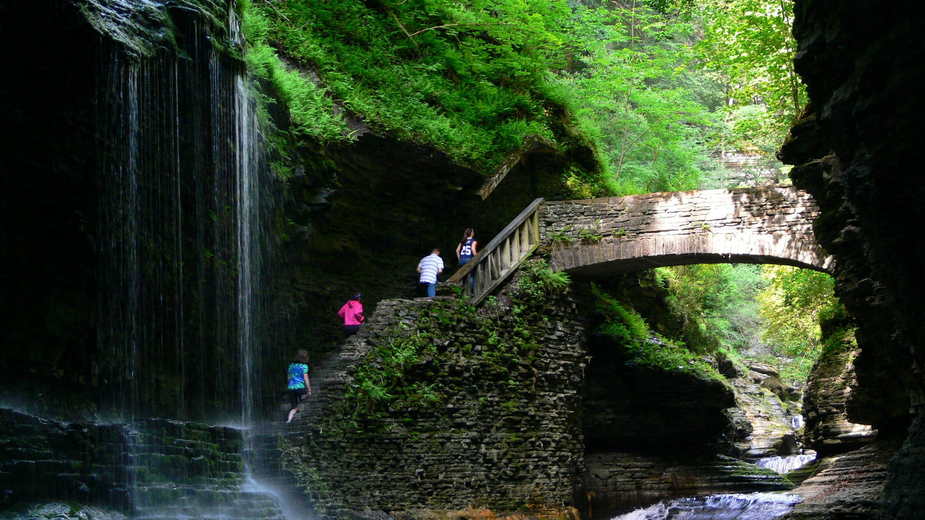
Watkins Glen State Park is a park with a size of 3.15 km², but the center is Watkins Glen, a 120 m deep gorge cut by the river Glen Creek. A 3.2 km long hike along the gorge past 19 waterfalls and 800 stone steps is the main attraction. There is even a waterfall from a side branch and the trail crosses along the wall behind the waterfall. Thats why it is called Cavern Cascade.
The Finger Lakes region was shaped by the glaciers of the Ice Ages, which covered the area multiple times during the last 2 Million years. The glaciers, coming from the north, widened and deepened the valleys. However, so close to their southern rim they were not very thick and probably the ridges between the valley were ice free. So it was not a single glacier, but many glacier tongues. When the glaciers receded north 10,000 years ago, at the end of the last cold age, water filled these valleys creating the 11 Finger Lakes. The water on the hills was 120 m higher than the valley floor beneath, which is called hanging. Those hanging tributaries formed waterfalls which started to cut deep into the hills, eroding the soft sedimentary rocks. The high amount of melting water at the begin and the debris from the glaciers which the water carried increased the erosion substantially.
The waterfalls are a result of different rock layers. The sediments consist of shale, limestone, and sandstone, and those rocks erode differently. Every hard or more resistant layer form a step in the valley and thus a waterfall.
- See also
 Search DuckDuckGo for "Watkins Glen State Park"
 Google Earth Placemark
 Watkins Glen State Park (visited: 19-JUN-2019)
 Watkins Glen State Park, official website (visited: 10-MAY-2020)
- Watkins Glen State Park (visited: 10-MAY-2020)
- James Hope (American, 1818-1892): Rainbow Falls Watkins Glen (visited: 10-MAY-2020)
 Index
Index Topics
 Hierarchical
 Countries
 Maps
Maps