Honanki Cliff Dwellings
Useful Information
| Location: |
11450 N Loy Butte Rd, Sedona, AZ 86336.
24 km west of Sedona, Arizona. SR 89A through West Sedona, at Layla's Bakery-Cafe turn right on Dry Creek Road, turn left Boynton Pass Road FR 152C, turn left on FR 525 to FR 795. SR 89A north from Cottonwood, 800 m north of mile marker 364 turn left FR 525, then FR 795, 11 km. FR are rough gravel roads, passable for passenger cars when dry. (34.9393915, -111.9332653) |
| Open: |
no restrictions. [2026] |
| Fee: |
free. [2026] |
| Classification: |
 Cliff Dwellings of the U.S. West Cliff Dwellings of the U.S. West
 Erosional Cave Erosional Cave
|
| Light: | n/a |
| Dimension: | |
| Guided tours: | |
| Photography: | allowed |
| Accessibility: | no |
| Bibliography: | |
| Address: |
Coconino National Forest Supervisor’s Office, 1824 S. Thompson St., Flagstaff, AZ 86001, Tel: +1-928-527-3600.
E-mail: Red Rock Ranger Visitor Center, 8375 State Route 179, Sedona, AZ 86351, Tel: +1-928-203-2900. E-mail: |
| As far as we know this information was accurate when it was published (see years in brackets), but may have changed since then. Please check rates and details directly with the companies in question if you need more recent info. |
|
History
| 1895 | archaeologist Dr. Jesse Walter Fewkes explored and photographed the dwelling for Smithsonian Institute. |
| 1911 | test excavations by Dr. Jesse Walter Fewkes. |
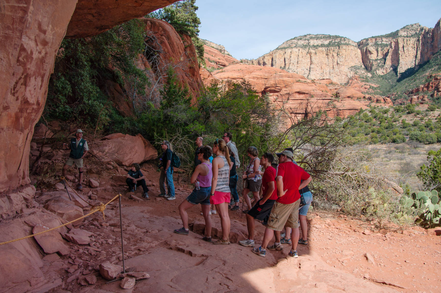
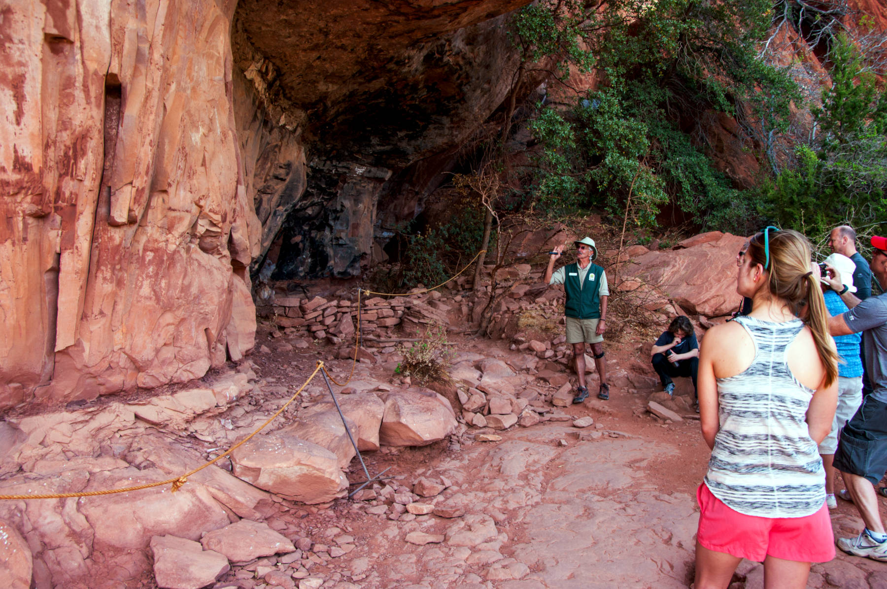
Description
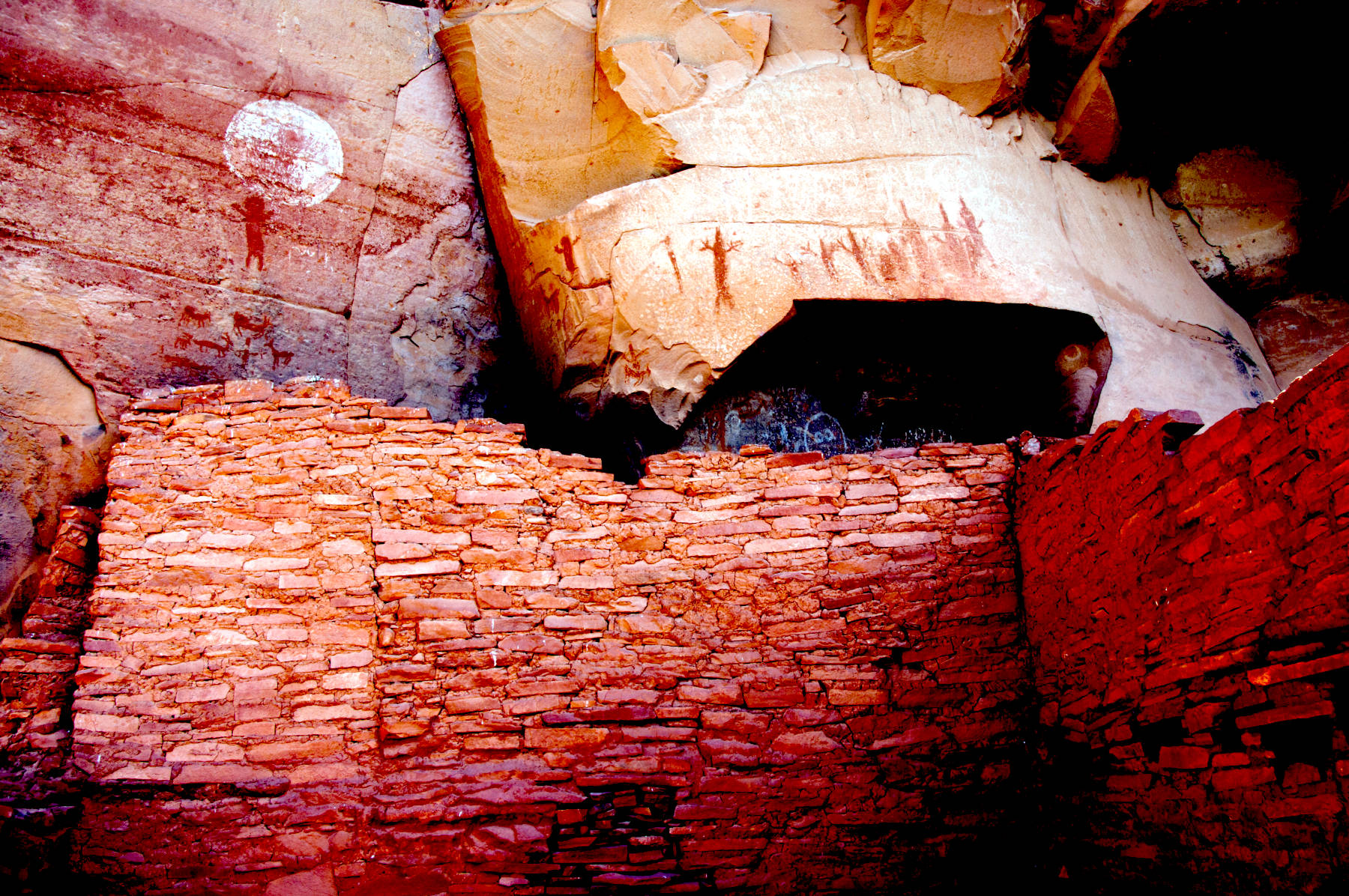
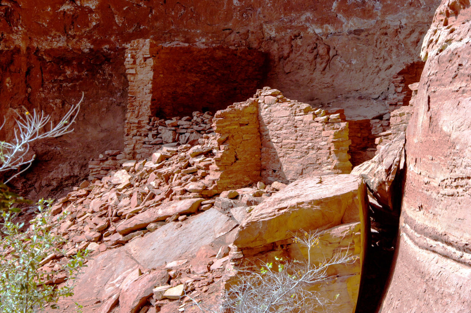
Honanki Cliff Dwellings is not far from the better known Palatki, the name Honanki is Hopi and means bear house. The name was given to the site by archaeologist Dr. Jesse Walter Fewkes, who explored and photographed the dwelling for the Smithsonian Institute in 1895. They were inhabited between 1100 and 1300 by the Sinagua culture of the Ancestral Puebloans. The Sinagua people planted crops and made pottery, created pictographs and petroglyphs. The oldest pictographs here were created 4,000 BP, long before the caves were inhabited. Most pictographs are from the Sinagua peoples though, dating between 900 and 1300. The site was later inhabited by both Yavapai (~1400) and Apache (~1875) people, both left pictographs.
The Sinagua (without water) Indians lived in the area north of Flagstaff down through the Verde Valley. Around 1450 they vanished, and it is unclear if they died out, moved away, or were driven away or killed by warring or hostile invaders. The northern branch probably melded into the early Hopi culture.
The pictures on this page were provided by Deborah Lee Soltesz from the USFS Coconino National Forest and are Public Domain.
 Search DuckDuckGo for "Honanki Cliff Dwellings"
 Google Earth Placemark
 OpenStreetMap
 Honanki - Wikipedia (visited: 27-FEB-2026)
 Palatki and Honanki Heritage Sites (visited: 27-FEB-2026)
 Index
Index Hierarchical
 Countries
 Maps
Maps