Palatki Cliff Dwellings
Useful Information
| Location: |
Sedona, AZ 86336.
20 km northwest of Sedona, Arizona. SR 89A through West Sedona, at Layla's Bakery-Cafe turn right on Dry Creek Road, turn left Boynton Pass Road FR 152C, turn left on FR 525 to FR 795. SR 89A north from Cottonwood, 800 m north of mile marker 364 turn left FR 525, then FR 795, 11 km. FR are rough gravel roads, passable for passenger cars when dry. (34.9172613, -111.8993635) |
| Open: |
JUN to AUG Wed-Sat 8:30-12. SEP to MAY Mon-Tue 9:30-15, Wed 9:30-12, Thu-Sun 9:30-15. Closed Thanksgiving, 25-DEC. [2026] |
| Fee: |
Online reservation mandatory. [2026] |
| Classification: |
 Cliff Dwellings of the U.S. West Cliff Dwellings of the U.S. West
 Erosional Cave Erosional Cave
|
| Light: | n/a |
| Dimension: | A=1,439 m asl. |
| Guided tours: | D=75 min, Max=14, St=120. |
| Photography: | allowed |
| Accessibility: | no |
| Bibliography: | |
| Address: |
Coconino National Forest Supervisor’s Office, 1824 S. Thompson St., Flagstaff, AZ 86001, Tel: +1-928-527-3600.
E-mail: Red Rock Ranger Visitor Center, 8375 State Route 179, Sedona, AZ 86351, Tel: +1-928-203-2900. E-mail: |
| As far as we know this information was accurate when it was published (see years in brackets), but may have changed since then. Please check rates and details directly with the companies in question if you need more recent info. |
|
History
| 1895 | archaeologist Dr. Jesse Walter Fewkes explored and photographed the dwelling for Smithsonian Institute. |
Description
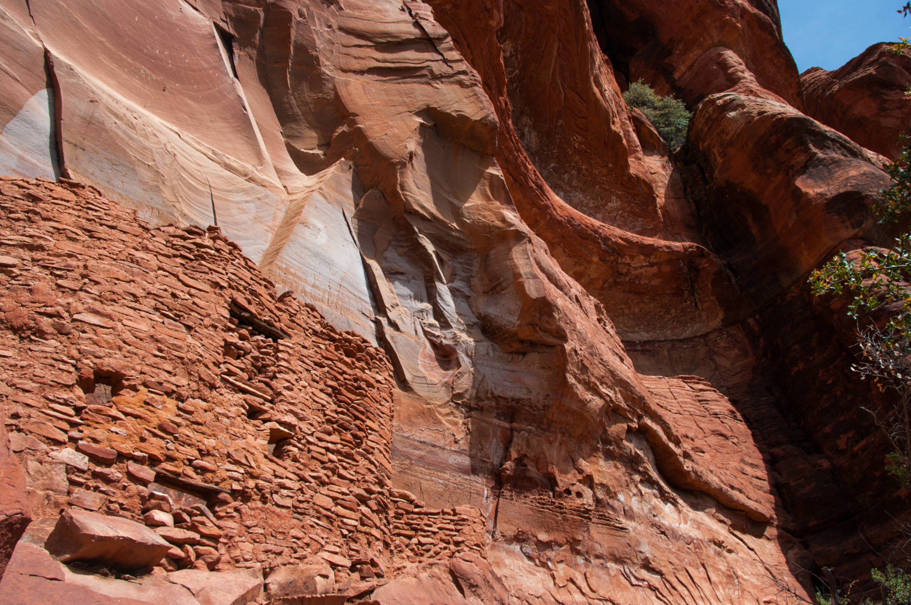
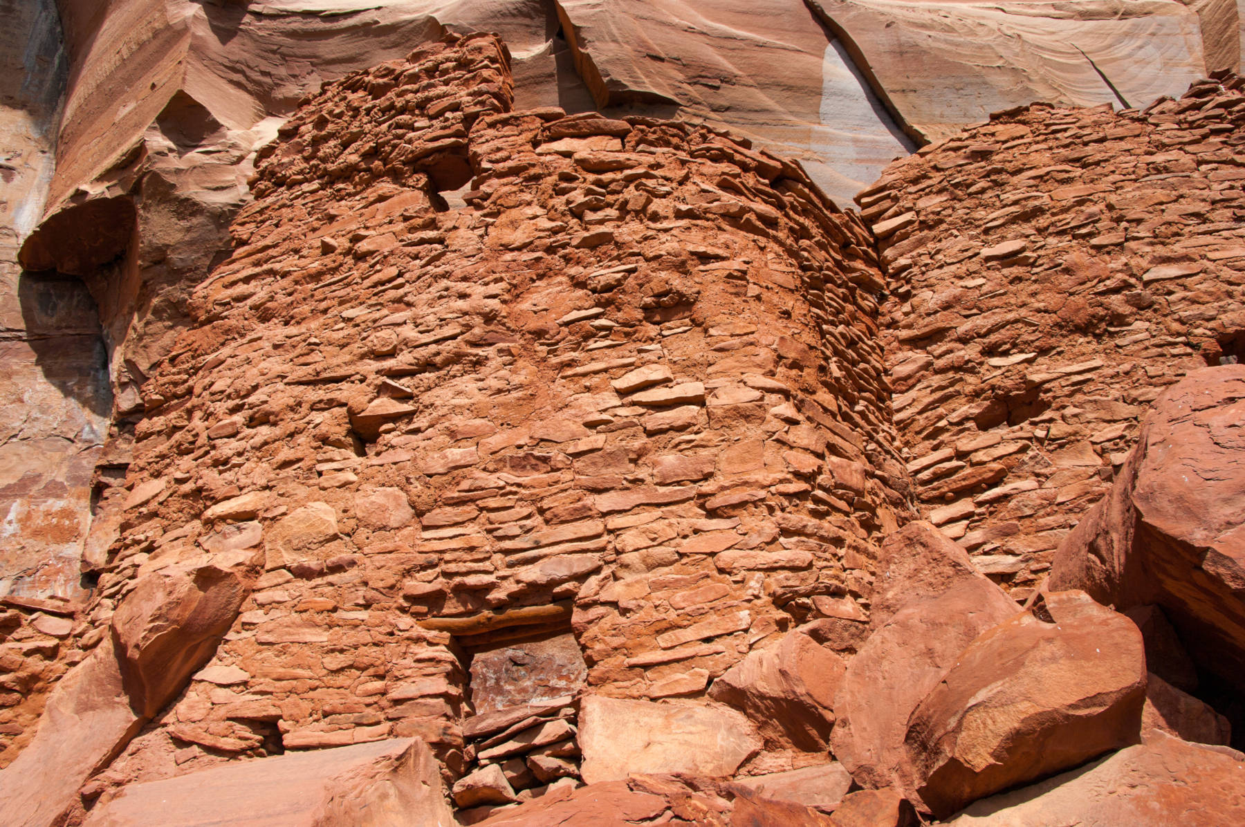
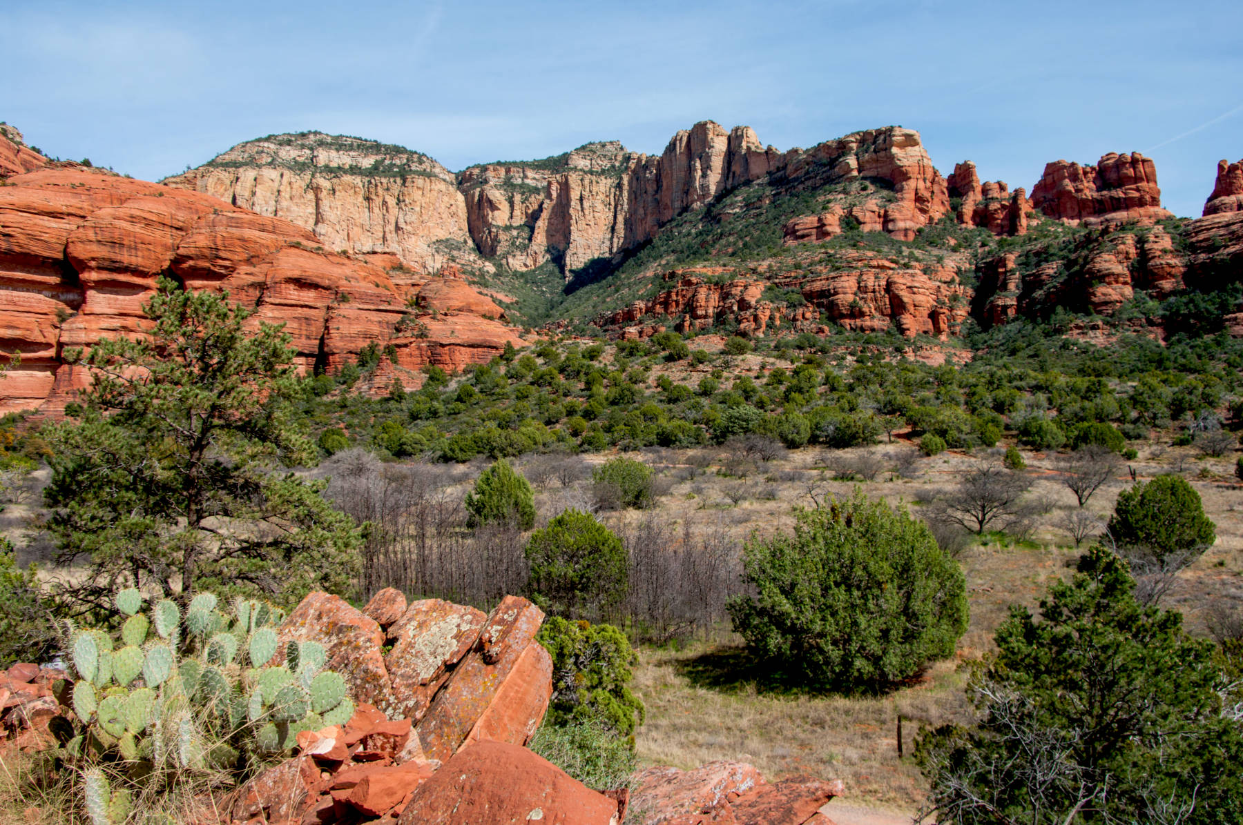
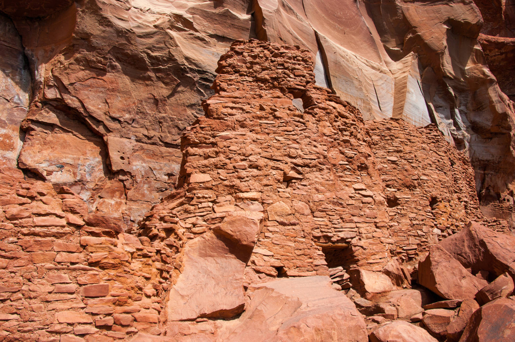
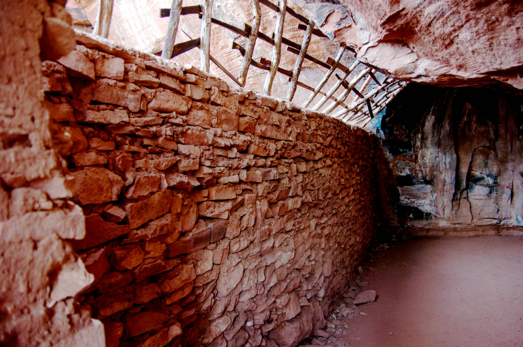
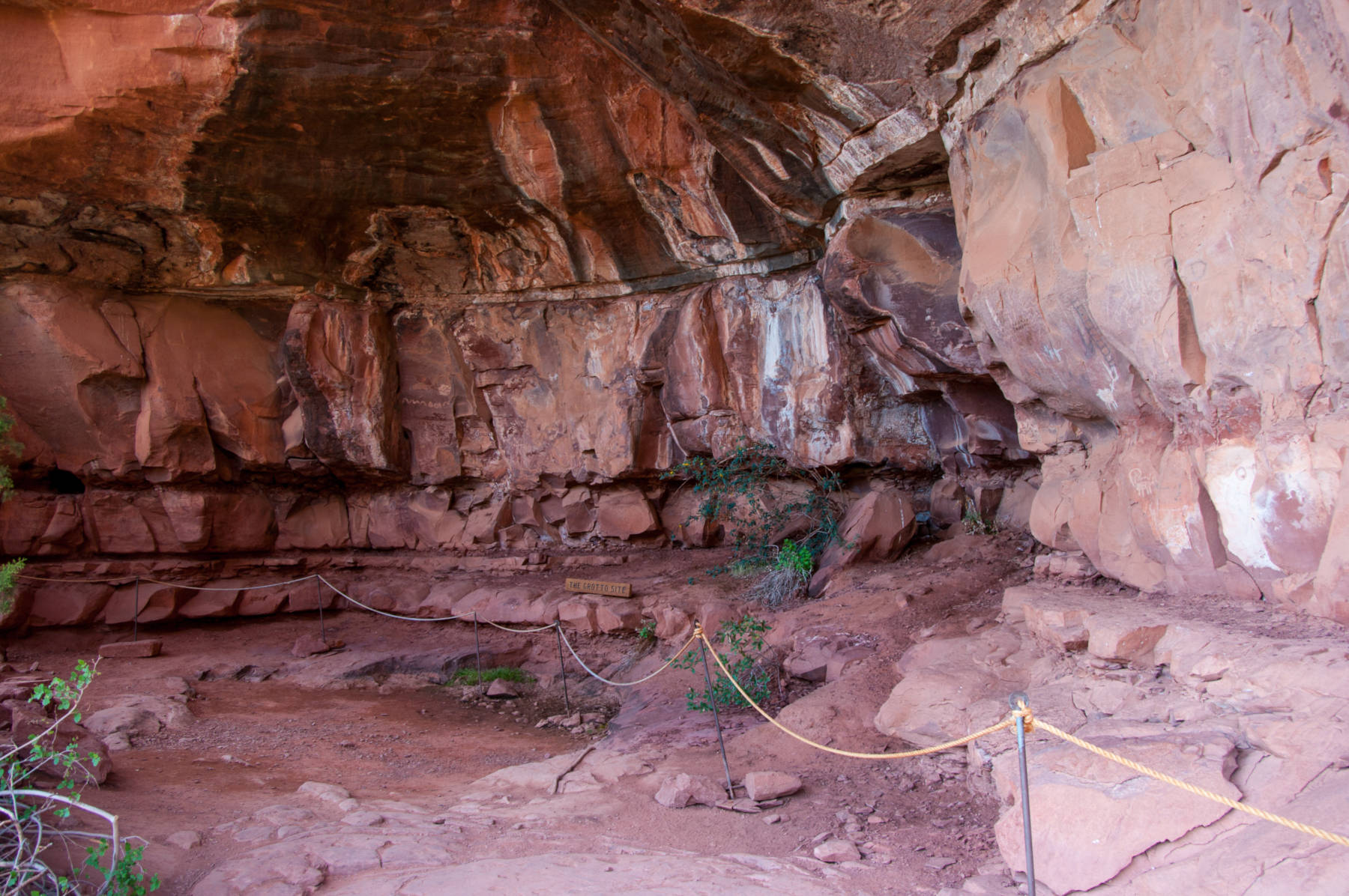
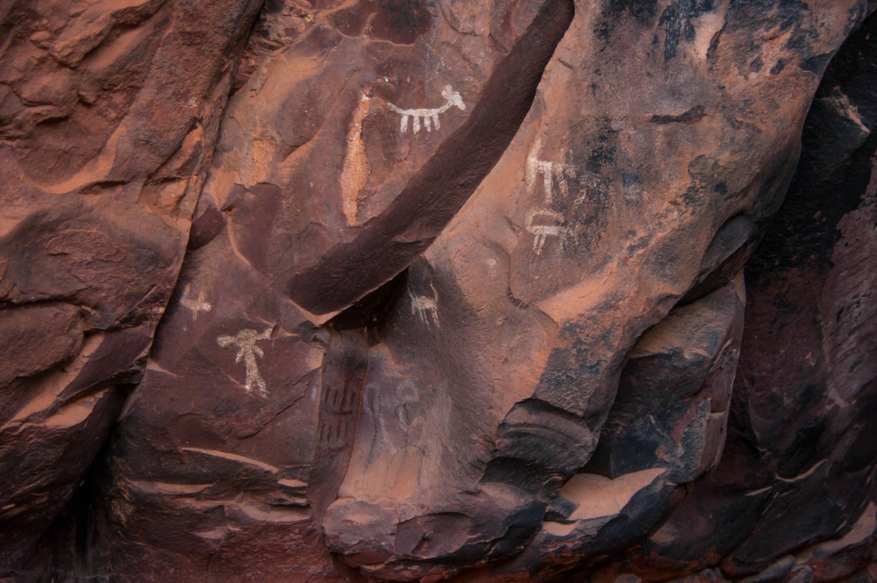
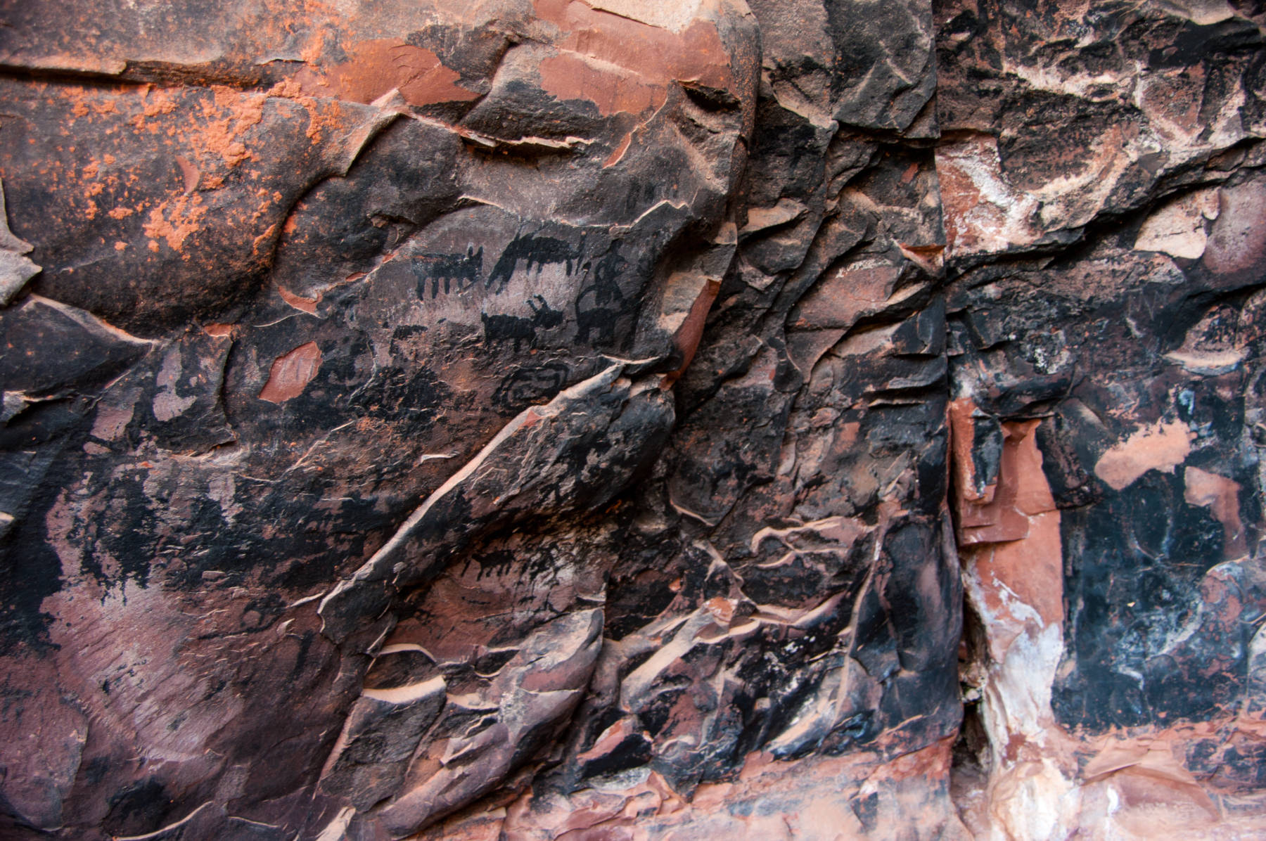
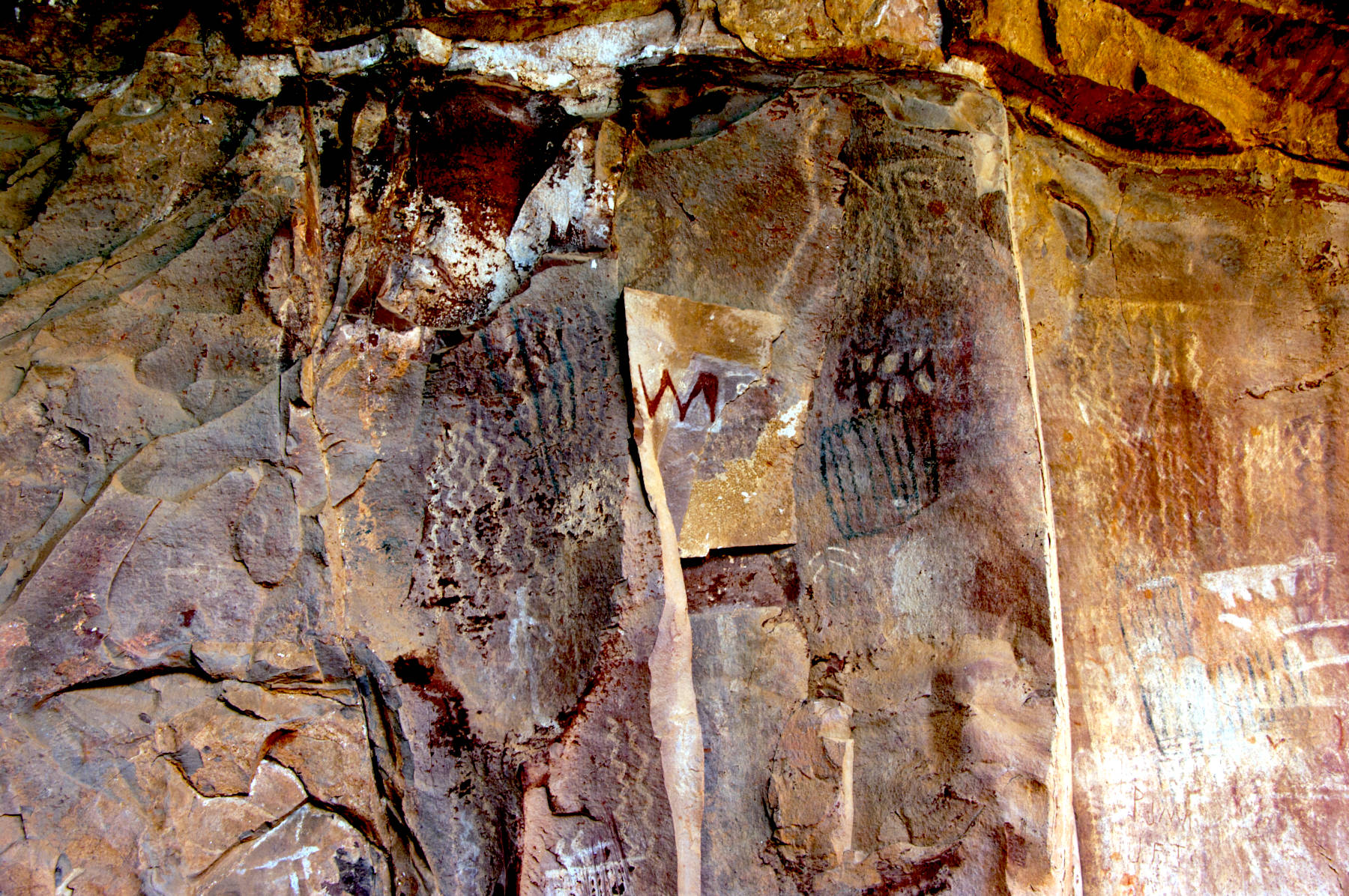
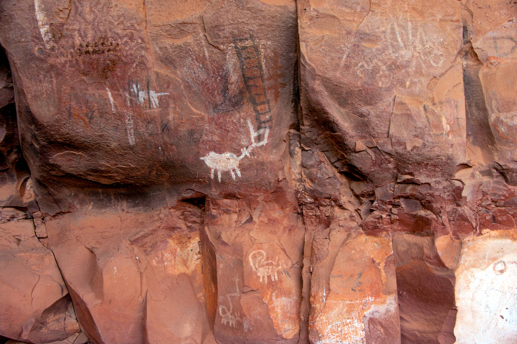
Palatki Cliff Dwellings is one of the largest cliff dwellings in the Red Rock area, Palatki is Hopi and means red house. The name was given to the site by archaeologist Dr. Jesse Walter Fewkes, who explored and photographed the dwelling for the Smithsonian Institute in 1895. They were inhabited between 1150 and 1350 by the Sinagua culture of the Ancestral Puebloans. The Sinagua people planted crops and made pottery, created pictographs and petroglyphs. The oldest pictographs here were created 5,000 to 3,000 BP and show more abstract pictograph symbols and drawings. In other words, the dwellings were used by multiple cultures for thousands of years.
The site has two separate pueblos, which is interpreted as the homes of two separate families or kin groups. The eastern pueblo has circular shield-like pictographs above the ruins, which are interpreted as a kin or clan symbol.
The pictures on this page were provided by Deborah Lee Soltesz from the USFS Coconino National Forest and are Public Domain.
- See also
 Search DuckDuckGo for "Palatki Cliff Dwellings"
 Google Earth Placemark
 OpenStreetMap
 Palatki Heritage Site - Wikipedia (visited: 27-FEB-2026)
 Palatki Heritage Site (visited: 27-FEB-2026)
- Palatki and Honanki Heritage Sites (visited: 27-FEB-2026)
- Tour durch den Südwesten der USA im Februar 2015 10.02.2015 - 11.Tag Palatki Heritage Site
 (visited: 28-FEB-2026)
 Index
Index Hierarchical
 Countries
 Maps
Maps