Caverna do Diabo
Devils Cave - Gruta da Tapagem - Caverna da Tapagem
Useful Information
| Location: |
Parque Estadual de Jacupiranga (PEJ).
Between Eldorado Paulista and Iporanga on Highway SP 165 at Km 111.
(-24.635957, -48.404509) |
| Open: |
JAN daily 8-17. FEB to JUN Tue-Sun, Hol 8-17. JUL daily 8-17. AUG to DEC Tue-Sun, Hol 8-17. [2020] |
| Fee: |
Park: Adults BRL 13, Children (0-12) free, Seniors (60+) free, Disabled free, Students BRL 7.50. Monitor Ambiental Local: Adults BRL 12, Children (7-12) BRL 12, Seniors (60+) BRL 12, Disabled BRL 12, Students BRL 12. [2020] |
| Classification: |
 Karst Cave Karst Cave
 Monitor Ambiental Monitor Ambiental
 Geotopes named after the Devil Geotopes named after the Devil
|
| Light: |
 Electric Light Electric Light
|
| Dimension: | L=6,237 m, VR=175 m. |
| Guided tours: | L=700 m, VR=152 m, D=60 min. V=27,000/a[2000] |
| Photography: | allowed |
| Accessibility: | no |
| Bibliography: |
Michel Le Bret (1975):
Maravilhoso Brasil Subterrâneo,
Série Japi Espeleologia

William Sallun Filho, Bruna Medeiros Cordeiro, Ivo Karmann (2015): Structural and hydrological controls on the development of a river cave in marble (Tapagem Cave - SE Brazil), International Journal of Speleology 44 (1) 75-90 Tampa, FL (USA) January 2015.  online (visited: 22-FEB-2026) online (visited: 22-FEB-2026)
|
| Address: |
Caverna do Diabo, Pousada do Quiririm, Rodovia SP-165 - Km 156,6, Iporanga, São Paulo, Tel: +55-13-3871-1242, Tel: +55-13-3871-1241. E-mail: |
| As far as we know this information was accurate when it was published (see years in brackets), but may have changed since then. Please check rates and details directly with the companies in question if you need more recent info. |
|
History
| 1886 | Caverna da Tapagem discovered by the explorer Sigismund Ernst Richard Krone. |
| 28-NOV-1964 | connection to the Gruta da Tapagem discovered. |
| 1969 | Parque Estadual de Jacupiranga founded. |
| 2000 | new light system installed. |
| 21-FEB-2008 | Parque Estadual Caverna do Diabo (Caverna do Diabo State Park) established. |
Description
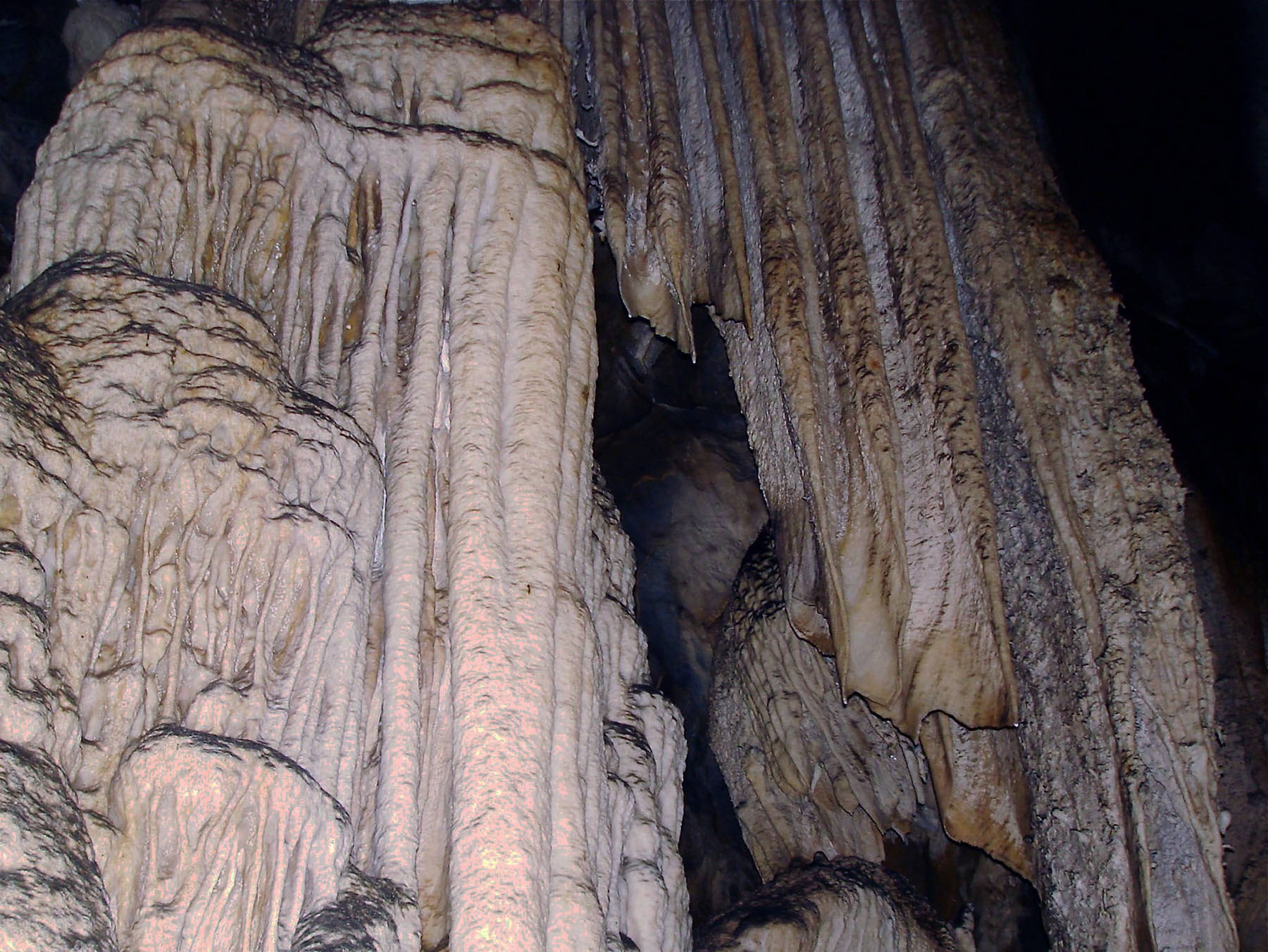

Caverna do Diabo (Devils Cave) is a well developed and beautiful cave with extraordinary speleothems. It is the longest cave of the state São Paulo. It is also called Gruta da Tapagem, a name which has a number of translations for unknown reasons, Cave of the Hedge or Hurdle’s Cave or Mysterious Place. The reason is simply two different entrances to the same cave system were known for a long time. Not knowing about the connection, the locals gave both of them different names. The connection was discovered in 1964 by the cavers Michel Le Bret, Philippe Goethals, Caille Goethals, Luiz Guilherme Assumpção (Méca), and Sérgio Audino.
Tapagem Cave is a river cave developed in the dolomite marble karst of the Serra do André Lopes. This dolomite karst has very few caves, so the Tapagem Cave is an anomalous feature. It is formed by the Tapagem River which sinks at the end of a blind valley and flows underground until it reappears as Rio das Ostras. The catchment area of the sink is much bigger than the karst area, a lot of water flows into the cave system and is the reason for the cave development. So you could say it is the result of contact karst: water draining on the surface of insoluble rocks and vanishing underground into a cave as soon as it reaches the soluble rocks.
The cave is developed as a show cave with trails and electric light. The entrance portal, which is 40 m high, is quite impressive. The tour is strenuous as the 700 m long trail goes down 152 m.
According to legend the cave was named Devil’s Cave by the Indians who inhabited the vicinity of the cave. They believed that if they were hit by drops of water from the ceiling, they would be transformed into stone. To them, the stalagmites were people and animals that had been petrified by the constant dripping in the cave. The noises emanating from the entrance of the cave were believed to be groans of lost souls who are punished by the devil.
The cave is visited on guided tours which start every 20 minutes for groups of up to 12 people. A maximum number of 672 people per day is allowed, and if the contingent is met there are no further tours on this day. Also, every tour is accompanied by a Monitor Ambiental Local (local environment monitor). They give no exact entrance fees on their website, its necessary to request them by email for some reason.
Actually the quality of the information given on this cave is quite poor, despite the fact that it is managed by a state park. Normally this means exact publication of the hard facts. In this case the number of contradictory data is overwhelming. Just an example: "Today almost 10 km of galleries and halls have already been mapped. Of the 6.237 meters of the cave, 3.200 meters have already been surveyed." So what’s the actual length, 10 km, 6 km or 3 km? We have no idea.
 Search DuckDuckGo for "Caverna do Diabo"
 Google Earth Placemark
 OpenStreetMap
 Caverna da Tapagem - Wikipedia (visited: 22-FEB-2026)
 Index
Index Hierarchical
 Countries
 Maps
Maps