Hohler Stein
Kallenhardter Höhle - Großes Loch und Kleines Loch - F1-Höhle
Useful Information
| Location: |
Parkplatz Hohler Stein, 59602 Rüthen.
A46 exit 71 Bestwig, through Bestwig towards Rüthen, after 12 km turn left towards Kallenhard, after 1 km turn left to the car park. A44 from the east Exit 60 Brilon/Marsberg, to Rüthen, continue to Kallenhard, turn right towards Kallenhard, after 1 km turn left to the car park. A44 from the west Exit Erwitte/Anröchte, B55 towards Warstein 11 km, turn left onto B516 towards Rüthen 6 km, turn right onto L735 to Kallenhardt, turn right into Günne. (51.4363284, 8.4026929) |
| Open: |
No restrictions. [2025] |
| Fee: |
free. [2025] |
| Classification: |
 Karst Cave Karst Cave
|
| Light: | bring torch |
| Dimension: | |
| Guided tours: | self guided |
| Photography: | allowed |
| Accessibility: | no |
| Bibliography: |
Julius Andree (1935):
Mittelsteinzeitliche Funde aus dem Hohlen Stein bei Callenhardt i. W. (Grabung 1933)
In: Aus der Vorzeit in Rheinland, Lippe und Westfalen 2 (1934/35), S. 129–136.

Franz Breitholz, Julius Andree (1933): Eisenschmelzöfen aus vorchristlicher Zeit im Loermecketal bei Callenhardt i. W. In: Aus der Vorzeit in Westfalen, Lippe und am Niederrhein 1 (1933), S. 37–42.
Eberhard Henneböle (1936): Neue Funde aus dem „Hohlen Stein“ bei Kallenhardt. Grabung 1934 In: Aus der Vorzeit in Rheinland, Lippe und Westfalen 3 (1936), S. 41–47.
Karl Kennepohl (1934): Eine Falschmünzerwerkstatt im „Hohlen Stein“ bei Callenhardt In: Aus der Vorzeit in Rheinland, Lippe und Westfalen 1 (1933/34), S. 233–235.
|
| Address: | |
| As far as we know this information was accurate when it was published (see years in brackets), but may have changed since then. Please check rates and details directly with the companies in question if you need more recent info. |
|
History
| 1590 | A shepherd from nearby Körtlinghausen Castle flees with his flock from wolves into the cave. |
| 17. Jahrhundert | The cave is home to a counterfeiting workshop. |
| 1813 | serves a saddler and belt cutter named Föhring as a workshop and emergency accommodation. |
Description
Hohler Stein (Hollow Stone) is one of those names which are often used, even in variations such as Hohler Fels (Hollow Rock). Therefore, the name Kallenhardter Höhle (Kallenhardt Cave) would actually be preferable, but it seems to have become naturalised as Hohler Stein near Kallenhardt. As this cave name exists in almost every cave area in Germany, it is unfortunately very easy to confuse the two. In addition, the neighbouring 50 m high rock formation is called Hoher Stein (high rock), which further increases the risk of confusion. The cave is located between Kallenhard and Warstein and belongs to the same karst area as the nearby Warstein Cave. Middle Devonian limestones around 350 Ma old formed as a reef at the bottom of the Devonian Sea. The limestone was folded by tectonic movements and today forms the Warstein Saddle, which actually consists of two large limestone regions. Contact karst formed at the contact with the Arnsberg strata because the water in the limestone immediately disappears into ponors and continues to flow underground.
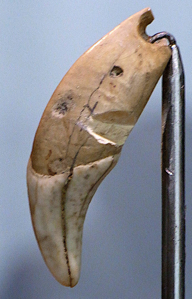
The Hohle Stein is a so-called cultural cave, a rather small cave whose significance lies in the archaeological finds that have been made here. At the beginning of the 1930s, it was excavated several times and finds from the late Palaeolithic to the pre-Roman Iron Age were made. There are several publications on various topics from this period. Together with Balver Höhle and Blätterhöhle, Hohle Stein is one of the most important archaeological caves in North Rhine-Westphalia. The main reason for this is probably the extremely favourable location for hunting: the rock of the Hohle Stein protruded into the valley and narrowed it, giving the prey fewer opportunities to escape. The hunters probably came to the cave seasonally when the herds were travelling through the valley.
The Hohle Stein is located in a limestone rock on the northern edge of the Lörmecke valley, at the foot of an almost vertical limestone wall. This applies to both cave entrances. The small entrance is slightly lower and faces south, about 3 metres above the normal water level of the Lörmecke. The large entrance is slightly higher, 8 metres above the normal water level of the Lörmecke, and faces west. Behind the large entrance is another large corridor, known as the main cave or Great Hall. It is about 30 metres long and up to 20 metres wide. At its end, it bends to the south and a much smaller passage leads 12 metres to the small entrance. During the Stone Age, the cave probably looked similar, although the ceiling was probably lower. Over the course of time, however, material was carried in by people, animals and the weather. In addition, debris kept falling from the ceiling. However, the largest masses of debris formed at the main entrance, material that was detached from the rock face by frost heave. By 1800, only a small entrance was left, and later the entrance was completely closed. However, the loose material was probably removed around 1880, mainly for road construction. Excavations began in 1928 and around 15,000 m³ of sediment was removed from the hall, which was 3 metres high at the time. Excavations at that time cannot be compared with today’s archaeological excavations, they were shovelled and sieved. Only the most conspicuous objects were collected. Numerous important archaeological features were completely destroyed. Fortunately, however, not the entire area was excavated, and it is quite conceivable that a further excavation could take place in the future. Many of the finds are now in the Museum für Archäologie und Kultur (Museum of Archaeology and Culture) in Herne.
The cave was a hunting station during the Stone Age and was visited in the Bronze Age and Roman period, as evidenced by artefacts. It is also said to have been the historical setting for events that can be found in the Middle High German Nibelungenlied. However, this is merely a theory. It was also used repeatedly in the Middle Ages. For example, a shepherd from nearby Körtlinghausen Castle fled with his flock from wolves into the cave in 1590. In the early 17th century, during the Thirty Years’ War, it served as a hiding place for a counterfeiting workshop. In 1813, a saddler and belt cutter named Föhring was initially not allowed to settle in Kallenhardt. So he set himself up in the cave which served as his workshop and emergency accommodation. Eventually he was granted permission. Many of these stories are probably a mixture of historical facts and legends or simply embellishments. The following story is probably a legend:
In the past, the cave was not a very safe place. The soul of a man named Röing, who died a violent death, was banished to the Hohler Stein. His soul has been wandering there ever since. One evening, an overconfident man dared to shout into the cave: ’Röing, come out here!’ It started to rumble in the cave and heavy boulders rolled down the rock, one of them right in front of Benz Mühle. All the people in the mill made the sign of the cross in fright. The large and otherwise cheeky wolfhound cowered in a corner, whimpering. The challenger didn’t dare go home that evening and asked to be allowed to stay in the mill overnight.
There are 12 legend stations on the 240 km long, Sauerland Waldroute (Sauerland Forest Route). One of them is located here at Hohle Stein. In addition to an information board at the car park, there is also an audio guide. The Sauerland Forest Route is a long-distance hiking trail that leads from Iserlohn in the east to Marsberg in the west of the Sauerland.
 Search DuckDuckGo for "Hohler Stein"
 Google Earth Placemark
 OpenStreetMap
 Hohler Stein (Kallenhardt) - Wikipedia (
 Hohler Stein bei Kallenhardt [Kallenhardter Höhle, Großes Loch und Kleines Loch, F1-Höhle] Cave or Rock Shelter : The Megalithic Portal and Megalith Map:
 Index
Index Topics
 Hierarchical
 Countries
 Maps
Maps