Zwergenkirche
Useful Information
| Location: |
A7 exit Seesen(Harz), B243 46 km to turnoff Bad Sachsa, turn left, bypass around Bad Sachsa towards Walkenried,
after 1 km parking lot right.
(51.5838801, 10.5851592) |
| Open: |
No restrictions. [2023] |
| Fee: |
free. [2023] |
| Classification: |
 Gipshöhle Gipshöhle
|
| Light: | bring torch |
| Dimension: | |
| Guided tours: | self guided |
| Photography: | allowed |
| Accessibility: | no |
| Bibliography: |
Matthias Reimann, Firouz Vladi (2003):
Zur Entwicklung der sog. Zwergenkirche am Sachsenstein bei Walkenried, Landkreis Osterode am Harz, Niedersachsen und vergleichende Beobachtungen zur rezenten Entstehung von Quellungshöhlen in einem aufgelassenen Gipssteinbruch bei Dingwall, Nova Scotia, Kanada
Mitt. Verb. dt. Höhlen- u. Karstforscher, 49 (3), 75-77, München 2003.
online
Fritz Reinboth (1997): Die Zwerglöcher bei Walkenried am Südharz - Bemerkungen zur Frage der Quellungshöhlen, Die Höhle 48, H.1, 1-13, Wien. online |
| Address: | |
| As far as we know this information was accurate when it was published (see years in brackets), but may have changed since then. Please check rates and details directly with the companies in question if you need more recent info. |
|
History
| 1990 | collapse of the Waldkirche. |
Description
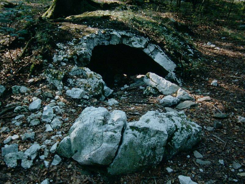
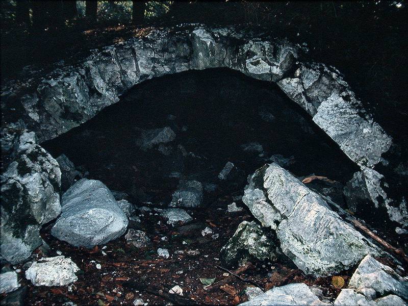
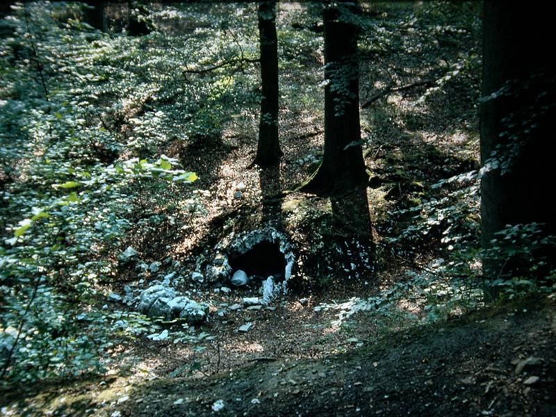
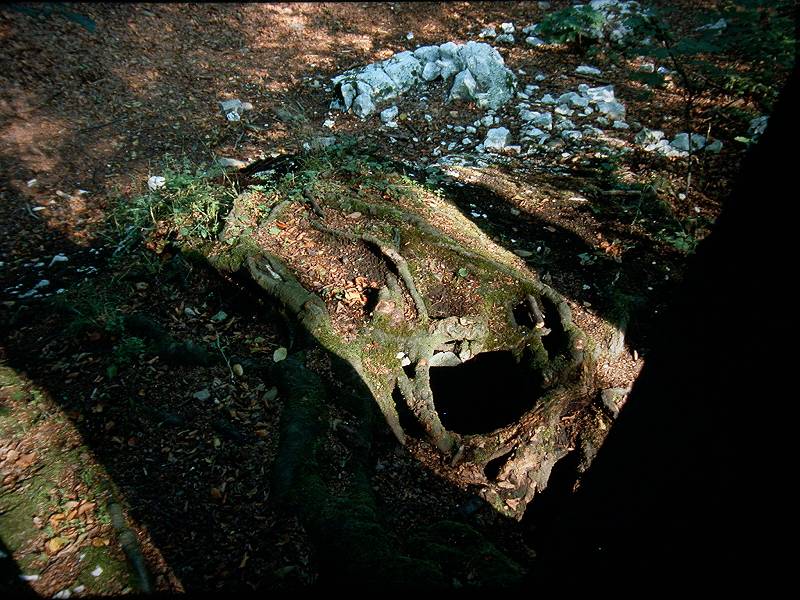
The Zwergenkirche (Dwarf Church) belongs to a very unusual type of cave, the so-called expansion caves. Anhydrite expands when it absorbs water. When a layer of anhydrite at the surface expands, the resulting forces cause it to bulge upwards. The already existing, fine layer joint is thus greatly widened. The cave has the shape of a flat lying lens or fold, similar to a fold in the carpet.
This cave is not a primary cave because it did not form with the rock. But unlike all other secondary caves, it was not formed by weathering or solution of any kind. In fact, no rock was removed. You could say it was formed mechanically, and yet it is not actually a tectonic cave either. The expansion effect is unique to gypsum, so this form of cave only occurs in gypsum, this is the only place in the world that we know of.
These expansion caves are very small and therefore difficult to find, but there are many of them here. The dwarf church and the dwarf sacristy near the K.-Helbing-lodge, the dwarf smithy and the dwarf house with chimney on the south side of the railway line and the forest smithy north of the railway line. They are also called dwarf holes as a group. The largest is the Waldschmiede (forest smithy), and it had achieved considerable notoriety, but was also quite fragile. Its interior was about 8 m long and 7.50 m wide, and the thickness of the roof was only 50 cm. As a result, the cave came close to collapse several times during the 20th century. Heimatfreunde, a non-profit association, repeatedly rebuilt it and bricked up damaged areas. But in 1990, the time finally came when the cave collapsed completely and could no longer be rebuilt.
The cave in the pictures here is located directly next to the Sachsenburg and probably has no name, but it is the easiest to find. Unfortunately this also resulted in considerable vandalism. The ruins of this castle built by Heinrich IV. are quite well signposted, so we recommend following this signposting. The hiking trail from Bad Sachsa is about 2.5 km to Sachsenburg. From the above-mentioned hikers’ car park, walk back along the road for about 400 m and then turn left onto the field path, after which it is another 900 m or so. You can also start at Walkenried railway station and more or less follow the tracks westwards past the Affenteich pond.
The area around the Sachsenburg has much more to offer geologists. There are several large sinkholes directly below the Sachsenburg. The path from Bad Sachsa leads directly through them, the other path from the car park leads along their edge. The size of these hollow forms suggests impressive cavities in the cave responsible for their formation.
 Search DuckDuckGo for "Zwergenkirche"
 Google Earth Placemark
 Die "Zwerglöcher" bei Walkenried am Südharz
  (visited: 04-JUN-2023)
 Index
Index Topics
 Hierarchical
 Countries
 Maps
Maps