Dyrhólaey
Useful Information
| Location: | Near Vik on Dyrhólaey peninsula. 175 km (2h) from Reykjavik. (63.3995957 N, -19.126898 W) |
| Open: |
JUL to APR no restrictions. MAY to JUN during nesting season closed to protect the birds. [2020] |
| Fee: |
free. [2020] |
| Classification: |
 Natural Bridge Natural Bridge
|
| Light: | n/a |
| Dimension: | H=120 m. |
| Guided tours: | |
| Photography: | allowed |
| Accessibility: | no |
| Bibliography: | |
| Address: | |
| As far as we know this information was accurate when it was published (see years in brackets), but may have changed since then. Please check rates and details directly with the companies in question if you need more recent info. |
|
History
Description
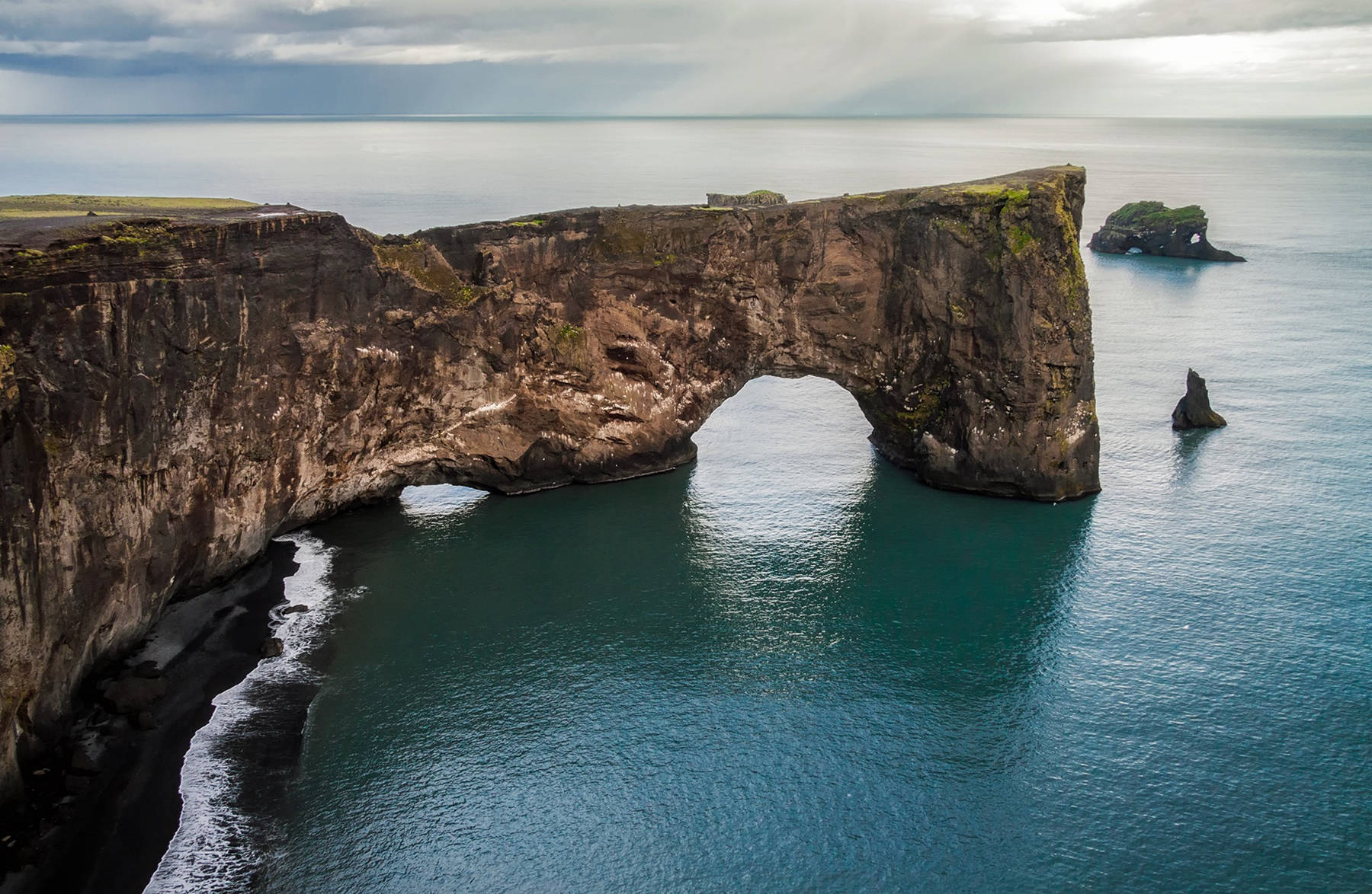

Dyrholaey is a peninsula which is the eroded remains of a volcano. It has a lighthouse and an impressive natural bridge. The easiest way to see the natural bridge is to follow the road to the lighthouse. The arch can be seen from the cliff to the south. The place offers nice views in all directions. The lighthouse has been renovated and converted into a private luxury hotel.
The peninsula is a bird sanctuary and frequented by thousands of bird lovers to see puffins in their natural habitat. During summer, thousands of the birds make their nest in Dyrholaey‘s grassy hills. Arctic terns also make their nests in the cliffs and they can get very aggressive when defending their nests, so we recommend to be careful. It is also possible to wath seals at the beaches around Dyrholaey, but swimming or even goning close to the shore is strongly discouraged due to rip tides and dangerous currents.
The name of the island is Dyrholaey which means door hill island. The reason is the arch, which is big enough for ships and even small airplanes to pass through.
 Search DuckDuckGo for "Dyrhólaey"
 Google Earth Placemark
 Index
Index Topics
 Hierarchical
 Countries
 Maps
Maps