Tsingy de Bemaraha
Useful Information
| Location: |
From Morondava 150 km to the north.
(-19.1434427, 44.8126353) |
| Open: |
Little Tsingy:
APR to NOV (dry season) daily 6:30-16:30. Big Tsingy: JUN to OCT daily 6:30-16:30. [2025] |
| Fee: |
Adults AR 55,000, Children AR 25,000. Malagasy: Adults AR 2,000, Children AR 500. Guide fees depend on the chosen route, guides are mandatory. Day trips by tour operators include all fees. [2025] |
| Classification: |
 Stone Forest
Karren Stone Forest
Karren
 Karst Cave Karst Cave
|
| Light: | bring torch for caves |
| Dimension: | |
| Guided tours: | |
| Photography: | allowed |
| Accessibility: | not accessible, except outlook |
| Bibliography: | |
| Address: |
Madagascar National Parks Mahajanga, 14 Rue Philibert Tsiranana, Mahajanga, Madagascar, Tel/Fax: +261-20-6222656, GSM: +261-32-5234900, +261-33-0986656
E-mail: Parc National Bemaraha, BP 7 – 406 Antsalova, Tel: +261-32-09-401-31. E-mail: |
| As far as we know this information was accurate when it was published (see years in brackets), but may have changed since then. Please check rates and details directly with the companies in question if you need more recent info. |
|
History
| 1927 | classified as Integral Nature Reserve No. 9. |
| 1990 | inscribed on the UNESCO World Heritage List. |
| 1991 | declared a National Cultural Heritage Site. |
| 1997 | part of the Reserve changed to National Park status. |
Description
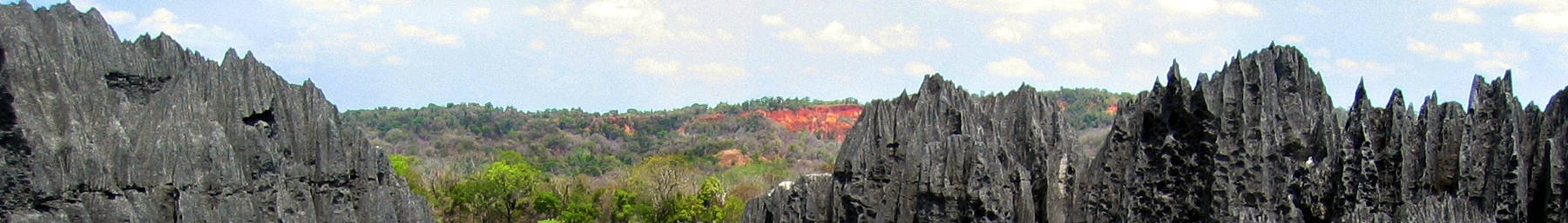
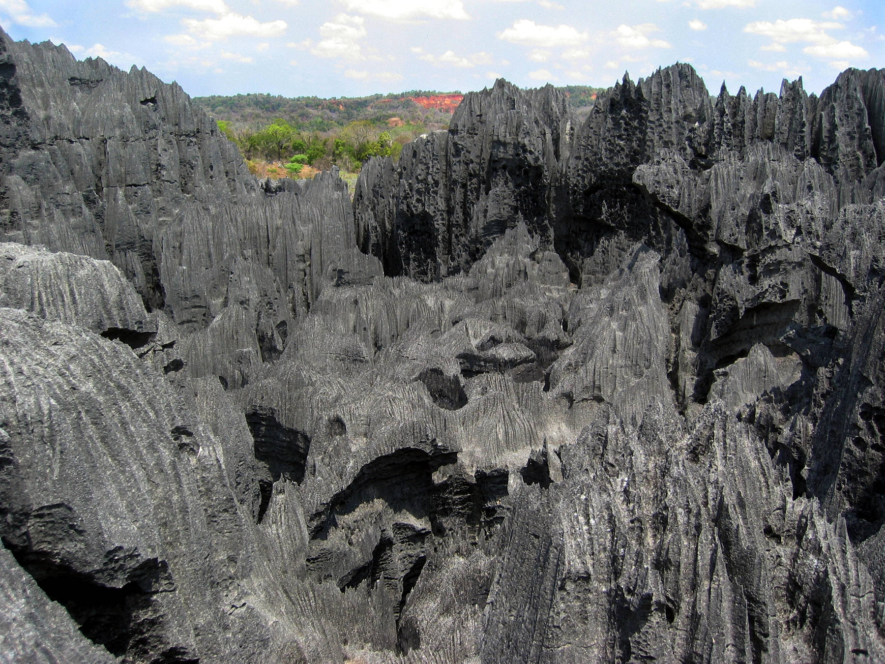
The Tsingy de Bemaraha is a karst area with extraordinary and weird karren formations, the area is also called the "stone forest", which is actually the international scientific term for this kind of formation. There are two developed areas with those limestone pillars named the Grand Tsingy (Large Tsingy) and the Petit Tsingy (Little Tsingy). There are two different parks protecting this area, the Parc National des Tsingy de Bemaraha and the Réserve Naturelle Intégrale des Tsingy de Bemaraha. The site is also on the UNESCO World Heritage List.
The word tsingy is an indigenous Malagasy term which means where one cannot walk barefoot. It is a common term for such karst badlands, and so it has become a synonym for the extraordinary karren structures. The area ends in the east at the Bemaraha Cliffs which rise up to 400 m above the Manambolo River. In the south is the Manambolo Gorge with spectacular waterfalls. Beneath the geologic importance and the aesthetic value, the area is also of great biologic importance. Caused by the barren rocks, there are various rare habitats which are the home of endemic plants and animals. Most spectacular are probably the 11 lemurs, but there are also 100 different birds and 45 reptiles and amphibians. 85 % of the Flora and Fauna are endemic for Madagascar, 47 % are not even found in other areas of the island.
Most people visit only the Petit Tsingy which is located at the southern border of the park in the village Andadoany at the ferry across Manambolo river. It has a National Park Visitor Center and a trail across the formation, the visit takes about half a day. The Grand Tsingy is located about 15 km north at the end of the road. The trail is much longer and the visit requires a full day. Various tour operators have started to offer tours into the park. Typically, there is a three night, two day schedule, arriving at the first day and leaving on the fourth. The visits include the Grand Tsingy, with hanging bridges and caves, the Petit Tsingy, and the Manambolo Gorge by canoe. The trails require surefootedness and take between 3 and 6 hours across difficult terrain. The visit is not suitable if you cannot walk that well, actually there are a few outlook platforms, but the geology and the animals are not visible from a single spot.
- See also
 Index: The Subterranean World Heritage List.
 Search DuckDuckGo for "Tsingy de Bemaraha"
 Google Earth Placemark
 OpenStreetMap: Petit Tsingy
- OpenStreetMap: Grand Tsingy
 Tsingy de Bemaraha National Park - Wikipedia (visited: 14-OCT-2012)
- Tsingy de Bemaraha Strict Nature Reserve - Wikipedia (visited: 14-OCT-2012)
 Tsingy de Bemaraha Strict Nature Reserve - UNESCO World Heritage Centre (visited: 14-OCT-2012)
 Tsingy de Bemaraha - Honestly WTF (visited: 14-OCT-2012)
 Index
Index Hierarchical
 Countries
 Maps
Maps