Kirkilai Lakes and Observation Tower
Useful Information
| Location: |
Kirkilai and Drąseikiai villages.
(56.248498, 24.690612) |
| Open: |
no restrictions. [2021] |
| Fee: |
free. [2021] |
| Classification: |
 karst lake karst lake
|
| Light: | n/a |
| Dimension: |
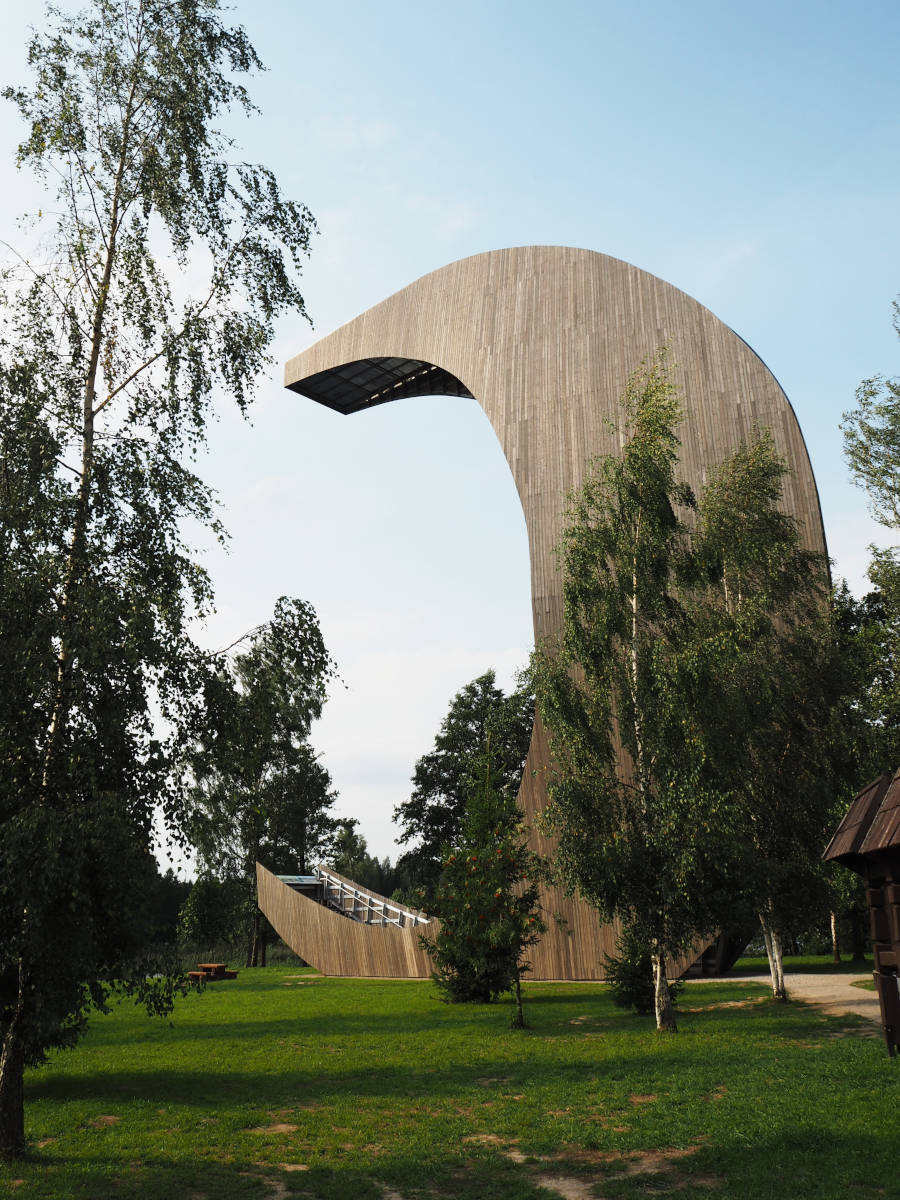
Ar=30 to 100 m³, D=0.8 to 4.5 m. Main Lake: L=600 m, W=300 m, D=7 m. observation tower: H=32 m, observation deck H=30 m. |
| Guided tours: | self guided |
| Photography: | allowed |
| Accessibility: | yes |
| Bibliography: | |
| Address: | Kirkilai Lakes, Kirkilų k., Biržų r., Lietuva 41184, Tel: +370-687-58343. |
| As far as we know this information was accurate when it was published (see years in brackets), but may have changed since then. Please check rates and details directly with the companies in question if you need more recent info. |
|
History
| 1926 | land reclamation ditch dug from the southernmost branch of the Lake Kirkilai. |
| 24-SEP-1992 | Biržai Regional Park created. |
| 2015 | observation tower of Biržai Regional Park built. |
Description
The Kirkilų ežerėliai (Kirkilai Lakes) around the villages Kirkilai and Drąseikiai are waterfilled dolines and karst lake or seasonal lakes. The most important and biggest lake in the lakeland area is actually called Lake Kirkilai. The water level of the lakes is the karst water table. The lakes are accessible by roads, there is the Kirkilų apžvalgos bokšto (Kirkilai Observation Tower) with explanatory signs and a walking trail named smegduobių ežero pažintinis takas (Cave Trail Lake Sightseeing Trail). The karst lakes formed mostly in dolines, either single dolines or numerous sinkholes. The field of dolines forms numerous semicircular shores with horns.
The lakes are located in the Biržai Regional Park which protects the local karst area. The abundant sinkholes and karstic landslides are caused by the dissolution of gypsum layers by the groundwater. The highest density of dolines in the area is more than 200 units/km². In total there are almost 11,000 dolines in the park. There are also numerous other karst related natural monuments in the park.
The waterfilled dolines have a unique biology, a result of the dissolved gypsum in the water. Especially sulphur bacteria colonies can only be seen here, aquatic plants, including chara, hornwort (Ceratophyllum demersum), lemna, and bulrush. The water level is the karst water level, so it rises during the spring melt and after heavy rains, and it goes down in summer when its dry. One of the stranges phenomena is the backflow of water into the lake. There is a reclamation ditch named Šilinėlis which was built from the northern end of the lake through lakelet Jonava and reaches the river Apaščia after 1.2 km. Normally it’s an outflow Lake Kirkilai, but when the water level of the lake is low and the water level in the river Apaščia is higher, the flood water rushes upstream Šilinėlis, through Lake Jonava,to Lake Kirkilai. This holds the water level of the lake at 46.7 m asl.
 Search DuckDuckGo for "Kirkilai Lakes and Observation Tower"
 Google Earth Placemark
 Index
Index Topics
 Hierarchical
 Countries
 Maps
Maps