Bandiagara Escarpment
La Falaise de Bandiagara
Useful Information
| Location: |
Mopti Region
(14.382372, -3.352265) |
| Open: |
no restrictions. [2021] |
| Fee: |
free. [2021] |
| Classification: |
 Escarpments Escarpments
 Cave Houses Cave Houses
|
| Light: | bring torch |
| Dimension: | L=200 km, H=500 m. |
| Guided tours: | tours with local guides |
| Photography: | allowed |
| Accessibility: | no |
| Bibliography: |
Leo Frobenius (1911):
Auf dem Wege nach Atlantis,
Expeditionsbericht der Zweiten Deutschen Inner-Afrika-Expedition (1907-09).
online
|
| Address: | |
| As far as we know this information was accurate when it was published (see years in brackets), but may have changed since then. Please check rates and details directly with the companies in question if you need more recent info. |
|
History
| 14th century | arrival of the Dogon. |
| 1985 | declare a national monument. |
| 1989 | inscribed on the UNESCO World Heritage List. |
Description
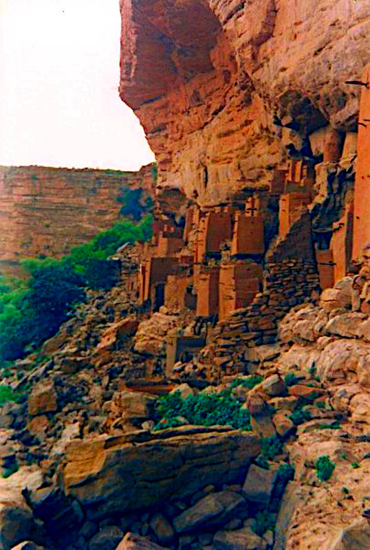
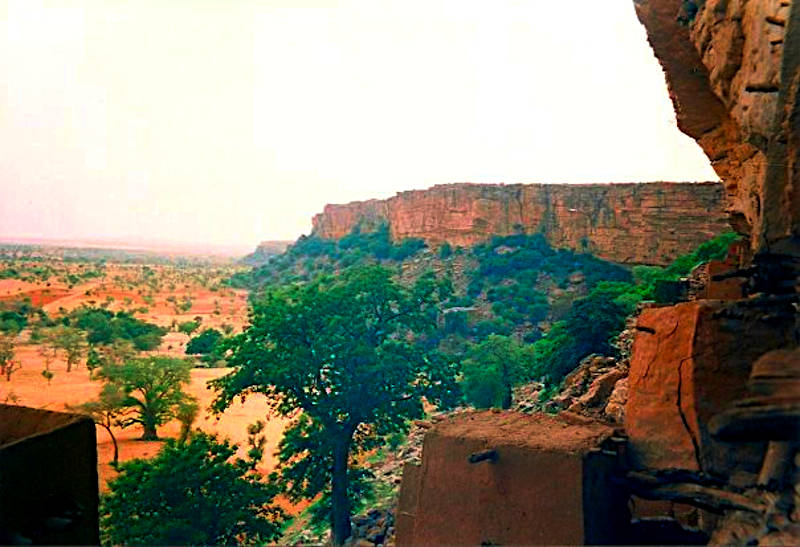
The Bandiagara Escarpment, as the name says, is an escarpment, a 500 m high sandstone cliff which is about 150 km long. Located in the Dogon country of Mali, the Sandstone cliffs were used to build Dogon villages into the overhanging cliff faces. Local guides escort tourist groups along the escarpment to visit Dogon villages. There are trails along the cliffs, and hostels in each village. On one side the growing tourism provides income for the village through the hostels and through tourist tax. On the other side the tourism is putting pressure on local, traditional cultures, which will increase with the construction of a new highway along the ridge. However, since the 2012 war in Mali, the area has become quite dangerous and is frequented by terrorists. In March 2018 a hotel visited by UN staff was attacked by an armed group and there were numerous injured and dead. As a result currently the Malian security forces turn back any tourists who try to visit the area. However, with Corona tourism ended anyway. Hopefully this situation will change in the future.
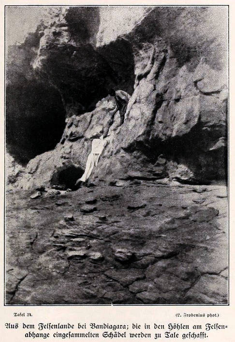
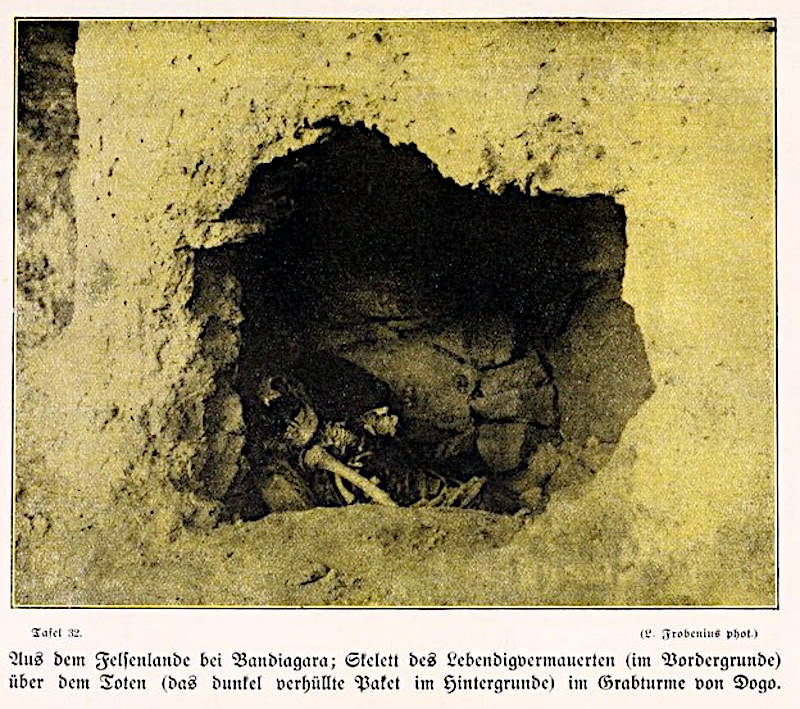
Before the caves were inhabited by the Dogon, they were used by the Tellem and Toloy peoples. The Tellem left a lot of structures, they especially buried their dead high up, far from the frequent flash floods of the area. Also numerous cave castles were built by them and are now abandoned. They were pushed out by the arrival of the Dogons during the 14th century.
The land was a French colony since the late 19th century. According to local lore the Dogon were relatively undisturbed by French colonial powers due to natural tunnels through the Bandiagara Escarpment. They were able to use them to ambush and repel them through the secret tunnels. While the existence of small caves in sandstone is possible, a bigger number or long caves are quite unlikely from the geological point of view. This is most likely some kind of hoax, probably they told the stories to make the French search for nonexistent caves.
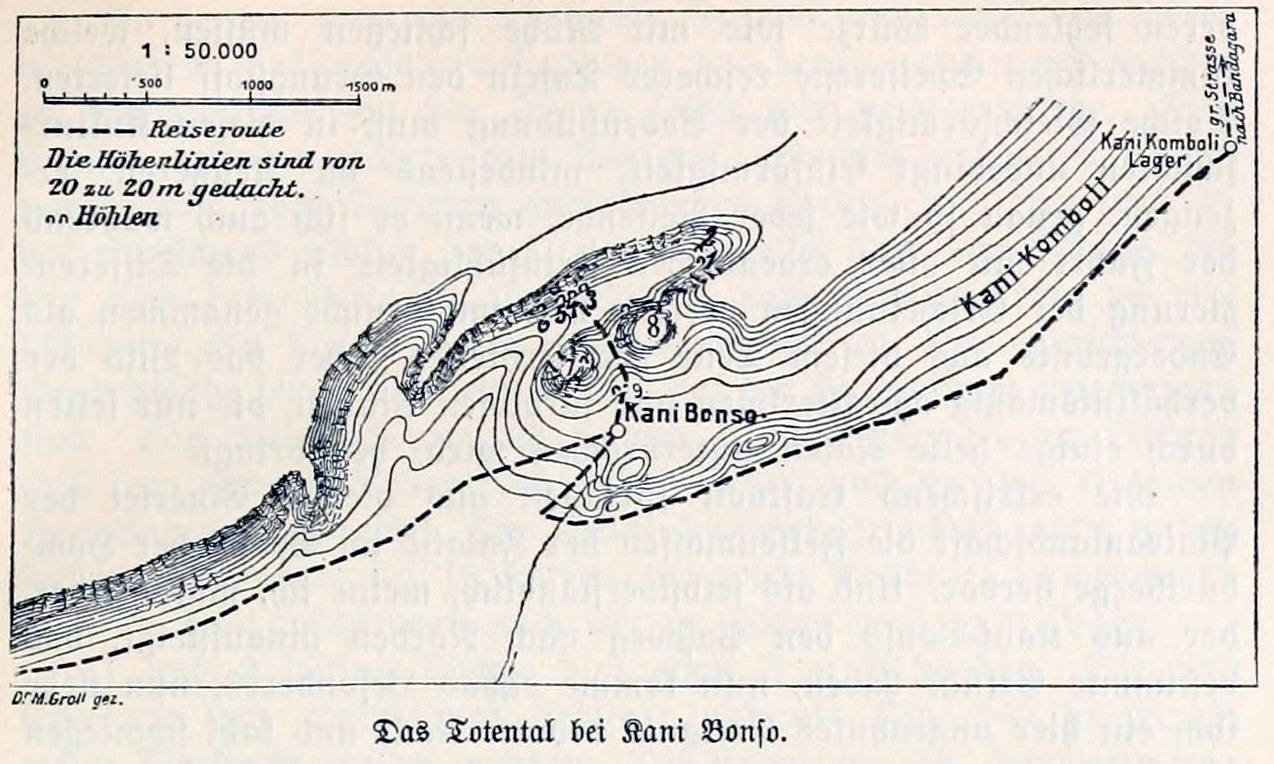
The area was explored by the Deutsche Innerafrikanische Forschungsexpedition (German Central Africa Expedition) between 1908 and 1910. The head of the expedition, Leo Frobenius, wrote a report in 1911 titled Auf dem Weg nach Atlantis (On the way to Atlantis). We are not sure if this was a joke or if he really thought Atlantis could be in central Africa. However, he made a lot of fotographs and described the cliff dwellings and the cave burials. His book is out of copyright and available from archive.org.
The Cliffs of Bandiagara are the southeastern side of a sandstone plateau. The escarpment is a result of tectonic activity and extends over 200 km. There are numerous overhanging cliffs and shelters along the foot of the escarpment. However, the Dogon villages today are built in the plain in front of the escarpment. The cave dwellings are mostly abandoned.
 Index: The Subterranean World Heritage List.
 Search DuckDuckGo for "Bandiagara Escarpment"
 Google Earth Placemark
 Bandiagara Escarpment - Wikipedia (visited: 08-APR-2016)
 Cliff of Bandiagara (Land of the Dogons) - UNESCO World Heritage Centre (visited: 08-APR-2016)
 Index
Index Hierarchical
 Countries
 Maps
Maps